Overview for Granary Way, SALE, M33 4GF
Introduction
Sale is a town in Trafford, Greater Manchester, England, in the historic county of Cheshire on the south bank of the River Mersey, 2 miles (3.2 km) south of Stretford, 3 miles (4.8 km) northeast of Altrincham, and 5 miles (8.0 km) southwest of Manchester. In 2021, it had a population of 54,515.
Evidence of Stone Age, Roman and Anglo-Saxon activity has previously been discovered locally. In the Middle Ages, Sale was a rural township, linked ecclesiastically with neighbouring Ashton upon Mersey, whose fields and meadows were used for crop and cattle farming. By the 17th century, Sale had a cottage industry manufacturing garthweb, the woven material from which horses' saddle girths were made.
The Bridgewater Canal reached the town in 1765, stimulating Sale's urbanisation. The arrival of the railway in 1849 triggered Sale's growth as an important town and place for people who wanted to travel to and from Manchester, leading to an influx of middle class residents; by the end of the 19th century, the town's population had more than tripled. Agriculture gradually declined as service industries boomed.
Sale's urban growth resulted in a merger with neighbouring Ashton upon Mersey, following the Local Government Act 1929. The increase in population led to the granting of a charter in 1935, giving Sale honorific borough status. Since then, Sale has continued to thrive as one of the main urban centres of Trafford due to its proximity to the M60 motorway and the connections to Manchester and other areas by the Manchester Metrolink network.
Summary for Granary Way, SALE, M33 4GF
Roadworks near M33 4GF
Road Safety near M33 4GF
Details of personal injury accidents in and around Granary Way, M33 4GF that have been reported to Greater Manchester Police over the past 20 years.
Traffic Levels near M33 4GF
View traffic levels near Granary Way, M33 4GF from official Department for Transport counts.
Images taken near to Granary Way, M33 4GF and the surrounding area
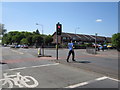
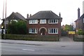

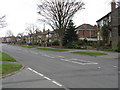


Please click the More button for more images, licensing and image copyright information.
Member of UK Parliament
This postcode is in the Wythenshawe and Sale East parliamentary constituency.
Wythenshawe and Sale East is a constituency in the North West region of England. The seat has been held by Mike Kane (Labour) since February 2014.

Most Recent House Sales for Granary Way, M33 4GF
27 Nov 2023
16 Aug 2023
14 Jul 2023
23 Jun 2021
Local Petrol Station Prices
Coordinates for M33 4GF
Residents at M33 4GF
Sunrise and Sunset at M33 4GF
Traffic Emission and Congestion Zones
Historical Weather Summary
| Clear | 17.96% |
| Cloudy | 59.76% |
| Rain | 7.47% |
| Windy | 14.63% |
| Other | 0.18% |
Population
Deprivation Index
the more deprived the postcode
Average Energy Performance
Companies Registered at M33 4GF
Postcode Details for M33 4GF
Recent Updates
|
18 Apr 2024 Added Traffic Camera Views from Traffic Scotland to Roadworks within Scotland |
|
15 Apr 2024 Schools Data updated for April 2024 |
|
10 Apr 2024 Companies Data updated for March 2024 |
|
7 Apr 2024 New option to receive automatic updates to roadworks that affect you |
|
7 Apr 2024 Police and Crime data updated for February 2024 |
|
3 Apr 2024 Sold House Price data updated for February 2024 |
|
30 Mar 2024 Energy Performance Certificates (England and Wales) updated February 2024 |
|
28 Mar 2024 New feature to use Geolocating functions to detect your current location |
Random Postcodes
Want an idea of what is in our extensive website? Try somewhere completely random!
The Rural/Urban classification is based upon data collected during the 2011 Census and released in August 2013 and is categorised into 6 distinct classes.
[A] Urban Major conurbation: A built up area with a population of 10,000 (3,000 in Scotland) or more and is assigned to the major conurbation settlement category.
[B] Urban Minor conurbation: A built up area with a population of 10,000 (3,000 in Scotland) or more and is assigned to the minor conurbation settlement category.
[C] Urban City and town: A built up area with a population of 10,000 (3,000 in Scotland) or more and is assigned to the city and town settlement category.
[D] Rural Town and fringe
[E] Rural Village
[F] Rural Hamlet and isolated dwelling
The Index of Multiple Deprivation (IMD) is the official measure of relative deprivation.
The index is based on 39 separate indicators across seven distinct domains (Income; Employment; Health and Disability; Education, Skills and Training; Crime; Barriers to Housing and Services; Living Environment) to provide an overall measure of multiple deprivation and is calculated for every neighbourhood.
The index is relative rather than an absolute scale and so a neighbourhood with a score of 10 is more deprived than one rated 20, but this does not equate to being twice as deprived.
Please note: Different indices are used in England, Scotland, Wales and Northern Ireland and so comparison of scores from neighbourhoods in different countries should not be undertaken.
These figures report on incorporated UK companies only that are registered at this postcode and do not include sole-traders, partnerships or overseas organisations.
The population figure shown for your area are an estimate provided by the Office for National Statistics and is rounded to the nearest 1,000.
The estimates are derived from the Annual Population Survey (APS) which is the Labour Force Survey (LFS) plus various sample boosts.
There are 36 metropolitan district councils which together cover 6 large urban areas: the counties of Greater Manchester, Merseyside, South Yorkshire, Tyne and Wear, West Midlands, and West Yorkshire.
Metropolitan districts are responsible for all services in their area, although certain conurbation wide services such as fire and civil defence, police, waste disposal and passenger transport are provided through joint authorities (the districts acting jointly).