Overview for DUNFERMLINE, KY11 7ER
Introduction
Dunfermline is a city, parish and former Royal Burgh, in Fife, Scotland, on high ground 3 miles (5 km) from the northern shore of the Firth of Forth. The city currently has an estimated population of 58,508. According to the National Records of Scotland, the Greater Dunfermline area has a population of 76,210.
The earliest known settlements in the area around Dunfermline probably date as far back as the Neolithic period. The area was not regionally significant until at least the Bronze Age. The city was first recorded in the 11th century, with the marriage of Malcolm III, King of Scots, and Saint Margaret at the church in Dunfermline. As his Queen consort, Margaret established a new church dedicated to the Holy Trinity, which evolved into an Abbey under their son, David I in 1128. During the reign of Alexander I, the church – later to be known as Dunfermline Abbey – was firmly established as a prosperous royal mausoleum for the Scottish Crown. A total of eighteen royals, including seven Kings, were buried here from Queen Margaret in 1093 to Robert Stewart, Duke of Albany in 1420. Robert the Bruce, otherwise known as Robert I, became the last of the seven Scottish Kings to be buried in 1329. His bones would eventually be re-discovered and re-buried in 1821, when the excavation of the grounds of what had formerly been the eastern section of the Abbey became the site for the new Abbey Church.
The city is a major service centre for west Fife. Dunfermline retains much of its historic significance, as well as providing facilities for leisure. Employment is focused in the service sector, with the largest employer being Sky UK. Other large employers in the area include Amazon (on-line retailer), Best Western (hotels), CR Smith (windows manufacturing), FMC Technologies (offshore energy), Lloyds and Nationwide (both financial services).
Summary for DUNFERMLINE, KY11 7ER
Roadworks near KY11 7ER
Road Safety near KY11 7ER
Details of personal injury accidents in and around KY11 7ER that have been reported to over the past 20 years.
Traffic Levels near KY11 7ER
View traffic levels near KY11 7ER from official Department for Transport counts.
Images taken in and around the ky117er area
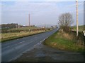
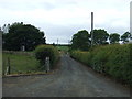
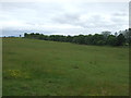

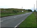


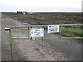
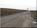
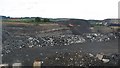
Please click the More button for more images, licensing and image copyright information.
Member of UK Parliament
This postcode is in the Dunfermline and West Fife parliamentary constituency.
Dunfermline and West Fife is a constituency in Scotland. The seat has been held by Douglas Chapman (Scottish National Party) since May 2015.

Most Recent House Sales for KY11 7ER
No recorded house sales or transfers for this postcode.
Local Petrol Station Prices
Coordinates for KY11 7ER
Sunrise and Sunset at KY11 7ER
Traffic Emission and Congestion Zones
Historical Weather Summary
| Clear | 8.26% |
| Cloudy | 55.94% |
| Rain | 11.75% |
| Windy | 23.50% |
| Other | 0.55% |
Average Energy Performance
Companies Registered at KY11 7ER
Postcode Details for KY11 7ER
Recent Updates
|
15 Apr 2024 Schools Data updated for April 2024 |
|
10 Apr 2024 Companies Data updated for March 2024 |
|
7 Apr 2024 New option to receive automatic updates to roadworks that affect you |
|
7 Apr 2024 Police and Crime data updated for February 2024 |
|
3 Apr 2024 Sold House Price data updated for February 2024 |
|
30 Mar 2024 Energy Performance Certificates (England and Wales) updated February 2024 |
|
28 Mar 2024 New feature to use Geolocating functions to detect your current location |
|
17 Mar 2024 Schools Data updated for March 2024 |
Random Postcodes
Want an idea of what is in our extensive website? Try somewhere completely random!
The Rural/Urban classification is based upon data collected during the 2011 Census and released in August 2013 and is categorised into 6 distinct classes.
[A] Urban Major conurbation: A built up area with a population of 10,000 (3,000 in Scotland) or more and is assigned to the major conurbation settlement category.
[B] Urban Minor conurbation: A built up area with a population of 10,000 (3,000 in Scotland) or more and is assigned to the minor conurbation settlement category.
[C] Urban City and town: A built up area with a population of 10,000 (3,000 in Scotland) or more and is assigned to the city and town settlement category.
[D] Rural Town and fringe
[E] Rural Village
[F] Rural Hamlet and isolated dwelling
The Index of Multiple Deprivation (IMD) is the official measure of relative deprivation.
The index is based on 39 separate indicators across seven distinct domains (Income; Employment; Health and Disability; Education, Skills and Training; Crime; Barriers to Housing and Services; Living Environment) to provide an overall measure of multiple deprivation and is calculated for every neighbourhood.
The index is relative rather than an absolute scale and so a neighbourhood with a score of 10 is more deprived than one rated 20, but this does not equate to being twice as deprived.
Please note: Different indices are used in England, Scotland, Wales and Northern Ireland and so comparison of scores from neighbourhoods in different countries should not be undertaken.
These figures report on incorporated UK companies only that are registered at this postcode and do not include sole-traders, partnerships or overseas organisations.
The population figure shown for your area are an estimate provided by the Office for National Statistics and is rounded to the nearest 1,000.
The estimates are derived from the Annual Population Survey (APS) which is the Labour Force Survey (LFS) plus various sample boosts.
There are 55 unitary authorities. They provide all local government services in their areas. These are mainly in the cities, urban areas and larger towns although there are now 6 shire county councils that are unitary (ie have no district councils beneath them).