Overview for Groveside Close, LEATHERHEAD, KT23 4LQ
Introduction
Leatherhead is a town in the Mole Valley district of Surrey, England, about 17 mi (27 km) south of Central London. The settlement grew up beside a ford on the River Mole, from which its name is thought to derive. During the late Anglo-Saxon period, Leatherhead was a royal vill and is first mentioned in the will of Alfred the Great in 880 AD. The first bridge across the Mole may have been constructed in around 1200 and this may have coincided with the expansion of the town and the enlargement of the parish church.
For much of its history, Leatherhead was primarily an agricultural settlement, with a weekly market being held until the mid-Elizabethan era. The construction of turnpike roads in the mid-18th century and the arrival of the railways in the second half of the 19th century attracted newcomers and began to stimulate the local economy. Large-scale manufacturing industries arrived following the end of the First World War and companies with factories in the town included Ronson and Goblin Vacuum Cleaners. Several organisations working with disabled people also opened treatment and training facilities, including The Royal School for the Blind, Queen Elizabeth's Foundation and the Ex-services Welfare Society.
Towards the end of the 20th century, manufacturing in Leatherhead had begun to decline and the town was instead starting to attract service sector employers. The former industrial areas were converted to business parks, which attracted multinational companies, including Esso and Unilever. A controversial redevelopment took place in the town centre in the early 1980s, which included the construction of the Swan Centre. The work, which also included the pedestrianisation of the main shopping area, was widely blamed for a decline in the local retail economy. In 2002, the BBC identified Leatherhead as having one of the worst High Streets in England, but in 2007, the local press described the town centre as "bustling".
Summary for Groveside Close, LEATHERHEAD, KT23 4LQ
Roadworks near KT23 4LQ
Road Safety near KT23 4LQ
Details of personal injury accidents in and around Groveside Close, KT23 4LQ that have been reported to Surrey Police over the past 20 years.
Traffic Levels near KT23 4LQ
View traffic levels near Groveside Close, KT23 4LQ from official Department for Transport counts.
Images taken near to Groveside Close, KT23 4LQ and the surrounding area
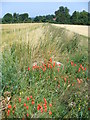
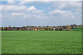

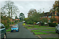
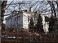
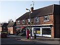
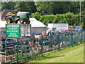
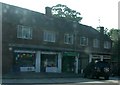
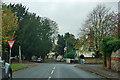
Please click the More button for more images, licensing and image copyright information.
Member of UK Parliament
This postcode is in the Mole Valley parliamentary constituency.
Mole Valley is a constituency in the South East region of England. The seat has been held by Sir Paul Beresford (Conservative) since May 2010.

Most Recent House Sales for Groveside Close, KT23 4LQ
26 Apr 2017
6 Nov 2015
17 Nov 2010
15 Jan 2007
Local Petrol Station Prices
Coordinates for KT23 4LQ
Residents at KT23 4LQ
Sunrise and Sunset at KT23 4LQ
Traffic Emission and Congestion Zones
Historical Weather Summary
| Clear | 22.46% |
| Cloudy | 65.04% |
| Rain | 6.76% |
| Windy | 5.45% |
| Other | 0.29% |
Population
Deprivation Index
the more deprived the postcode
Average Energy Performance
Companies Registered at KT23 4LQ
Postcode Details for KT23 4LQ
Recent Updates
|
18 Apr 2024 Added Traffic Camera Views from Traffic Scotland to Roadworks within Scotland |
|
15 Apr 2024 Schools Data updated for April 2024 |
|
10 Apr 2024 Companies Data updated for March 2024 |
|
7 Apr 2024 New option to receive automatic updates to roadworks that affect you |
|
7 Apr 2024 Police and Crime data updated for February 2024 |
|
3 Apr 2024 Sold House Price data updated for February 2024 |
|
30 Mar 2024 Energy Performance Certificates (England and Wales) updated February 2024 |
|
28 Mar 2024 New feature to use Geolocating functions to detect your current location |
Random Postcodes
Want an idea of what is in our extensive website? Try somewhere completely random!
The Rural/Urban classification is based upon data collected during the 2011 Census and released in August 2013 and is categorised into 6 distinct classes.
[A] Urban Major conurbation: A built up area with a population of 10,000 (3,000 in Scotland) or more and is assigned to the major conurbation settlement category.
[B] Urban Minor conurbation: A built up area with a population of 10,000 (3,000 in Scotland) or more and is assigned to the minor conurbation settlement category.
[C] Urban City and town: A built up area with a population of 10,000 (3,000 in Scotland) or more and is assigned to the city and town settlement category.
[D] Rural Town and fringe
[E] Rural Village
[F] Rural Hamlet and isolated dwelling
The Index of Multiple Deprivation (IMD) is the official measure of relative deprivation.
The index is based on 39 separate indicators across seven distinct domains (Income; Employment; Health and Disability; Education, Skills and Training; Crime; Barriers to Housing and Services; Living Environment) to provide an overall measure of multiple deprivation and is calculated for every neighbourhood.
The index is relative rather than an absolute scale and so a neighbourhood with a score of 10 is more deprived than one rated 20, but this does not equate to being twice as deprived.
Please note: Different indices are used in England, Scotland, Wales and Northern Ireland and so comparison of scores from neighbourhoods in different countries should not be undertaken.
These figures report on incorporated UK companies only that are registered at this postcode and do not include sole-traders, partnerships or overseas organisations.
The population figure shown for your area are an estimate provided by the Office for National Statistics and is rounded to the nearest 1,000.
The estimates are derived from the Annual Population Survey (APS) which is the Labour Force Survey (LFS) plus various sample boosts.
There are 26 county councils in 2-tier areas, providing services such as education, social services and waste disposal.
In 2-tier areas, each county council area is subdivided into districts, for which there is an independent district council. There are 192 district councils.
District councils are responsible for local services such as rubbish collection, housing and planning applications.