Overview for Tattenham Crescent, EPSOM, KT18 5QG
Introduction
Epsom is a town in the Borough of Epsom and Ewell in Surrey, England, about 13.5 miles (22 kilometres) south of central London. The town is first recorded as Ebesham in the 10th century and its name probably derives from that of a Saxon landowner. The earliest evidence of human activity is from the mid-Bronze Age, but the modern settlement probably grew up in the area surrounding St Martin's Church in the 6th or 7th centuries and the street pattern is thought to have become established in the Middle Ages. Today the High Street is dominated by the clock tower, which was erected in 1847–8.
Like other nearby settlements, Epsom is located on the spring line where the permeable chalk of the North Downs meets the impermeable London Clay. Several tributaries of the Hogsmill River rise in the town and in the 17th and early 18th centuries, the spring on Epsom Common was believed to have healing qualities. The mineral waters were found to be rich in Epsom salts, which were later identified as magnesium sulphate. Charles II was among those who regularly took the waters and several prominent writers, including John Aubrey, Samuel Pepys and Celia Fiennes recorded their visits. The popularity of the spa declined rapidly in the 1720s as a result of competition from other towns, including Bath and Tunbridge Wells.
Organised horse racing on Epsom Downs is believed to have taken place since the early 17th century. The popularity of Epsom grew as The Oaks and The Derby were established in 1779 and 1780 respectively. The first grandstand at the racecourse was constructed in 1829 and more than 127,000 people attended Derby Day in 1843. During the 1913 Derby, the suffragette, Emily Davison, sustained fatal injuries after being hit by King George V's horse.
The opening of the first railway station in Epsom in 1847, coupled with the breakup of the Epsom Court estate, stimulated the development of the town. Today Epsom station is an important railway junction, where lines to London Victoria and London Waterloo diverge. Since 1946, the town has been surrounded on three sides by the Metropolitan Green Belt, which severely limits the potential for expansion. Two local nature reserves, Epsom Common and Horton Country Park, are to the west of the centre and Epsom Downs, to the south, is a Site of Nature Conservation Importance.
Summary for Tattenham Crescent, EPSOM, KT18 5QG
Roadworks near KT18 5QG
Road Safety near KT18 5QG
Details of personal injury accidents in and around Tattenham Crescent, KT18 5QG that have been reported to Surrey Police over the past 20 years.
Traffic Levels near KT18 5QG
View traffic levels near Tattenham Crescent, KT18 5QG from official Department for Transport counts.
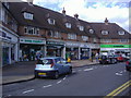
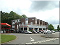
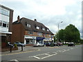
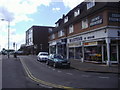
Images taken near to Tattenham Crescent, KT18 5QG and the surrounding area
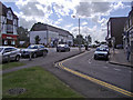
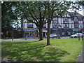
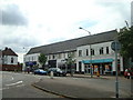
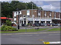
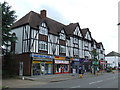
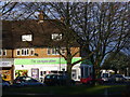
Please click the More button for more images, licensing and image copyright information.
Member of UK Parliament
This postcode is in the Epsom and Ewell parliamentary constituency.
Epsom and Ewell is a constituency in the South East region of England. The seat has been held by Chris Grayling (Conservative) since May 2010.

Most Recent House Sales for Tattenham Crescent, KT18 5QG
5 Jun 2019
31 Jul 2015
15 Oct 2007
10 Oct 2007
Local Petrol Station Prices
Coordinates for KT18 5QG
Residents at KT18 5QG
Sunrise and Sunset at KT18 5QG
Traffic Emission and Congestion Zones
Historical Weather Summary
| Clear | 23.46% |
| Cloudy | 67.41% |
| Rain | 6.74% |
| Windy | 2.23% |
| Other | 0.16% |
Population
Deprivation Index
the more deprived the postcode
Average Energy Performance
Companies Registered at KT18 5QG
Postcode Details for KT18 5QG
Recent Updates
|
18 Apr 2024 Added Traffic Camera Views from Traffic Scotland to Roadworks within Scotland |
|
15 Apr 2024 Schools Data updated for April 2024 |
|
10 Apr 2024 Companies Data updated for March 2024 |
|
7 Apr 2024 New option to receive automatic updates to roadworks that affect you |
|
7 Apr 2024 Police and Crime data updated for February 2024 |
|
3 Apr 2024 Sold House Price data updated for February 2024 |
|
30 Mar 2024 Energy Performance Certificates (England and Wales) updated February 2024 |
|
28 Mar 2024 New feature to use Geolocating functions to detect your current location |
Random Postcodes
Want an idea of what is in our extensive website? Try somewhere completely random!
The Rural/Urban classification is based upon data collected during the 2011 Census and released in August 2013 and is categorised into 6 distinct classes.
[A] Urban Major conurbation: A built up area with a population of 10,000 (3,000 in Scotland) or more and is assigned to the major conurbation settlement category.
[B] Urban Minor conurbation: A built up area with a population of 10,000 (3,000 in Scotland) or more and is assigned to the minor conurbation settlement category.
[C] Urban City and town: A built up area with a population of 10,000 (3,000 in Scotland) or more and is assigned to the city and town settlement category.
[D] Rural Town and fringe
[E] Rural Village
[F] Rural Hamlet and isolated dwelling
The Index of Multiple Deprivation (IMD) is the official measure of relative deprivation.
The index is based on 39 separate indicators across seven distinct domains (Income; Employment; Health and Disability; Education, Skills and Training; Crime; Barriers to Housing and Services; Living Environment) to provide an overall measure of multiple deprivation and is calculated for every neighbourhood.
The index is relative rather than an absolute scale and so a neighbourhood with a score of 10 is more deprived than one rated 20, but this does not equate to being twice as deprived.
Please note: Different indices are used in England, Scotland, Wales and Northern Ireland and so comparison of scores from neighbourhoods in different countries should not be undertaken.
These figures report on incorporated UK companies only that are registered at this postcode and do not include sole-traders, partnerships or overseas organisations.
The population figure shown for your area are an estimate provided by the Office for National Statistics and is rounded to the nearest 1,000.
The estimates are derived from the Annual Population Survey (APS) which is the Labour Force Survey (LFS) plus various sample boosts.
There are 26 county councils in 2-tier areas, providing services such as education, social services and waste disposal.
In 2-tier areas, each county council area is subdivided into districts, for which there is an independent district council. There are 192 district councils.
District councils are responsible for local services such as rubbish collection, housing and planning applications.