Overview for Lodge Hill, ILFORD, IG4 5LJ
Introduction
Ilford is a large town in east London, England, 9 miles (14 km) north-east of Charing Cross. Part of the London Borough of Redbridge, Ilford is within the ceremonial county of Greater London. It had a population of 168,168 in 2011, compared to 303,858 for the entire borough.
Identified as a metropolitan centre in the London Plan, Ilford's commercial and retail centre is surrounded by extensive residential development. The town is on the transport corridor between London and coastal Essex, with both the A12 and the central railway station linking the regions. In recent years, as a result of increased levels of immigration, Ilford has become one of the most multicultural towns in England.
Historically a small rural settlement in the ancient parish of Barking in the Becontree hundred of the historic county of Essex, its strategic position on the River Roding and the London to Colchester road made it a coaching town. The arrival of the railway in 1839 accelerated its growth, leading to the area becoming a suburb and part of the conurbation of London. It split from the parish of Barking in 1888, and, in the 20th century, Ilford significantly expanded and increased in population, becoming a municipal borough in 1926. In 1965, it merged with Wanstead and Woodford, also incorporating parts of neighbouring districts, to form the London Borough of Redbridge, part of Greater London.
Summary for Lodge Hill, ILFORD, IG4 5LJ
Roadworks near IG4 5LJ
Road Safety near IG4 5LJ
Details of personal injury accidents in and around Lodge Hill, IG4 5LJ that have been reported to Metropolitan Police Service over the past 20 years.
Traffic Levels near IG4 5LJ
View traffic levels near Lodge Hill, IG4 5LJ from official Department for Transport counts.
Images taken near to Lodge Hill, IG4 5LJ and the surrounding area

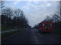
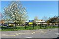
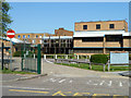
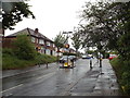
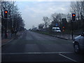
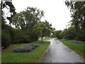
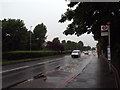
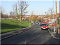
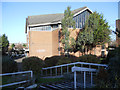
Please click the More button for more images, licensing and image copyright information.
Member of UK Parliament
This postcode is in the Ilford North parliamentary constituency.
Ilford North is a constituency in London, England. The seat has been held by Wes Streeting (Labour) since May 2015.

Most Recent House Sales for Lodge Hill, IG4 5LJ
19 Aug 2022
21 Feb 2006
27 Oct 2005
Local Petrol Station Prices
Coordinates for IG4 5LJ
Residents at IG4 5LJ
Sunrise and Sunset at IG4 5LJ
Traffic Emission Zones
Historical Weather Summary
| Clear | 9.06% |
| Cloudy | 80.11% |
| Rain | 7.73% |
| Windy | 3.01% |
| Other | 0.09% |
Population
Deprivation Index
the more deprived the postcode
Average Energy Performance
Companies Registered at IG4 5LJ
Postcode Details for IG4 5LJ
Recent Updates
|
18 Apr 2024 Added Traffic Camera Views from Traffic Scotland to Roadworks within Scotland |
|
15 Apr 2024 Schools Data updated for April 2024 |
|
10 Apr 2024 Companies Data updated for March 2024 |
|
7 Apr 2024 New option to receive automatic updates to roadworks that affect you |
|
7 Apr 2024 Police and Crime data updated for February 2024 |
|
3 Apr 2024 Sold House Price data updated for February 2024 |
|
30 Mar 2024 Energy Performance Certificates (England and Wales) updated February 2024 |
|
28 Mar 2024 New feature to use Geolocating functions to detect your current location |
Random Postcodes
Want an idea of what is in our extensive website? Try somewhere completely random!
The Rural/Urban classification is based upon data collected during the 2011 Census and released in August 2013 and is categorised into 6 distinct classes.
[A] Urban Major conurbation: A built up area with a population of 10,000 (3,000 in Scotland) or more and is assigned to the major conurbation settlement category.
[B] Urban Minor conurbation: A built up area with a population of 10,000 (3,000 in Scotland) or more and is assigned to the minor conurbation settlement category.
[C] Urban City and town: A built up area with a population of 10,000 (3,000 in Scotland) or more and is assigned to the city and town settlement category.
[D] Rural Town and fringe
[E] Rural Village
[F] Rural Hamlet and isolated dwelling
The Index of Multiple Deprivation (IMD) is the official measure of relative deprivation.
The index is based on 39 separate indicators across seven distinct domains (Income; Employment; Health and Disability; Education, Skills and Training; Crime; Barriers to Housing and Services; Living Environment) to provide an overall measure of multiple deprivation and is calculated for every neighbourhood.
The index is relative rather than an absolute scale and so a neighbourhood with a score of 10 is more deprived than one rated 20, but this does not equate to being twice as deprived.
Please note: Different indices are used in England, Scotland, Wales and Northern Ireland and so comparison of scores from neighbourhoods in different countries should not be undertaken.
These figures report on incorporated UK companies only that are registered at this postcode and do not include sole-traders, partnerships or overseas organisations.
The population figure shown for your area are an estimate provided by the Office for National Statistics and is rounded to the nearest 1,000.
The estimates are derived from the Annual Population Survey (APS) which is the Labour Force Survey (LFS) plus various sample boosts.
There are 32 London boroughs. They provide nearly all the services in their area. However, the Greater London Authority (GLA) provides London-wide government, including special responsibility for police, fire, strategic planning and transport.