Overview for Breamer Lane, HULL, HU11 5SQ
Introduction
Kingston upon Hull, usually abbreviated to Hull, is a port city and unitary authority area in the East Riding of Yorkshire, England. It lies upon the River Hull at its confluence with the Humber Estuary, 25 miles (40 km) inland from the North Sea and 37 miles (60 km) south-east of York, the historic county town. With a population of 267,014 (2021), it is the fourth-largest city in the Yorkshire and the Humber region after Leeds, Sheffield and Bradford.
The town of Wyke on Hull was founded late in the 12th century by the monks of Meaux Abbey as a port from which to export their wool.
Renamed Kings-town upon Hull in 1299, Hull had been a market town, military supply port, trading centre, fishing and whaling centre and industrial metropolis.
Hull was an early theatre of battle in the English Civil Wars. Its 18th-century Member of Parliament, William Wilberforce, took a prominent part in the abolition of the slave trade in Britain.
More than 95% of the city was damaged or destroyed in the blitz and suffered a period of post-industrial decline (social deprivation, education and policing). The destroyed areas of the city were rebuilt in the post-Second World War period. In the early 21st century spending boom before the late 2000s recession the city saw large amounts of new retail, commercial, housing and public service construction spending.
In 2017, it was the UK City of Culture and hosted the Turner Prize at the city's Ferens Art Gallery. Other notable landmarks in the city are the Minster, the tidal surge barrier, the Paragon Interchange and The Deep aquarium. Areas of the town centre include the old town (including its museum quarter) and the marina. Hull University was founded in 1927 and had over 16,000 students in 2022. Rugby league football teams include clubs Hull F.
C. and Hull Kingston Rovers. The city's association football club is Hull City (EFL Championship). Hull RUFC and Hull Ionians both play in the National League 2 North of rugby union.
Summary for Breamer Lane, HULL, HU11 5SQ
Roadworks near HU11 5SQ
Road Safety near HU11 5SQ
Details of personal injury accidents in and around Breamer Lane, HU11 5SQ that have been reported to Humberside Police over the past 20 years.
Traffic Levels near HU11 5SQ
View traffic levels near Breamer Lane, HU11 5SQ from official Department for Transport counts.
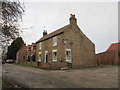
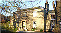
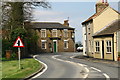
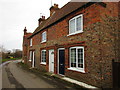
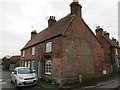
Images taken near to Breamer Lane, HU11 5SQ and the surrounding area
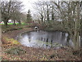
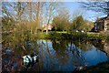
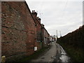
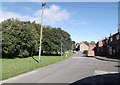

Please click the More button for more images, licensing and image copyright information.
Hull and nearby Videos From YouTube
West Hill Fly By
Just hooning around the local area. If you would like to use or license any of this footage please feel free to contact me. Please ...
Channel: Flight Fantastic (View Channel)
Published: 19 Jun 2023
Police
This area is policed by Humberside Police.
Humberside Police split their policing area into 81 separate neighbourhoods and this postcode is in the North Holderness neighbourhood.

North Holderness Neighbourhood Crime
Top 3 Categories
For full details of all categories together with more crime information, click on the Details button.
Member of UK Parliament
This postcode is in the Beverley and Holderness parliamentary constituency.
Beverley and Holderness is a constituency in the Yorkshire and The Humber region of England. The seat has been held by Graham Stuart (Conservative) since May 2010.

Most Recent House Sales for Breamer Lane, HU11 5SQ
30 Jun 2022
10 Nov 2021
30 Jul 2020
31 Oct 2018
Local Petrol Station Prices
Coordinates for HU11 5SQ
Residents at HU11 5SQ
Sunrise and Sunset at HU11 5SQ
Traffic Emission and Congestion Zones
Historical Weather Summary
| Clear | 10.10% |
| Cloudy | 51.27% |
| Rain | 8.47% |
| Windy | 30.16% |
| Other | 0.00% |
Population
Deprivation Index
the more deprived the postcode
Average Energy Performance
Companies Registered at HU11 5SQ
Postcode Details for HU11 5SQ
Recent Updates
|
18 Apr 2024 Added Traffic Camera Views from Traffic Scotland to Roadworks within Scotland |
|
15 Apr 2024 Schools Data updated for April 2024 |
|
10 Apr 2024 Companies Data updated for March 2024 |
|
7 Apr 2024 New option to receive automatic updates to roadworks that affect you |
|
7 Apr 2024 Police and Crime data updated for February 2024 |
|
3 Apr 2024 Sold House Price data updated for February 2024 |
|
30 Mar 2024 Energy Performance Certificates (England and Wales) updated February 2024 |
|
28 Mar 2024 New feature to use Geolocating functions to detect your current location |
Random Postcodes
Want an idea of what is in our extensive website? Try somewhere completely random!
The Rural/Urban classification is based upon data collected during the 2011 Census and released in August 2013 and is categorised into 6 distinct classes.
[A] Urban Major conurbation: A built up area with a population of 10,000 (3,000 in Scotland) or more and is assigned to the major conurbation settlement category.
[B] Urban Minor conurbation: A built up area with a population of 10,000 (3,000 in Scotland) or more and is assigned to the minor conurbation settlement category.
[C] Urban City and town: A built up area with a population of 10,000 (3,000 in Scotland) or more and is assigned to the city and town settlement category.
[D] Rural Town and fringe
[E] Rural Village
[F] Rural Hamlet and isolated dwelling
The Index of Multiple Deprivation (IMD) is the official measure of relative deprivation.
The index is based on 39 separate indicators across seven distinct domains (Income; Employment; Health and Disability; Education, Skills and Training; Crime; Barriers to Housing and Services; Living Environment) to provide an overall measure of multiple deprivation and is calculated for every neighbourhood.
The index is relative rather than an absolute scale and so a neighbourhood with a score of 10 is more deprived than one rated 20, but this does not equate to being twice as deprived.
Please note: Different indices are used in England, Scotland, Wales and Northern Ireland and so comparison of scores from neighbourhoods in different countries should not be undertaken.
These figures report on incorporated UK companies only that are registered at this postcode and do not include sole-traders, partnerships or overseas organisations.
The population figure shown for your area are an estimate provided by the Office for National Statistics and is rounded to the nearest 1,000.
The estimates are derived from the Annual Population Survey (APS) which is the Labour Force Survey (LFS) plus various sample boosts.
There are 55 unitary authorities. They provide all local government services in their areas. These are mainly in the cities, urban areas and larger towns although there are now 6 shire county councils that are unitary (ie have no district councils beneath them).