Overview for EDGWARE, HA8 7XD
Introduction
Edgware is a suburban town in northern Greater London, mostly in the London Borough of Barnet but with some parts falling in the London Borough of Harrow and in the London Borough of Brent. Edgware is centred 9.5 miles (15.3 km) north-northwest of Charing Cross and has its own commercial centre. Edgware has a generally suburban character, typical of the rural-urban fringe. It was an ancient parish in the county of Middlesex directly east of the ancient Watling Street, and gives its name to the present day Edgware Road that runs from central London towards the town. The community benefits from some elevated woodland on a high ridge marking the Hertfordshire border of gravel and sand. It includes the areas of Burnt Oak, The Hale, Edgwarebury, Canons Park, and parts of Queensbury.
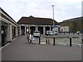
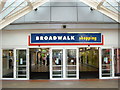
Edgware is principally a shopping and residential area, identified in the London Plan as one of the capital's 35 major centres, and one of the northern termini of the Northern line. It has a bus garage, a shopping centre called the Broadwalk Centre, a library, a community hospital—Edgware Community Hospital, and two streams—Edgware Brook and Deans Brook, both tributaries of a small brook known as Silk Stream, which in turn merges with the River Brent at Brent Reservoir.
As of 2011, the town had a population of 76,506 and is made up of five wards from Barnet, Harrow and Brent boroughs.
Summary for EDGWARE, HA8 7XD
Roadworks near HA8 7XD
Road Safety near HA8 7XD
Details of personal injury accidents in and around HA8 7XD that have been reported to Metropolitan Police Service over the past 20 years.
Traffic Levels near HA8 7XD
View traffic levels near HA8 7XD from official Department for Transport counts.
Images taken in and around the ha87xd area
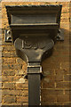
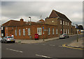
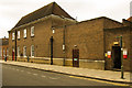
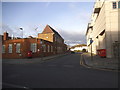
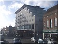
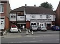
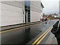
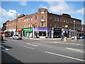
Please click the More button for more images, licensing and image copyright information.
Member of UK Parliament
This postcode is in the Hendon parliamentary constituency.
Hendon is a constituency in London, England. The seat has been held by Dr Matthew Offord (Conservative) since May 2010.

Most Recent House Sales for HA8 7XD
No recorded house sales or transfers for this postcode.
Local Petrol Station Prices
Coordinates for HA8 7XD
Residents at HA8 7XD
Sunrise and Sunset at HA8 7XD
Traffic Emission Zones
Historical Weather Summary
| Clear | 9.27% |
| Cloudy | 80.61% |
| Rain | 7.99% |
| Windy | 2.08% |
| Other | 0.05% |
Population
Deprivation Index
the more deprived the postcode
Companies Registered at HA8 7XD
Postcode Details for HA8 7XD
Recent Updates
|
18 Apr 2024 Added Traffic Camera Views from Traffic Scotland to Roadworks within Scotland |
|
15 Apr 2024 Schools Data updated for April 2024 |
|
10 Apr 2024 Companies Data updated for March 2024 |
|
7 Apr 2024 New option to receive automatic updates to roadworks that affect you |
|
7 Apr 2024 Police and Crime data updated for February 2024 |
|
3 Apr 2024 Sold House Price data updated for February 2024 |
|
30 Mar 2024 Energy Performance Certificates (England and Wales) updated February 2024 |
|
28 Mar 2024 New feature to use Geolocating functions to detect your current location |
Random Postcodes
Want an idea of what is in our extensive website? Try somewhere completely random!
The Rural/Urban classification is based upon data collected during the 2011 Census and released in August 2013 and is categorised into 6 distinct classes.
[A] Urban Major conurbation: A built up area with a population of 10,000 (3,000 in Scotland) or more and is assigned to the major conurbation settlement category.
[B] Urban Minor conurbation: A built up area with a population of 10,000 (3,000 in Scotland) or more and is assigned to the minor conurbation settlement category.
[C] Urban City and town: A built up area with a population of 10,000 (3,000 in Scotland) or more and is assigned to the city and town settlement category.
[D] Rural Town and fringe
[E] Rural Village
[F] Rural Hamlet and isolated dwelling
The Index of Multiple Deprivation (IMD) is the official measure of relative deprivation.
The index is based on 39 separate indicators across seven distinct domains (Income; Employment; Health and Disability; Education, Skills and Training; Crime; Barriers to Housing and Services; Living Environment) to provide an overall measure of multiple deprivation and is calculated for every neighbourhood.
The index is relative rather than an absolute scale and so a neighbourhood with a score of 10 is more deprived than one rated 20, but this does not equate to being twice as deprived.
Please note: Different indices are used in England, Scotland, Wales and Northern Ireland and so comparison of scores from neighbourhoods in different countries should not be undertaken.
These figures report on incorporated UK companies only that are registered at this postcode and do not include sole-traders, partnerships or overseas organisations.
The population figure shown for your area are an estimate provided by the Office for National Statistics and is rounded to the nearest 1,000.
The estimates are derived from the Annual Population Survey (APS) which is the Labour Force Survey (LFS) plus various sample boosts.
Large User Postcode
This postcode is designated a large user postcode. A large user postcode is assigned by Royal Mail to those organisations typically receiving at least 500 mail items per day and so will usually be found assigned to business premises.
There are 32 London boroughs. They provide nearly all the services in their area. However, the Greater London Authority (GLA) provides London-wide government, including special responsibility for police, fire, strategic planning and transport.