Overview for Eastcote Road, PINNER, HA5 1DS
Introduction
Pinner is a suburb in the London Borough of Harrow, northwest London, England, 12 miles (19 km) northwest of Charing Cross, close to the border with Hillingdon, historically in the county of Middlesex. The population was 38,698 in 2021.
Originally a mediaeval hamlet, the St John Baptist church dates from the 14th century and other parts of the historic village include Tudor buildings. The newer High Street is mainly 18th-century buildings, while Bridge Street has a more urban character and many chain stores.
Summary for Eastcote Road, PINNER, HA5 1DS
Roadworks near HA5 1DS
Road Safety near HA5 1DS
Details of personal injury accidents in and around Eastcote Road, HA5 1DS that have been reported to Metropolitan Police Service over the past 20 years.
Traffic Levels near HA5 1DS
View traffic levels near Eastcote Road, HA5 1DS from official Department for Transport counts.
Images taken near to Eastcote Road, HA5 1DS and the surrounding area
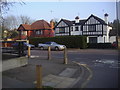
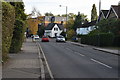
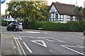
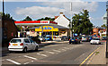
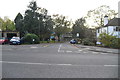
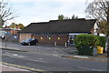
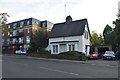

Please click the More button for more images, licensing and image copyright information.
Member of UK Parliament
This postcode is in the Ruislip, Northwood and Pinner parliamentary constituency.
Ruislip, Northwood and Pinner is a constituency in London, England. The seat has been held by David Simmonds (Conservative) since December 2019.

Most Recent House Sales for Eastcote Road, HA5 1DS
No recorded house sales or transfers for this postcode.
Local Petrol Station Prices
Coordinates for HA5 1DS
Residents at HA5 1DS
Sunrise and Sunset at HA5 1DS
Traffic Emission Zones
Historical Weather Summary
| Clear | 8.97% |
| Cloudy | 79.12% |
| Rain | 8.21% |
| Windy | 3.66% |
| Other | 0.04% |
Population
Deprivation Index
the more deprived the postcode
Average Energy Performance
Companies Registered at HA5 1DS
Postcode Details for HA5 1DS
Recent Updates
|
18 Apr 2024 Added Traffic Camera Views from Traffic Scotland to Roadworks within Scotland |
|
15 Apr 2024 Schools Data updated for April 2024 |
|
10 Apr 2024 Companies Data updated for March 2024 |
|
7 Apr 2024 New option to receive automatic updates to roadworks that affect you |
|
7 Apr 2024 Police and Crime data updated for February 2024 |
|
3 Apr 2024 Sold House Price data updated for February 2024 |
|
30 Mar 2024 Energy Performance Certificates (England and Wales) updated February 2024 |
|
28 Mar 2024 New feature to use Geolocating functions to detect your current location |
Random Postcodes
Want an idea of what is in our extensive website? Try somewhere completely random!
The Rural/Urban classification is based upon data collected during the 2011 Census and released in August 2013 and is categorised into 6 distinct classes.
[A] Urban Major conurbation: A built up area with a population of 10,000 (3,000 in Scotland) or more and is assigned to the major conurbation settlement category.
[B] Urban Minor conurbation: A built up area with a population of 10,000 (3,000 in Scotland) or more and is assigned to the minor conurbation settlement category.
[C] Urban City and town: A built up area with a population of 10,000 (3,000 in Scotland) or more and is assigned to the city and town settlement category.
[D] Rural Town and fringe
[E] Rural Village
[F] Rural Hamlet and isolated dwelling
The Index of Multiple Deprivation (IMD) is the official measure of relative deprivation.
The index is based on 39 separate indicators across seven distinct domains (Income; Employment; Health and Disability; Education, Skills and Training; Crime; Barriers to Housing and Services; Living Environment) to provide an overall measure of multiple deprivation and is calculated for every neighbourhood.
The index is relative rather than an absolute scale and so a neighbourhood with a score of 10 is more deprived than one rated 20, but this does not equate to being twice as deprived.
Please note: Different indices are used in England, Scotland, Wales and Northern Ireland and so comparison of scores from neighbourhoods in different countries should not be undertaken.
These figures report on incorporated UK companies only that are registered at this postcode and do not include sole-traders, partnerships or overseas organisations.
The population figure shown for your area are an estimate provided by the Office for National Statistics and is rounded to the nearest 1,000.
The estimates are derived from the Annual Population Survey (APS) which is the Labour Force Survey (LFS) plus various sample boosts.
There are 32 London boroughs. They provide nearly all the services in their area. However, the Greater London Authority (GLA) provides London-wide government, including special responsibility for police, fire, strategic planning and transport.