Overview for Minley Road, FLEET, GU51 2RA
Introduction
Fleet is a town and civil parish in the Hart District of Hampshire, England, centred 38.2 miles (61.5 km) WSW of London and 13 miles (21 km) east of Basingstoke. It is the major town of the Hart District, and has large technology business areas, fast rail links to London, and is well connected to the M3. The Fleet built-up area has a total population of 42,835, and includes the contiguous parishes of Church Crookham, Crookham Village, Dogmersfield, and Elvetham Heath. The town has a prominent golf club, an annual half marathon, an athletics club, and four football clubs. The nearby service station on the motorway is named after the town.
Hart, of which Fleet is the main town, was voted the best place to live in the UK by the Halifax Quality of Life study in 2011, 2012, 2013, 2014, 2015, and again in 2017, above areas such as Elmbridge in Surrey and Wokingham in Berkshire. This is due to the highly affluent majority of the population, better weather and health conditions, high levels of access to leisure space, and the town's surrounding countryside which includes woodlands and the Basingstoke Canal.
Local landmarks include Fleet Pond, the largest freshwater lake in Hampshire, and a High Street with many Victorian and Edwardian buildings. Fleet holds a weekly Saturday market in Gurkha Square.
Summary for Minley Road, FLEET, GU51 2RA
Roadworks near GU51 2RA
Road Safety near GU51 2RA
Details of personal injury accidents in and around Minley Road, GU51 2RA that have been reported to Hampshire Constabulary over the past 20 years.
Traffic Levels near GU51 2RA
View traffic levels near Minley Road, GU51 2RA from official Department for Transport counts.
Images taken near to Minley Road, GU51 2RA and the surrounding area
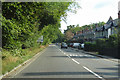


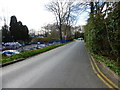


Please click the More button for more images, licensing and image copyright information.
Police
This area is policed by Hampshire Constabulary.
Hampshire Constabulary split their policing area into 95 separate neighbourhoods and this postcode is in the Fleet and Church Crookham neighbourhood.

Fleet and Church Crookham Neighbourhood Crime
Top 3 Categories
For full details of all categories together with more crime information, click on the Details button.
Member of UK Parliament
This postcode is in the North East Hampshire parliamentary constituency.
North East Hampshire is a constituency in the South East region of England. The seat has been held by Mr Ranil Jayawardena (Conservative) since May 2015.

Most Recent House Sales for Minley Road, GU51 2RA
3 Feb 2021
25 Mar 2019
18 Feb 2019
20 Oct 2017
Local Petrol Station Prices
Coordinates for GU51 2RA
Residents at GU51 2RA
Sunrise and Sunset at GU51 2RA
Traffic Emission and Congestion Zones
Historical Weather Summary
| Clear | 22.06% |
| Cloudy | 69.73% |
| Rain | 6.75% |
| Windy | 1.31% |
| Other | 0.15% |
Population
Deprivation Index
the more deprived the postcode
Average Energy Performance
Companies Registered at GU51 2RA
Postcode Details for GU51 2RA
Recent Updates
|
18 Apr 2024 Added Traffic Camera Views from Traffic Scotland to Roadworks within Scotland |
|
15 Apr 2024 Schools Data updated for April 2024 |
|
10 Apr 2024 Companies Data updated for March 2024 |
|
7 Apr 2024 New option to receive automatic updates to roadworks that affect you |
|
7 Apr 2024 Police and Crime data updated for February 2024 |
|
3 Apr 2024 Sold House Price data updated for February 2024 |
|
30 Mar 2024 Energy Performance Certificates (England and Wales) updated February 2024 |
|
28 Mar 2024 New feature to use Geolocating functions to detect your current location |
Random Postcodes
Want an idea of what is in our extensive website? Try somewhere completely random!
The Rural/Urban classification is based upon data collected during the 2011 Census and released in August 2013 and is categorised into 6 distinct classes.
[A] Urban Major conurbation: A built up area with a population of 10,000 (3,000 in Scotland) or more and is assigned to the major conurbation settlement category.
[B] Urban Minor conurbation: A built up area with a population of 10,000 (3,000 in Scotland) or more and is assigned to the minor conurbation settlement category.
[C] Urban City and town: A built up area with a population of 10,000 (3,000 in Scotland) or more and is assigned to the city and town settlement category.
[D] Rural Town and fringe
[E] Rural Village
[F] Rural Hamlet and isolated dwelling
The Index of Multiple Deprivation (IMD) is the official measure of relative deprivation.
The index is based on 39 separate indicators across seven distinct domains (Income; Employment; Health and Disability; Education, Skills and Training; Crime; Barriers to Housing and Services; Living Environment) to provide an overall measure of multiple deprivation and is calculated for every neighbourhood.
The index is relative rather than an absolute scale and so a neighbourhood with a score of 10 is more deprived than one rated 20, but this does not equate to being twice as deprived.
Please note: Different indices are used in England, Scotland, Wales and Northern Ireland and so comparison of scores from neighbourhoods in different countries should not be undertaken.
These figures report on incorporated UK companies only that are registered at this postcode and do not include sole-traders, partnerships or overseas organisations.
The population figure shown for your area are an estimate provided by the Office for National Statistics and is rounded to the nearest 1,000.
The estimates are derived from the Annual Population Survey (APS) which is the Labour Force Survey (LFS) plus various sample boosts.
There are 26 county councils in 2-tier areas, providing services such as education, social services and waste disposal.
In 2-tier areas, each county council area is subdivided into districts, for which there is an independent district council. There are 192 district councils.
District councils are responsible for local services such as rubbish collection, housing and planning applications.