Overview for Oak Close, HASLEMERE, GU27 3AJ
Introduction
The town of Haslemere and the villages of Shottermill and Grayswood are in south west Surrey, England, around 39 mi (62 km) south west of London. Together with the settlements of Hindhead and Beacon Hill, they comprise the civil parish of Haslemere in the Borough of Waverley. The tripoint between the counties of Surrey, Hampshire and West Sussex is at the west end of Shottermill.
Much of the civil parish is in the catchment area of the south branch of the River Wey, which rises on Blackdown in West Sussex. The urban areas of Haslemere and Shottermill are concentrated along the valleys of the young river and its tributaries, and many of the local roads are narrow and steep. The National Trust is a major landowner in the civil parish and its properties include Swan Barn Farm. The Surrey Hills Area of Outstanding Natural Beauty is to the north of the town and the South Downs National Park is to the south.
Haslemere is thought to have originated as a planned town in the 12th century and was awarded a market charter in 1221. By the early 16th century, it had become a Parliamentary borough and was represented by two MPs in the House of Commons until 1832. The town began to grow in the second half of the 19th century, following the opening of the London to Portsmouth railway line in 1859. In late-Victorian times, it became a centre for the Arts and Crafts movement and the International Dolmetsch Early Music Festival was founded in 1925. Haslemere became an Urban District in 1913, but under the Local Government Act 1972, its status was reduced to a civil parish with a town council.
Shottermill grew up as a hamlet near to one of the watermills on the River Wey in the 16th century. The settlement began to expand in the 1880s and joined the Haslemere Urban District in 1933. Until the end of the 19th century, Grayswood was a small farming community, but became an ecclesiastical parish in 1901.
Summary for Oak Close, HASLEMERE, GU27 3AJ
Roadworks near GU27 3AJ
Road Safety near GU27 3AJ
Details of personal injury accidents in and around Oak Close, GU27 3AJ that have been reported to Sussex Police over the past 20 years.
Traffic Levels near GU27 3AJ
View traffic levels near Oak Close, GU27 3AJ from official Department for Transport counts.
Images taken near to Oak Close, GU27 3AJ and the surrounding area
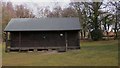
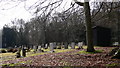
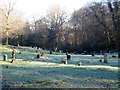
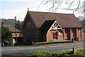
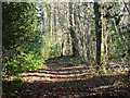
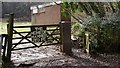
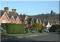
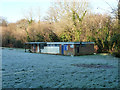
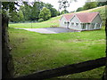
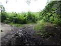
Please click the More button for more images, licensing and image copyright information.
Police
This area is policed by Sussex Police.
Sussex Police split their policing area into 273 separate neighbourhoods and this postcode is in the Fernhurst neighbourhood.

Fernhurst Neighbourhood Crime
Top 3 Categories
For full details of all categories together with more crime information, click on the Details button.
Member of UK Parliament
This postcode is in the Chichester parliamentary constituency.
Chichester is a constituency in the South East region of England. The seat has been held by Gillian Keegan (Conservative) since June 2017.

Most Recent House Sales for Oak Close, GU27 3AJ
No recorded house sales or transfers for this postcode.
Local Petrol Station Prices
Coordinates for GU27 3AJ
Residents at GU27 3AJ
Sunrise and Sunset at GU27 3AJ
Traffic Emission and Congestion Zones
Historical Weather Summary
| Clear | 22.84% |
| Cloudy | 67.19% |
| Rain | 7.37% |
| Windy | 2.39% |
| Other | 0.21% |
Population
Deprivation Index
the more deprived the postcode
Average Energy Performance
Companies Registered at GU27 3AJ
National Park for GU27 3AJ
Postcode Details for GU27 3AJ
Recent Updates
|
18 Apr 2024 Added Traffic Camera Views from Traffic Scotland to Roadworks within Scotland |
|
15 Apr 2024 Schools Data updated for April 2024 |
|
10 Apr 2024 Companies Data updated for March 2024 |
|
7 Apr 2024 New option to receive automatic updates to roadworks that affect you |
|
7 Apr 2024 Police and Crime data updated for February 2024 |
|
3 Apr 2024 Sold House Price data updated for February 2024 |
|
30 Mar 2024 Energy Performance Certificates (England and Wales) updated February 2024 |
|
28 Mar 2024 New feature to use Geolocating functions to detect your current location |
Random Postcodes
Want an idea of what is in our extensive website? Try somewhere completely random!
The Rural/Urban classification is based upon data collected during the 2011 Census and released in August 2013 and is categorised into 6 distinct classes.
[A] Urban Major conurbation: A built up area with a population of 10,000 (3,000 in Scotland) or more and is assigned to the major conurbation settlement category.
[B] Urban Minor conurbation: A built up area with a population of 10,000 (3,000 in Scotland) or more and is assigned to the minor conurbation settlement category.
[C] Urban City and town: A built up area with a population of 10,000 (3,000 in Scotland) or more and is assigned to the city and town settlement category.
[D] Rural Town and fringe
[E] Rural Village
[F] Rural Hamlet and isolated dwelling
The Index of Multiple Deprivation (IMD) is the official measure of relative deprivation.
The index is based on 39 separate indicators across seven distinct domains (Income; Employment; Health and Disability; Education, Skills and Training; Crime; Barriers to Housing and Services; Living Environment) to provide an overall measure of multiple deprivation and is calculated for every neighbourhood.
The index is relative rather than an absolute scale and so a neighbourhood with a score of 10 is more deprived than one rated 20, but this does not equate to being twice as deprived.
Please note: Different indices are used in England, Scotland, Wales and Northern Ireland and so comparison of scores from neighbourhoods in different countries should not be undertaken.
These figures report on incorporated UK companies only that are registered at this postcode and do not include sole-traders, partnerships or overseas organisations.
The population figure shown for your area are an estimate provided by the Office for National Statistics and is rounded to the nearest 1,000.
The estimates are derived from the Annual Population Survey (APS) which is the Labour Force Survey (LFS) plus various sample boosts.
There are 26 county councils in 2-tier areas, providing services such as education, social services and waste disposal.
In 2-tier areas, each county council area is subdivided into districts, for which there is an independent district council. There are 192 district councils.
District councils are responsible for local services such as rubbish collection, housing and planning applications.