Overview for Hawkesbury Upton, BADMINTON, GL9 1AL
Introduction
Badminton is a racquet sport played using racquets to hit a shuttlecock across a net. Although it may be played with larger teams, the most common forms of the game are "singles" (with one player per side) and "doubles" (with two players per side). Badminton is often played as a casual outdoor activity in a yard or on a beach; formal games are played on a rectangular indoor court. Points are scored by striking the shuttlecock with the racquet and landing it within the other team's half of the court.
Each side may only strike the shuttlecock once before it passes over the net. Play ends once the shuttlecock has struck the floor or ground, or if a fault has been called by the umpire, service judge, or (in their absence) the opposing side.
The shuttlecock is a feathered or (in informal matches) plastic projectile that flies differently from the balls used in many other sports. In particular, the feathers create much higher drag, causing the shuttlecock to decelerate more rapidly. Shuttlecocks also have a high top speed compared to the balls in other racquet sports. The flight of the shuttlecock gives the sport its distinctive nature.
The game developed in British India from the earlier game of battledore and shuttlecock. European play came to be dominated by Denmark but the game has become very popular in Asia, with recent competitions dominated by China. In 1992, badminton debuted as a Summer Olympic sport with four events: men's singles, women's singles, men's doubles, and women's doubles; mixed doubles was added four years later. At high levels of play, the sport demands excellent fitness: players require aerobic stamina, agility, strength, speed, and precision. It is also a technical sport, requiring good motor coordination and the development of sophisticated racquet movements.
Summary for Hawkesbury Upton, BADMINTON, GL9 1AL
Roadworks near GL9 1AL
Road Safety near GL9 1AL
Details of personal injury accidents in and around GL9 1AL that have been reported to Avon and Somerset Constabulary over the past 20 years.
Traffic Levels near GL9 1AL
View traffic levels near GL9 1AL from official Department for Transport counts.
Images taken in and around the gl91al area
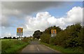
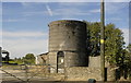
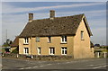
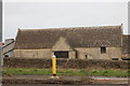
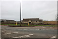
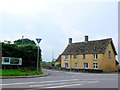
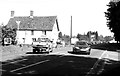
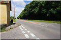
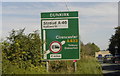
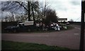
Please click the More button for more images, licensing and image copyright information.
Police
This area is policed by Avon and Somerset Constabulary.
Avon and Somerset Constabulary split their policing area into 123 separate neighbourhoods and this postcode is in the Chipping Sodbury neighbourhood.

Chipping Sodbury Neighbourhood Crime
Top 3 Categories
For full details of all categories together with more crime information, click on the Details button.
Member of UK Parliament
This postcode is in the Thornbury and Yate parliamentary constituency.
Thornbury and Yate is a constituency in the South West region of England. The seat has been held by Luke Hall (Conservative) since May 2015.

Most Recent House Sales for GL9 1AL
25 Jan 2016
18 Aug 1995
Local Petrol Station Prices
Coordinates for GL9 1AL
Residents at GL9 1AL
Sunrise and Sunset at GL9 1AL
Traffic Emission and Congestion Zones
Historical Weather Summary
| Clear | 20.03% |
| Cloudy | 68.21% |
| Rain | 7.09% |
| Windy | 4.52% |
| Other | 0.15% |
Population
Deprivation Index
the more deprived the postcode
Average Energy Performance
Companies Registered at GL9 1AL
Postcode Details for GL9 1AL
Recent Updates
|
18 Apr 2024 Added Traffic Camera Views from Traffic Scotland to Roadworks within Scotland |
|
15 Apr 2024 Schools Data updated for April 2024 |
|
10 Apr 2024 Companies Data updated for March 2024 |
|
7 Apr 2024 New option to receive automatic updates to roadworks that affect you |
|
7 Apr 2024 Police and Crime data updated for February 2024 |
|
3 Apr 2024 Sold House Price data updated for February 2024 |
|
30 Mar 2024 Energy Performance Certificates (England and Wales) updated February 2024 |
|
28 Mar 2024 New feature to use Geolocating functions to detect your current location |
Random Postcodes
Want an idea of what is in our extensive website? Try somewhere completely random!
The Rural/Urban classification is based upon data collected during the 2011 Census and released in August 2013 and is categorised into 6 distinct classes.
[A] Urban Major conurbation: A built up area with a population of 10,000 (3,000 in Scotland) or more and is assigned to the major conurbation settlement category.
[B] Urban Minor conurbation: A built up area with a population of 10,000 (3,000 in Scotland) or more and is assigned to the minor conurbation settlement category.
[C] Urban City and town: A built up area with a population of 10,000 (3,000 in Scotland) or more and is assigned to the city and town settlement category.
[D] Rural Town and fringe
[E] Rural Village
[F] Rural Hamlet and isolated dwelling
The Index of Multiple Deprivation (IMD) is the official measure of relative deprivation.
The index is based on 39 separate indicators across seven distinct domains (Income; Employment; Health and Disability; Education, Skills and Training; Crime; Barriers to Housing and Services; Living Environment) to provide an overall measure of multiple deprivation and is calculated for every neighbourhood.
The index is relative rather than an absolute scale and so a neighbourhood with a score of 10 is more deprived than one rated 20, but this does not equate to being twice as deprived.
Please note: Different indices are used in England, Scotland, Wales and Northern Ireland and so comparison of scores from neighbourhoods in different countries should not be undertaken.
These figures report on incorporated UK companies only that are registered at this postcode and do not include sole-traders, partnerships or overseas organisations.
The population figure shown for your area are an estimate provided by the Office for National Statistics and is rounded to the nearest 1,000.
The estimates are derived from the Annual Population Survey (APS) which is the Labour Force Survey (LFS) plus various sample boosts.
There are 55 unitary authorities. They provide all local government services in their areas. These are mainly in the cities, urban areas and larger towns although there are now 6 shire county councils that are unitary (ie have no district councils beneath them).