Overview for Pauls Walk, GLOUCESTER, GL19 3SF
Introduction
Gloucester (GLOS-tər) is a cathedral city and the county town of Gloucestershire in the South West of England. Gloucester lies on the River Severn, between the Cotswolds to the east and the Forest of Dean to the west, 19 miles (31 km) east of Monmouth and 17 miles (27 km) east of the border with Wales. Including suburban areas, Gloucester has a population of around 132,000. It is a port, linked via the Gloucester and Sharpness Canal to the Severn Estuary.
Gloucester was founded by the Romans and became an important city and colony in AD 97 under Emperor Nerva as Colonia Glevum Nervensis.
It was granted its first charter in 1155 by Henry II. In 1216, Henry III, aged only nine years, was crowned with a gilded iron ring in the Chapter House of Gloucester Cathedral. Gloucester's significance in the Middle Ages is underlined by the fact that it had a number of monastic establishments, including St Peter's Abbey, founded in 679 (later Gloucester Cathedral); the nearby St Oswald's Priory, founded in the 880s or 890s; and Llanthony Secunda Priory, founded in 1136. The town is also the site of the siege of Gloucester in 1643, during which the city held out against Royalist forces in the First English Civil War.
A major attraction of the city is Gloucester Cathedral, which is the burial place of King Edward II and Walter de Lacy; it features in scenes from the Harry Potter films. Other features of interest include the museum and school of art and science, the former county jail (on the site of a Saxon and Norman castle), the Shire Hall (now headquarters of the County Council) and the Whitefield memorial church. A park in the south of the city contains a spa, a chalybeate spring having been discovered in 1814.
Economically, the city is dominated by the service industries and has strong financial, research, distribution and light industrial sectors. Historically, it was prominent in the aerospace industry.
In 1926, the Gloucestershire Aircraft Company at Brockworth changed its name to the Gloster Aircraft Company because international customers claimed that the name Gloucestershire was too difficult to spell. A sculpture in the city centre celebrates Gloucester's aviation history and its involvement in the jet engine.
Summary for Pauls Walk, GLOUCESTER, GL19 3SF
Roadworks near GL19 3SF
Road Safety near GL19 3SF
Details of personal injury accidents in and around Pauls Walk, GL19 3SF that have been reported to Gloucestershire Constabulary over the past 20 years.
Traffic Levels near GL19 3SF
View traffic levels near Pauls Walk, GL19 3SF from official Department for Transport counts.
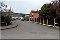
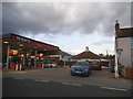
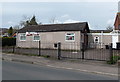
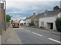
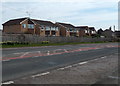
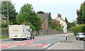
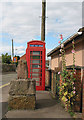
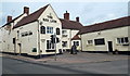
Images taken near to Pauls Walk, GL19 3SF and the surrounding area
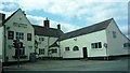
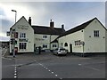
Please click the More button for more images, licensing and image copyright information.
Gloucester and nearby Videos From YouTube
🇬🇧🏴 Gloucester - Gloucester Cathedral
Gloucester Cathedral, Gloucester, Gloucestershire, U.K..
Channel: Aquila Aerial Photography (View Channel)
Published: 1 Jan 2023
Police
This area is policed by Gloucestershire Constabulary.
Gloucestershire Constabulary split their policing area into 55 separate neighbourhoods and this postcode is in the Newent neighbourhood.

Newent Neighbourhood Crime
Top 3 Categories
For full details of all categories together with more crime information, click on the Details button.
Member of UK Parliament
This postcode is in the Forest of Dean parliamentary constituency.
Forest of Dean is a constituency in the South West region of England. The seat has been held by Mr Mark Harper (Conservative) since May 2010.

Most Recent House Sales for Pauls Walk, GL19 3SF
14 Jul 2023
7 Oct 2019
10 Feb 2017
14 Mar 2014
Local Petrol Station Prices
Coordinates for GL19 3SF
Residents at GL19 3SF
Sunrise and Sunset at GL19 3SF
Traffic Emission and Congestion Zones
Historical Weather Summary
| Clear | 19.51% |
| Cloudy | 71.24% |
| Rain | 7.02% |
| Windy | 2.03% |
| Other | 0.20% |
Population
Deprivation Index
the more deprived the postcode
Average Energy Performance
Companies Registered at GL19 3SF
Postcode Details for GL19 3SF
Recent Updates
|
18 Apr 2024 Added Traffic Camera Views from Traffic Scotland to Roadworks within Scotland |
|
15 Apr 2024 Schools Data updated for April 2024 |
|
10 Apr 2024 Companies Data updated for March 2024 |
|
7 Apr 2024 New option to receive automatic updates to roadworks that affect you |
|
7 Apr 2024 Police and Crime data updated for February 2024 |
|
3 Apr 2024 Sold House Price data updated for February 2024 |
|
30 Mar 2024 Energy Performance Certificates (England and Wales) updated February 2024 |
|
28 Mar 2024 New feature to use Geolocating functions to detect your current location |
Random Postcodes
Want an idea of what is in our extensive website? Try somewhere completely random!
The Rural/Urban classification is based upon data collected during the 2011 Census and released in August 2013 and is categorised into 6 distinct classes.
[A] Urban Major conurbation: A built up area with a population of 10,000 (3,000 in Scotland) or more and is assigned to the major conurbation settlement category.
[B] Urban Minor conurbation: A built up area with a population of 10,000 (3,000 in Scotland) or more and is assigned to the minor conurbation settlement category.
[C] Urban City and town: A built up area with a population of 10,000 (3,000 in Scotland) or more and is assigned to the city and town settlement category.
[D] Rural Town and fringe
[E] Rural Village
[F] Rural Hamlet and isolated dwelling
The Index of Multiple Deprivation (IMD) is the official measure of relative deprivation.
The index is based on 39 separate indicators across seven distinct domains (Income; Employment; Health and Disability; Education, Skills and Training; Crime; Barriers to Housing and Services; Living Environment) to provide an overall measure of multiple deprivation and is calculated for every neighbourhood.
The index is relative rather than an absolute scale and so a neighbourhood with a score of 10 is more deprived than one rated 20, but this does not equate to being twice as deprived.
Please note: Different indices are used in England, Scotland, Wales and Northern Ireland and so comparison of scores from neighbourhoods in different countries should not be undertaken.
These figures report on incorporated UK companies only that are registered at this postcode and do not include sole-traders, partnerships or overseas organisations.
The population figure shown for your area are an estimate provided by the Office for National Statistics and is rounded to the nearest 1,000.
The estimates are derived from the Annual Population Survey (APS) which is the Labour Force Survey (LFS) plus various sample boosts.
There are 26 county councils in 2-tier areas, providing services such as education, social services and waste disposal.
In 2-tier areas, each county council area is subdivided into districts, for which there is an independent district council. There are 192 district councils.
District councils are responsible for local services such as rubbish collection, housing and planning applications.