Overview for Dryburgh Avenue, BLACKPOOL, FY3 9RH
Introduction
Blackpool is a seaside resort in Lancashire, England. Located on the northwest coast of England, it is the main settlement within the borough also called Blackpool. The town is by the Irish Sea, between the Ribble and Wyre rivers, and is 27 miles (43 km) north of Liverpool and 40 miles (64 km) northwest of Manchester. At the 2011 census, the unitary authority of Blackpool had an estimated population of 139,720 while the urban settlement had a population of 147,663, making it the most populous settlement in Lancashire, and the fifth-most populous in North West England after Manchester, Liverpool, Bolton and Warrington. The wider built-up area (which also includes additional settlements outside the unitary authority) had a population of 239,409, making it the fifth-most populous urban area in the North West after the Manchester, Liverpool, Preston and Birkenhead areas. It is home to the Blackpool Tower, which when built in 1894 was the tallest building in the British Empire.
Throughout the Medieval and Early Modern period, Blackpool was a coastal hamlet in Lancashire's Amounderness Hundred and remained as such until the mid-18th century, when it became fashionable in England to travel to the coast in the summer to improve well-being. In 1781, visitors attracted to Blackpool's 7-mile (11 km) sandy beach were able to use a new private road, built by Thomas Clifton and Sir Henry Hoghton. Stagecoaches began running to Blackpool from Manchester in the same year, and from Halifax in 1782. In the early 19th century, Henry Banks and his son-in-law John Cocker erected new buildings in Blackpool, which increased its population from less than 500 in 1801 to over 2,500 in 1851. St John's Church in Blackpool was consecrated in 1821.
Blackpool rose to prominence as a major centre of tourism in England when a railway was built in the 1840s connecting it to the industrialised regions of northern England. The railway made it much easier and cheaper for visitors to reach Blackpool, triggering an influx of settlers; in 1876, Blackpool was incorporated as a borough, governed by its own town council and aldermen. In 1881, Blackpool was a booming resort with a population of 14,000 and a promenade complete with piers, fortune-tellers, public houses, trams, donkey rides, fish and chip shops, and theatres. By 1901, the population of Blackpool was 47,000, by which time its place was cemented as "the archetypal British seaside resort". By 1951, it had grown to 147,000 people.
Shifts in tastes, combined with opportunities for British people to travel overseas, affected Blackpool's status as a leading resort in the late 20th century. Its urban fabric and economy both remain relatively undiversified and firmly rooted in the tourism sector, and the borough's seafront continues to attract millions of visitors every year. Blackpool's major attractions and landmarks include Blackpool Tower, Blackpool Illuminations, Pleasure Beach, Blackpool Zoo, Sandcastle Water Park, the Winter Gardens and Blackpool Tramway (the UK's only surviving first-generation tramway).
Summary for Dryburgh Avenue, BLACKPOOL, FY3 9RH
Roadworks near FY3 9RH
Road Safety near FY3 9RH
Details of personal injury accidents in and around Dryburgh Avenue, FY3 9RH that have been reported to Lancashire Constabulary over the past 20 years.
Traffic Levels near FY3 9RH
View traffic levels near Dryburgh Avenue, FY3 9RH from official Department for Transport counts.
Images taken near to Dryburgh Avenue, FY3 9RH and the surrounding area
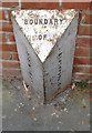
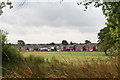
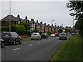
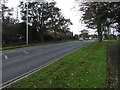
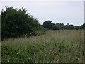
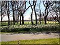
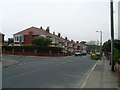
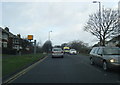
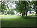
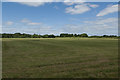
Please click the More button for more images, licensing and image copyright information.
Blackpool and nearby Videos From YouTube
DJI Mavic 2 Pro 4k video footage of Blackpool Tower also Piers
DJI Mavic 2 Pro 4k video footage Blackpool Tower also Piers, I used my Mavic 2 Pro to get footage in 4K video, was 2 windy to ...
Channel: TS Drones (View Channel)
Published: 11 May 2021
Police
This area is policed by Lancashire Constabulary.
Lancashire Constabulary split their policing area into 236 separate neighbourhoods and this postcode is in the Marton neighbourhood.

Marton Neighbourhood Crime
Top 3 Categories
For full details of all categories together with more crime information, click on the Details button.
Member of UK Parliament
This postcode is in the Blackpool South parliamentary constituency.
Blackpool South is a constituency in the North West region of England. The seat is currently vacant, and was last held by Scott Benton (Independent) between 12 December 2019 to 25 March 2024.

Most Recent House Sales for Dryburgh Avenue, FY3 9RH
30 Sep 2022
23 Sep 2022
25 Feb 2022
14 Dec 2021
Local Petrol Station Prices
Coordinates for FY3 9RH
Residents at FY3 9RH
Sunrise and Sunset at FY3 9RH
Traffic Emission and Congestion Zones
Historical Weather Summary
| Clear | 18.61% |
| Cloudy | 58.53% |
| Rain | 8.20% |
| Windy | 14.59% |
| Other | 0.07% |
Population
Deprivation Index
the more deprived the postcode
Average Energy Performance
Companies Registered at FY3 9RH
Postcode Details for FY3 9RH
Recent Updates
|
18 Apr 2024 Added Traffic Camera Views from Traffic Scotland to Roadworks within Scotland |
|
15 Apr 2024 Schools Data updated for April 2024 |
|
10 Apr 2024 Companies Data updated for March 2024 |
|
7 Apr 2024 New option to receive automatic updates to roadworks that affect you |
|
7 Apr 2024 Police and Crime data updated for February 2024 |
|
3 Apr 2024 Sold House Price data updated for February 2024 |
|
30 Mar 2024 Energy Performance Certificates (England and Wales) updated February 2024 |
|
28 Mar 2024 New feature to use Geolocating functions to detect your current location |
Random Postcodes
Want an idea of what is in our extensive website? Try somewhere completely random!
The Rural/Urban classification is based upon data collected during the 2011 Census and released in August 2013 and is categorised into 6 distinct classes.
[A] Urban Major conurbation: A built up area with a population of 10,000 (3,000 in Scotland) or more and is assigned to the major conurbation settlement category.
[B] Urban Minor conurbation: A built up area with a population of 10,000 (3,000 in Scotland) or more and is assigned to the minor conurbation settlement category.
[C] Urban City and town: A built up area with a population of 10,000 (3,000 in Scotland) or more and is assigned to the city and town settlement category.
[D] Rural Town and fringe
[E] Rural Village
[F] Rural Hamlet and isolated dwelling
The Index of Multiple Deprivation (IMD) is the official measure of relative deprivation.
The index is based on 39 separate indicators across seven distinct domains (Income; Employment; Health and Disability; Education, Skills and Training; Crime; Barriers to Housing and Services; Living Environment) to provide an overall measure of multiple deprivation and is calculated for every neighbourhood.
The index is relative rather than an absolute scale and so a neighbourhood with a score of 10 is more deprived than one rated 20, but this does not equate to being twice as deprived.
Please note: Different indices are used in England, Scotland, Wales and Northern Ireland and so comparison of scores from neighbourhoods in different countries should not be undertaken.
These figures report on incorporated UK companies only that are registered at this postcode and do not include sole-traders, partnerships or overseas organisations.
The population figure shown for your area are an estimate provided by the Office for National Statistics and is rounded to the nearest 1,000.
The estimates are derived from the Annual Population Survey (APS) which is the Labour Force Survey (LFS) plus various sample boosts.
There are 55 unitary authorities. They provide all local government services in their areas. These are mainly in the cities, urban areas and larger towns although there are now 6 shire county councils that are unitary (ie have no district councils beneath them).