Overview for Standrigg Road, FALKIRK, FK2 0EE
Introduction
Falkirk is a town in the Central Lowlands of Scotland, historically within the county of Stirlingshire. It lies in the Forth Valley, 23+1⁄2 miles (38 kilometres) northwest of Edinburgh and 20+1⁄2 miles (33 km) northeast of Glasgow.
Falkirk had a resident population of 32,422 at the 2001 UK Census. The population of the town had risen to 34,570 according to a 2008 estimate, making it the 20th most populous settlement in Scotland. Falkirk is the main town and administrative centre of the Falkirk council area, which has an overall population of 156,800 and inholds the nearby towns of Grangemouth, Bo'ness, Denny, Camelon, Larbert and Stenhousemuir, and the cluster of Braes villages.
The town is at the junction of the Forth and Clyde and Union Canals, a location which proved key to its growth as a centre of heavy industry during the Industrial Revolution. In the eighteenth and nineteenth centuries, Falkirk was at the centre of the iron and steel industry, underpinned by the Carron Company in nearby Carron. The company made very many different items, from flat irons to kitchen ranges to fireplaces to benches to railings and many other items, but also carronades for the Royal Navy and, later, manufactured pillar boxes and phone boxes. Within the last fifty years, heavy industry has waned, and the economy relies increasingly on retail and tourism. Despite this, Falkirk remains the home of many international companies like Alexander Dennis, the largest bus production company in the United Kingdom.
Falkirk has a long association with the publishing industry. The company now known as Johnston Press was established in the town in 1846. The company, now based in Edinburgh, produces the Falkirk Herald, the largest selling weekly newspaper in Scotland.
Attractions in and around Falkirk include the Falkirk Wheel, The Helix, The Kelpies, Callendar House and Park and remnants of the Antonine Wall. In a 2011 poll conducted by STV, it was voted as Scotland's most beautiful town.
Summary for Standrigg Road, FALKIRK, FK2 0EE
Roadworks near FK2 0EE
Road Safety near FK2 0EE
Details of personal injury accidents in and around Standrigg Road, FK2 0EE that have been reported to over the past 20 years.
Traffic Levels near FK2 0EE
View traffic levels near Standrigg Road, FK2 0EE from official Department for Transport counts.
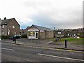
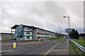
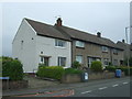
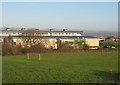
Images taken near to Standrigg Road, FK2 0EE and the surrounding area

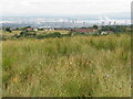
Please click the More button for more images, licensing and image copyright information.
Member of UK Parliament
This postcode is in the Linlithgow and East Falkirk parliamentary constituency.
Linlithgow and East Falkirk is a constituency in Scotland. The seat has been held by Martyn Day (Scottish National Party) since May 2015.

Most Recent House Sales for Standrigg Road, FK2 0EE
No recorded house sales or transfers for this postcode.
Local Petrol Station Prices
Coordinates for FK2 0EE
Sunrise and Sunset at FK2 0EE
Traffic Emission and Congestion Zones
Historical Weather Summary
| Clear | 7.60% |
| Cloudy | 55.65% |
| Rain | 11.77% |
| Windy | 24.33% |
| Other | 0.65% |
Average Energy Performance
Companies Registered at FK2 0EE
Postcode Details for FK2 0EE
Recent Updates
|
18 Apr 2024 Added Traffic Camera Views from Traffic Scotland to Roadworks within Scotland |
|
15 Apr 2024 Schools Data updated for April 2024 |
|
10 Apr 2024 Companies Data updated for March 2024 |
|
7 Apr 2024 New option to receive automatic updates to roadworks that affect you |
|
7 Apr 2024 Police and Crime data updated for February 2024 |
|
3 Apr 2024 Sold House Price data updated for February 2024 |
|
30 Mar 2024 Energy Performance Certificates (England and Wales) updated February 2024 |
|
28 Mar 2024 New feature to use Geolocating functions to detect your current location |
Random Postcodes
Want an idea of what is in our extensive website? Try somewhere completely random!
The Rural/Urban classification is based upon data collected during the 2011 Census and released in August 2013 and is categorised into 6 distinct classes.
[A] Urban Major conurbation: A built up area with a population of 10,000 (3,000 in Scotland) or more and is assigned to the major conurbation settlement category.
[B] Urban Minor conurbation: A built up area with a population of 10,000 (3,000 in Scotland) or more and is assigned to the minor conurbation settlement category.
[C] Urban City and town: A built up area with a population of 10,000 (3,000 in Scotland) or more and is assigned to the city and town settlement category.
[D] Rural Town and fringe
[E] Rural Village
[F] Rural Hamlet and isolated dwelling
The Index of Multiple Deprivation (IMD) is the official measure of relative deprivation.
The index is based on 39 separate indicators across seven distinct domains (Income; Employment; Health and Disability; Education, Skills and Training; Crime; Barriers to Housing and Services; Living Environment) to provide an overall measure of multiple deprivation and is calculated for every neighbourhood.
The index is relative rather than an absolute scale and so a neighbourhood with a score of 10 is more deprived than one rated 20, but this does not equate to being twice as deprived.
Please note: Different indices are used in England, Scotland, Wales and Northern Ireland and so comparison of scores from neighbourhoods in different countries should not be undertaken.
These figures report on incorporated UK companies only that are registered at this postcode and do not include sole-traders, partnerships or overseas organisations.
The population figure shown for your area are an estimate provided by the Office for National Statistics and is rounded to the nearest 1,000.
The estimates are derived from the Annual Population Survey (APS) which is the Labour Force Survey (LFS) plus various sample boosts.
There are 55 unitary authorities. They provide all local government services in their areas. These are mainly in the cities, urban areas and larger towns although there are now 6 shire county councils that are unitary (ie have no district councils beneath them).