Overview for Drewsteignton, EXETER, EX6 6RG
Introduction
Exeter is a cathedral city and the county town of Devon, South West England. It is situated on the River Exe, approximately 36 mi (58 km) northeast of Plymouth and 65 mi (105 km) southwest of Bristol.
In Roman Britain, Exeter was established as the base of Legio II Augusta under the personal command of Vespasian. Exeter became a religious centre in the Middle Ages. Exeter Cathedral, founded in the mid 11th century, became Anglican in the 16th-century English Reformation. Exeter became an affluent centre for the wool trade, although by the First World War the city was in decline. After the Second World War, much of the city centre was rebuilt and is now a centre for education, business and tourism in Devon and Cornwall. It is home to two of the constituent campuses of the University of Exeter: Streatham and St Luke's.
The administrative area of Exeter has the status of a non-metropolitan district under the administration of the County Council. It is the county town of Devon and home to the headquarters of Devon County Council. A plan to grant the city unitary authority status was scrapped by the 2010 coalition government.
Summary for Drewsteignton, EXETER, EX6 6RG
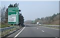
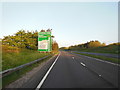
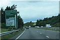
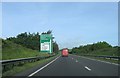
Roadworks near EX6 6RG
Road Safety near EX6 6RG
Details of personal injury accidents in and around EX6 6RG that have been reported to Devon & Cornwall Police over the past 20 years.
Traffic Levels near EX6 6RG
View traffic levels near EX6 6RG from official Department for Transport counts.
Images taken in and around the ex66rg area
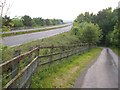
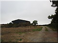
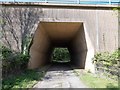
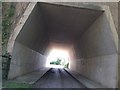
Please click the More button for more images, licensing and image copyright information.
Exeter and nearby Videos From YouTube
Magical South Devon Coastline: Drone Footage
Introducing the magical South Devon Coastline with stunning 4k video footage shot using a drone! From cliff-top walks to ...
Channel: Paul Newbery Photography (View Channel)
Published: 21 Sep 2022
Member of UK Parliament
This postcode is in the Central Devon parliamentary constituency.
Central Devon is a constituency in the South West region of England. The seat has been held by Mel Stride (Conservative) since May 2010.

Most Recent House Sales for EX6 6RG
11 Jun 2001
7 Jan 1997
Local Petrol Station Prices
Coordinates for EX6 6RG
Residents at EX6 6RG
Sunrise and Sunset at EX6 6RG
Traffic Emission and Congestion Zones
Historical Weather Summary
| Clear | 20.02% |
| Cloudy | 44.92% |
| Rain | 7.60% |
| Windy | 26.76% |
| Other | 0.70% |
Population
Deprivation Index
the more deprived the postcode
Average Energy Performance
Companies Registered at EX6 6RG
National Park for EX6 6RG
Postcode Details for EX6 6RG
Recent Updates
|
18 Apr 2024 Added Traffic Camera Views from Traffic Scotland to Roadworks within Scotland |
|
15 Apr 2024 Schools Data updated for April 2024 |
|
10 Apr 2024 Companies Data updated for March 2024 |
|
7 Apr 2024 New option to receive automatic updates to roadworks that affect you |
|
7 Apr 2024 Police and Crime data updated for February 2024 |
|
3 Apr 2024 Sold House Price data updated for February 2024 |
|
30 Mar 2024 Energy Performance Certificates (England and Wales) updated February 2024 |
|
28 Mar 2024 New feature to use Geolocating functions to detect your current location |
Random Postcodes
Want an idea of what is in our extensive website? Try somewhere completely random!
The Rural/Urban classification is based upon data collected during the 2011 Census and released in August 2013 and is categorised into 6 distinct classes.
[A] Urban Major conurbation: A built up area with a population of 10,000 (3,000 in Scotland) or more and is assigned to the major conurbation settlement category.
[B] Urban Minor conurbation: A built up area with a population of 10,000 (3,000 in Scotland) or more and is assigned to the minor conurbation settlement category.
[C] Urban City and town: A built up area with a population of 10,000 (3,000 in Scotland) or more and is assigned to the city and town settlement category.
[D] Rural Town and fringe
[E] Rural Village
[F] Rural Hamlet and isolated dwelling
The Index of Multiple Deprivation (IMD) is the official measure of relative deprivation.
The index is based on 39 separate indicators across seven distinct domains (Income; Employment; Health and Disability; Education, Skills and Training; Crime; Barriers to Housing and Services; Living Environment) to provide an overall measure of multiple deprivation and is calculated for every neighbourhood.
The index is relative rather than an absolute scale and so a neighbourhood with a score of 10 is more deprived than one rated 20, but this does not equate to being twice as deprived.
Please note: Different indices are used in England, Scotland, Wales and Northern Ireland and so comparison of scores from neighbourhoods in different countries should not be undertaken.
These figures report on incorporated UK companies only that are registered at this postcode and do not include sole-traders, partnerships or overseas organisations.
The population figure shown for your area are an estimate provided by the Office for National Statistics and is rounded to the nearest 1,000.
The estimates are derived from the Annual Population Survey (APS) which is the Labour Force Survey (LFS) plus various sample boosts.
There are 26 county councils in 2-tier areas, providing services such as education, social services and waste disposal.
In 2-tier areas, each county council area is subdivided into districts, for which there is an independent district council. There are 192 district councils.
District councils are responsible for local services such as rubbish collection, housing and planning applications.