Overview for Menzies Road, BATHGATE, EH48 1TQ
Introduction
Bathgate is a town in West Lothian, Scotland, 5 miles (8 km) west of Livingston and adjacent to the M8 motorway. Nearby towns are Armadale, Blackburn, Linlithgow, Livingston, West Calder and Whitburn. Situated 2 miles (3 km) south of the ancient Neolithic burial site at Cairnpapple Hill, Bathgate and the surrounding area show signs of habitation since about 3500 BC and the world's oldest known reptile fossil has been found in the town. By the 12th century, Bathgate was a small settlement, with a church at Kirkton and a castle south of the present day town centre. Local mines were established in the 17th century but the town remained small in size until the coming of the industrial revolution. By the Victorian era, Bathgate grew in prominence as an industrial and mining centre, principally associated with the coal and shale oil industries. By the early 20th century, much of the mining and heavy industry around the town had ceased and the town developed manufacturing industries, principally in vehicle production and later electronics before these factories closed in the late 20th century. Today Bathgate is the second largest town in West Lothian, after Livingston and serves as a regional commuter town within the Scottish Central Belt.
Summary for Menzies Road, BATHGATE, EH48 1TQ
Roadworks near EH48 1TQ
Road Safety near EH48 1TQ
Details of personal injury accidents in and around Menzies Road, EH48 1TQ that have been reported to over the past 20 years.
Traffic Levels near EH48 1TQ
View traffic levels near Menzies Road, EH48 1TQ from official Department for Transport counts.
Images taken near to Menzies Road, EH48 1TQ and the surrounding area
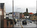
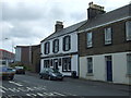
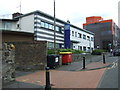
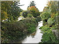
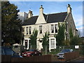
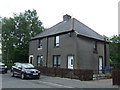
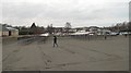
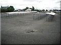
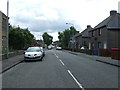
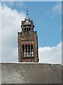
Please click the More button for more images, licensing and image copyright information.
Member of UK Parliament
This postcode is in the Linlithgow and East Falkirk parliamentary constituency.
Linlithgow and East Falkirk is a constituency in Scotland. The seat has been held by Martyn Day (Scottish National Party) since May 2015.

Most Recent House Sales for Menzies Road, EH48 1TQ
No recorded house sales or transfers for this postcode.
Local Petrol Station Prices
Coordinates for EH48 1TQ
Sunrise and Sunset at EH48 1TQ
Traffic Emission and Congestion Zones
Historical Weather Summary
| Clear | 6.58% |
| Cloudy | 49.77% |
| Rain | 12.00% |
| Windy | 29.94% |
| Other | 1.71% |
Average Energy Performance
Companies Registered at EH48 1TQ
Postcode Details for EH48 1TQ
Recent Updates
|
18 Apr 2024 Added Traffic Camera Views from Traffic Scotland to Roadworks within Scotland |
|
15 Apr 2024 Schools Data updated for April 2024 |
|
10 Apr 2024 Companies Data updated for March 2024 |
|
7 Apr 2024 New option to receive automatic updates to roadworks that affect you |
|
7 Apr 2024 Police and Crime data updated for February 2024 |
|
3 Apr 2024 Sold House Price data updated for February 2024 |
|
30 Mar 2024 Energy Performance Certificates (England and Wales) updated February 2024 |
|
28 Mar 2024 New feature to use Geolocating functions to detect your current location |
Random Postcodes
Want an idea of what is in our extensive website? Try somewhere completely random!
The Rural/Urban classification is based upon data collected during the 2011 Census and released in August 2013 and is categorised into 6 distinct classes.
[A] Urban Major conurbation: A built up area with a population of 10,000 (3,000 in Scotland) or more and is assigned to the major conurbation settlement category.
[B] Urban Minor conurbation: A built up area with a population of 10,000 (3,000 in Scotland) or more and is assigned to the minor conurbation settlement category.
[C] Urban City and town: A built up area with a population of 10,000 (3,000 in Scotland) or more and is assigned to the city and town settlement category.
[D] Rural Town and fringe
[E] Rural Village
[F] Rural Hamlet and isolated dwelling
The Index of Multiple Deprivation (IMD) is the official measure of relative deprivation.
The index is based on 39 separate indicators across seven distinct domains (Income; Employment; Health and Disability; Education, Skills and Training; Crime; Barriers to Housing and Services; Living Environment) to provide an overall measure of multiple deprivation and is calculated for every neighbourhood.
The index is relative rather than an absolute scale and so a neighbourhood with a score of 10 is more deprived than one rated 20, but this does not equate to being twice as deprived.
Please note: Different indices are used in England, Scotland, Wales and Northern Ireland and so comparison of scores from neighbourhoods in different countries should not be undertaken.
These figures report on incorporated UK companies only that are registered at this postcode and do not include sole-traders, partnerships or overseas organisations.
The population figure shown for your area are an estimate provided by the Office for National Statistics and is rounded to the nearest 1,000.
The estimates are derived from the Annual Population Survey (APS) which is the Labour Force Survey (LFS) plus various sample boosts.
There are 55 unitary authorities. They provide all local government services in their areas. These are mainly in the cities, urban areas and larger towns although there are now 6 shire county councils that are unitary (ie have no district councils beneath them).