Overview for Charlton Horethorne, SHERBORNE, DT9 4PB
Introduction
Sherborne is a market town and civil parish in north west Dorset, in South West England. It is sited on the River Yeo, on the edge of the Blackmore Vale, 6 miles (10 kilometres) east of Yeovil. The parish includes the hamlets of Nether Coombe and Lower Clatcombe. The A30 road, which connects London to Penzance, runs through the town. In the 2011 census the population of Sherborne parish and the two electoral wards was 9,523. 28.7% of the population is aged 65 or older.
Sherborne's historic buildings include Sherborne Abbey, its manor house, independent schools, and two castles: the ruins of a 12th-century fortified palace and the 16th-century mansion known as Sherborne Castle built by Sir Walter Raleigh. Much of the old town, including the abbey and many medieval and Georgian buildings, is built from distinctive ochre-coloured ham stone.
The town is served by Sherborne railway station.
Summary for Charlton Horethorne, SHERBORNE, DT9 4PB
Roadworks near DT9 4PB
Road Safety near DT9 4PB
Details of personal injury accidents in and around DT9 4PB that have been reported to Avon and Somerset Constabulary over the past 20 years.
Traffic Levels near DT9 4PB
View traffic levels near DT9 4PB from official Department for Transport counts.
Images taken in and around the dt94pb area
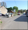
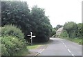
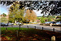
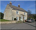
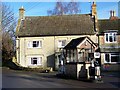
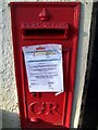
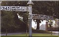
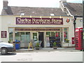
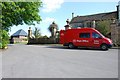
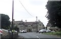
Please click the More button for more images, licensing and image copyright information.
Police
This area is policed by Avon and Somerset Constabulary.
Avon and Somerset Constabulary split their policing area into 123 separate neighbourhoods and this postcode is in the Wincanton Rural East neighbourhood.

Wincanton Rural East Neighbourhood Crime
Top 3 Categories
For full details of all categories together with more crime information, click on the Details button.
Member of UK Parliament
This postcode is in the Somerton and Frome parliamentary constituency.
Somerton and Frome is a constituency in the South West region of England. The seat has been held by Sarah Dyke (Liberal Democrat) since July 2023.

Most Recent House Sales for DT9 4PB
18 Jan 2021
8 Jan 2021
20 Apr 2017
11 Nov 2015
Local Petrol Station Prices
Coordinates for DT9 4PB
Residents at DT9 4PB
Sunrise and Sunset at DT9 4PB
Traffic Emission and Congestion Zones
Historical Weather Summary
| Clear | 22.39% |
| Cloudy | 67.32% |
| Rain | 7.43% |
| Windy | 2.62% |
| Other | 0.24% |
Deprivation Index
the more deprived the postcode
Average Energy Performance
Companies Registered at DT9 4PB
Postcode Details for DT9 4PB
Recent Updates
|
15 Apr 2024 Schools Data updated for April 2024 |
|
10 Apr 2024 Companies Data updated for March 2024 |
|
7 Apr 2024 New option to receive automatic updates to roadworks that affect you |
|
7 Apr 2024 Police and Crime data updated for February 2024 |
|
3 Apr 2024 Sold House Price data updated for February 2024 |
|
30 Mar 2024 Energy Performance Certificates (England and Wales) updated February 2024 |
|
28 Mar 2024 New feature to use Geolocating functions to detect your current location |
|
17 Mar 2024 Schools Data updated for March 2024 |
Random Postcodes
Want an idea of what is in our extensive website? Try somewhere completely random!
The Rural/Urban classification is based upon data collected during the 2011 Census and released in August 2013 and is categorised into 6 distinct classes.
[A] Urban Major conurbation: A built up area with a population of 10,000 (3,000 in Scotland) or more and is assigned to the major conurbation settlement category.
[B] Urban Minor conurbation: A built up area with a population of 10,000 (3,000 in Scotland) or more and is assigned to the minor conurbation settlement category.
[C] Urban City and town: A built up area with a population of 10,000 (3,000 in Scotland) or more and is assigned to the city and town settlement category.
[D] Rural Town and fringe
[E] Rural Village
[F] Rural Hamlet and isolated dwelling
The Index of Multiple Deprivation (IMD) is the official measure of relative deprivation.
The index is based on 39 separate indicators across seven distinct domains (Income; Employment; Health and Disability; Education, Skills and Training; Crime; Barriers to Housing and Services; Living Environment) to provide an overall measure of multiple deprivation and is calculated for every neighbourhood.
The index is relative rather than an absolute scale and so a neighbourhood with a score of 10 is more deprived than one rated 20, but this does not equate to being twice as deprived.
Please note: Different indices are used in England, Scotland, Wales and Northern Ireland and so comparison of scores from neighbourhoods in different countries should not be undertaken.
These figures report on incorporated UK companies only that are registered at this postcode and do not include sole-traders, partnerships or overseas organisations.
The population figure shown for your area are an estimate provided by the Office for National Statistics and is rounded to the nearest 1,000.
The estimates are derived from the Annual Population Survey (APS) which is the Labour Force Survey (LFS) plus various sample boosts.
There are 55 unitary authorities. They provide all local government services in their areas. These are mainly in the cities, urban areas and larger towns although there are now 6 shire county councils that are unitary (ie have no district councils beneath them).