Overview for Potten Street, BIRCHINGTON, CT7 0QR
Introduction
Birchington-on-Sea is a village in the Thanet district in Kent, England, with a population of 9,961.
The village forms part of the civil parish of Birchington. It lies on the coast facing the North Sea, east of the Thames Estuary, between the seaside resorts of Herne Bay and Margate. As a seaside resort, the village is a tourist and retirement destination. The village's Minnis Bay is a family beach with attractions such as sailing, windsurfing, a paddling pool and coastal walking routes. Its three smaller beaches are surrounded by chalk cliffs, cliff stacks and caves.
The village was first recorded in 1240. Its parish church, All Saints', dates to the 13th century and its churchyard is the burial place of the 19th-century Pre-Raphaelite artist Dante Gabriel Rossetti. Quex Park, a local 19th century manor house, is home to the Powell-Cotton Museum and a twelve-bell tower built for change ringing.
The museum contains a large collection of stuffed exotic animals collected by Major Percy Powell-Cotton on his travels in Africa, and also houses artefacts unearthed in and around Birchington by his daughter, Antoinette Powell-Cotton, a keen archaeologist.
Summary for Potten Street, BIRCHINGTON, CT7 0QR
Roadworks near CT7 0QR
Road Safety near CT7 0QR
Details of personal injury accidents in and around Potten Street, CT7 0QR that have been reported to Kent Police over the past 20 years.
Traffic Levels near CT7 0QR
View traffic levels near Potten Street, CT7 0QR from official Department for Transport counts.
Images taken near to Potten Street, CT7 0QR and the surrounding area
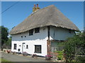
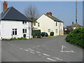
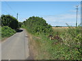
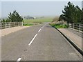
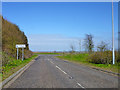
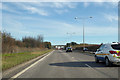
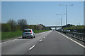

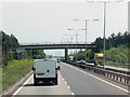

Please click the More button for more images, licensing and image copyright information.
Police
This area is policed by Kent Police.
Kent Police split their policing area into 293 separate neighbourhoods and this postcode is in the Thanet Villages neighbourhood.

Thanet Villages Neighbourhood Crime
Top 3 Categories
For full details of all categories together with more crime information, click on the Details button.
Member of UK Parliament
This postcode is in the North Thanet parliamentary constituency.
North Thanet is a constituency in the South East region of England. The seat has been held by Sir Roger Gale (Conservative) since May 2010.

Most Recent House Sales for Potten Street, CT7 0QR
19 Jul 2007
14 Dec 2000
Local Petrol Station Prices
Coordinates for CT7 0QR
Residents at CT7 0QR
Sunrise and Sunset at CT7 0QR
Traffic Emission and Congestion Zones
Historical Weather Summary
| Clear | 12.05% |
| Cloudy | 75.54% |
| Rain | 8.97% |
| Windy | 3.44% |
| Other | 0.00% |
Population
Deprivation Index
the more deprived the postcode
Average Energy Performance
Companies Registered at CT7 0QR
Postcode Details for CT7 0QR
Recent Updates
|
18 Apr 2024 Added Traffic Camera Views from Traffic Scotland to Roadworks within Scotland |
|
15 Apr 2024 Schools Data updated for April 2024 |
|
10 Apr 2024 Companies Data updated for March 2024 |
|
7 Apr 2024 New option to receive automatic updates to roadworks that affect you |
|
7 Apr 2024 Police and Crime data updated for February 2024 |
|
3 Apr 2024 Sold House Price data updated for February 2024 |
|
30 Mar 2024 Energy Performance Certificates (England and Wales) updated February 2024 |
|
28 Mar 2024 New feature to use Geolocating functions to detect your current location |
Random Postcodes
Want an idea of what is in our extensive website? Try somewhere completely random!
The Rural/Urban classification is based upon data collected during the 2011 Census and released in August 2013 and is categorised into 6 distinct classes.
[A] Urban Major conurbation: A built up area with a population of 10,000 (3,000 in Scotland) or more and is assigned to the major conurbation settlement category.
[B] Urban Minor conurbation: A built up area with a population of 10,000 (3,000 in Scotland) or more and is assigned to the minor conurbation settlement category.
[C] Urban City and town: A built up area with a population of 10,000 (3,000 in Scotland) or more and is assigned to the city and town settlement category.
[D] Rural Town and fringe
[E] Rural Village
[F] Rural Hamlet and isolated dwelling
The Index of Multiple Deprivation (IMD) is the official measure of relative deprivation.
The index is based on 39 separate indicators across seven distinct domains (Income; Employment; Health and Disability; Education, Skills and Training; Crime; Barriers to Housing and Services; Living Environment) to provide an overall measure of multiple deprivation and is calculated for every neighbourhood.
The index is relative rather than an absolute scale and so a neighbourhood with a score of 10 is more deprived than one rated 20, but this does not equate to being twice as deprived.
Please note: Different indices are used in England, Scotland, Wales and Northern Ireland and so comparison of scores from neighbourhoods in different countries should not be undertaken.
These figures report on incorporated UK companies only that are registered at this postcode and do not include sole-traders, partnerships or overseas organisations.
The population figure shown for your area are an estimate provided by the Office for National Statistics and is rounded to the nearest 1,000.
The estimates are derived from the Annual Population Survey (APS) which is the Labour Force Survey (LFS) plus various sample boosts.
There are 26 county councils in 2-tier areas, providing services such as education, social services and waste disposal.
In 2-tier areas, each county council area is subdivided into districts, for which there is an independent district council. There are 192 district councils.
District councils are responsible for local services such as rubbish collection, housing and planning applications.