Overview for Ash Trees, HERNE BAY, CT6 6EX
Introduction
Herne Bay is a seaside town on the north coast of Kent in South East England. It is 6 miles (10 km) north of Canterbury and 4 miles (6 km) east of Whitstable. It neighbours the ancient villages of Herne and Reculver and is part of the City of Canterbury local government district, although it remains a separate town with countryside between it and Canterbury. Herne Bay's seafront is home to the world's first freestanding purpose-built Clock Tower, built in 1837. From the late Victorian period until 1978, the town had the second-longest pier in the United Kingdom.
The town began as a small shipping community, receiving goods and passengers from London en route to Canterbury and Dover. The town rose to prominence as a seaside resort during the early 19th century after the building of a pleasure pier and promenade by a group of London investors, and reached its heyday in the late Victorian era. Its popularity as a holiday destination has declined over the past decades, due to the increase in foreign travel and to a lesser degree exposure to flooding that has prevented the town's redevelopment. In 2011 the town had a population of 38,563.
Summary for Ash Trees, HERNE BAY, CT6 6EX
Roadworks near CT6 6EX
Road Safety near CT6 6EX
Details of personal injury accidents in and around Ash Trees, CT6 6EX that have been reported to Kent Police over the past 20 years.
Traffic Levels near CT6 6EX
View traffic levels near Ash Trees, CT6 6EX from official Department for Transport counts.
Images taken near to Ash Trees, CT6 6EX and the surrounding area
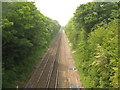
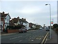
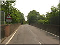
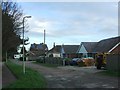
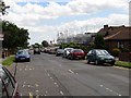
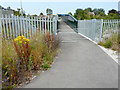
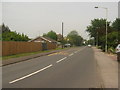
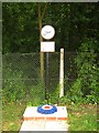
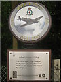
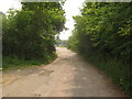
Please click the More button for more images, licensing and image copyright information.
Police
This area is policed by Kent Police.
Kent Police split their policing area into 293 separate neighbourhoods and this postcode is in the Beltinge neighbourhood.

Beltinge Neighbourhood Crime
Top 3 Categories
For full details of all categories together with more crime information, click on the Details button.
Member of UK Parliament
This postcode is in the North Thanet parliamentary constituency.
North Thanet is a constituency in the South East region of England. The seat has been held by Sir Roger Gale (Conservative) since May 2010.

Most Recent House Sales for Ash Trees, CT6 6EX
10 Nov 2015
28 Mar 2012
26 Sep 2008
8 Aug 2007
Local Petrol Station Prices
Coordinates for CT6 6EX
Residents at CT6 6EX
Sunrise and Sunset at CT6 6EX
Traffic Emission and Congestion Zones
Historical Weather Summary
| Clear | 11.82% |
| Cloudy | 75.85% |
| Rain | 8.55% |
| Windy | 3.70% |
| Other | 0.08% |
Population
Deprivation Index
the more deprived the postcode
Average Energy Performance
Companies Registered at CT6 6EX
Postcode Details for CT6 6EX
Recent Updates
|
18 Apr 2024 Added Traffic Camera Views from Traffic Scotland to Roadworks within Scotland |
|
15 Apr 2024 Schools Data updated for April 2024 |
|
10 Apr 2024 Companies Data updated for March 2024 |
|
7 Apr 2024 New option to receive automatic updates to roadworks that affect you |
|
7 Apr 2024 Police and Crime data updated for February 2024 |
|
3 Apr 2024 Sold House Price data updated for February 2024 |
|
30 Mar 2024 Energy Performance Certificates (England and Wales) updated February 2024 |
|
28 Mar 2024 New feature to use Geolocating functions to detect your current location |
Random Postcodes
Want an idea of what is in our extensive website? Try somewhere completely random!
The Rural/Urban classification is based upon data collected during the 2011 Census and released in August 2013 and is categorised into 6 distinct classes.
[A] Urban Major conurbation: A built up area with a population of 10,000 (3,000 in Scotland) or more and is assigned to the major conurbation settlement category.
[B] Urban Minor conurbation: A built up area with a population of 10,000 (3,000 in Scotland) or more and is assigned to the minor conurbation settlement category.
[C] Urban City and town: A built up area with a population of 10,000 (3,000 in Scotland) or more and is assigned to the city and town settlement category.
[D] Rural Town and fringe
[E] Rural Village
[F] Rural Hamlet and isolated dwelling
The Index of Multiple Deprivation (IMD) is the official measure of relative deprivation.
The index is based on 39 separate indicators across seven distinct domains (Income; Employment; Health and Disability; Education, Skills and Training; Crime; Barriers to Housing and Services; Living Environment) to provide an overall measure of multiple deprivation and is calculated for every neighbourhood.
The index is relative rather than an absolute scale and so a neighbourhood with a score of 10 is more deprived than one rated 20, but this does not equate to being twice as deprived.
Please note: Different indices are used in England, Scotland, Wales and Northern Ireland and so comparison of scores from neighbourhoods in different countries should not be undertaken.
These figures report on incorporated UK companies only that are registered at this postcode and do not include sole-traders, partnerships or overseas organisations.
The population figure shown for your area are an estimate provided by the Office for National Statistics and is rounded to the nearest 1,000.
The estimates are derived from the Annual Population Survey (APS) which is the Labour Force Survey (LFS) plus various sample boosts.
There are 26 county councils in 2-tier areas, providing services such as education, social services and waste disposal.
In 2-tier areas, each county council area is subdivided into districts, for which there is an independent district council. There are 192 district councils.
District councils are responsible for local services such as rubbish collection, housing and planning applications.