Overview for Oates Lane, ELY, CB6 2RG
Introduction
Ely (EE-lee) is a cathedral city in the East Cambridgeshire district of Cambridgeshire, England, about 14 miles (23 km) north-northeast of Cambridge and 80 miles (130 km) from London.
Ely is built on a 23-square-mile (60 km2) Kimmeridge Clay island which, at 85 feet (26 m), is the highest land in the Fens. It was due to this topography that Ely was not waterlogged like the surrounding Fenland, and was an island separated from the mainland. Major rivers including the Witham, Welland, Nene and Great Ouse feed into the Fens and, until draining commenced in the eighteenth century, formed freshwater marshes and meres within which peat was laid down. Once the Fens were drained, this peat created a rich and fertile soil ideal for farming.
The River Great Ouse was a significant means of transport until the Fens were drained and Ely ceased to be an island in the seventeenth century. The river is now a popular boating spot, and has a large marina. Although now surrounded by land, the city is still known as "The Isle of Ely".
There are two Sites of Special Scientific Interest in the city: a former Kimmeridge Clay quarry, and one of the United Kingdom's best remaining examples of medieval ridge and furrow agriculture.
The economy of the region is mainly agricultural. Before the Fens were drained, eel fishing was an important activity, from which the settlement's name may have been derived. Other important activities included wildfowling, peat extraction, and the harvesting of osier (willow) and sedge (rush). The city had been the centre of local pottery production for more than 700 years, including pottery known as Babylon ware. A Roman road, Akeman Street, passes through the city; the southern end is at Ermine Street near Wimpole and its northern end is at Brancaster. Little direct evidence of Roman occupation in Ely exists, although there are nearby Roman settlements such as those at Little Thetford and Stretham.
A coach route, known to have existed in 1753 between Ely and Cambridge, was improved in 1769 as a turnpike (toll road). The present-day A10 closely follows this route. Ely railway station, built in 1845, is on the Fen Line and is now a railway hub, with lines north to King's Lynn, northwest to Peterborough, east to Norwich, southeast to Ipswich and south to Cambridge and London.
Henry II granted the first annual fair, Saint Etheldreda's (or Saint Audrey's) seven-day event, to the abbot and convent on 10 October 1189. The word "tawdry" originates from cheap lace sold at this fair. A weekly market has taken place in Ely Market Square since at least the 13th century. Markets are now held on Thursdays, Saturdays and Sundays, with a farmers' market on the 2nd and 4th Saturdays of each month.
Present-day annual events include the Eel Festival in May, established in 2004, and a fireworks display in Ely Park, first staged in 1974. The city of Ely has been twinned with Denmark's oldest town, Ribe, since 1956. Ely City Football Club was formed in 1885.
Summary for Oates Lane, ELY, CB6 2RG
Roadworks near CB6 2RG
Road Safety near CB6 2RG
Details of personal injury accidents in and around Oates Lane, CB6 2RG that have been reported to Cambridgeshire Constabulary over the past 20 years.
Traffic Levels near CB6 2RG
View traffic levels near Oates Lane, CB6 2RG from official Department for Transport counts.
Images taken near to Oates Lane, CB6 2RG and the surrounding area
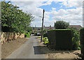


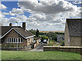
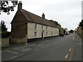
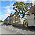
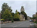
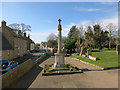
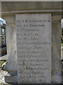
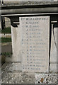
Please click the More button for more images, licensing and image copyright information.
Police
This area is policed by Cambridgeshire Constabulary.
Cambridgeshire Constabulary split their policing area into 14 separate neighbourhoods and this postcode is in the East Cambridgeshire neighbourhood.

East Cambridgeshire Neighbourhood Crime
Top 3 Categories
For full details of all categories together with more crime information, click on the Details button.
Member of UK Parliament
This postcode is in the North East Cambridgeshire parliamentary constituency.
North East Cambridgeshire is a constituency in the East of England region of England. The seat has been held by Steve Barclay (Conservative) since May 2010.

Most Recent House Sales for Oates Lane, CB6 2RG
14 Jun 2023
31 Jan 2020
10 Sep 2018
7 Jul 2016
Local Petrol Station Prices
Coordinates for CB6 2RG
Residents at CB6 2RG
Sunrise and Sunset at CB6 2RG
Traffic Emission and Congestion Zones
Historical Weather Summary
| Clear | 9.32% |
| Cloudy | 59.45% |
| Rain | 7.13% |
| Windy | 24.10% |
| Other | 0.00% |
Population
Deprivation Index
the more deprived the postcode
Average Energy Performance
Companies Registered at CB6 2RG
Postcode Details for CB6 2RG
Recent Updates
|
18 Apr 2024 Added Traffic Camera Views from Traffic Scotland to Roadworks within Scotland |
|
15 Apr 2024 Schools Data updated for April 2024 |
|
10 Apr 2024 Companies Data updated for March 2024 |
|
7 Apr 2024 New option to receive automatic updates to roadworks that affect you |
|
7 Apr 2024 Police and Crime data updated for February 2024 |
|
3 Apr 2024 Sold House Price data updated for February 2024 |
|
30 Mar 2024 Energy Performance Certificates (England and Wales) updated February 2024 |
|
28 Mar 2024 New feature to use Geolocating functions to detect your current location |
Random Postcodes
Want an idea of what is in our extensive website? Try somewhere completely random!
The Rural/Urban classification is based upon data collected during the 2011 Census and released in August 2013 and is categorised into 6 distinct classes.
[A] Urban Major conurbation: A built up area with a population of 10,000 (3,000 in Scotland) or more and is assigned to the major conurbation settlement category.
[B] Urban Minor conurbation: A built up area with a population of 10,000 (3,000 in Scotland) or more and is assigned to the minor conurbation settlement category.
[C] Urban City and town: A built up area with a population of 10,000 (3,000 in Scotland) or more and is assigned to the city and town settlement category.
[D] Rural Town and fringe
[E] Rural Village
[F] Rural Hamlet and isolated dwelling
The Index of Multiple Deprivation (IMD) is the official measure of relative deprivation.
The index is based on 39 separate indicators across seven distinct domains (Income; Employment; Health and Disability; Education, Skills and Training; Crime; Barriers to Housing and Services; Living Environment) to provide an overall measure of multiple deprivation and is calculated for every neighbourhood.
The index is relative rather than an absolute scale and so a neighbourhood with a score of 10 is more deprived than one rated 20, but this does not equate to being twice as deprived.
Please note: Different indices are used in England, Scotland, Wales and Northern Ireland and so comparison of scores from neighbourhoods in different countries should not be undertaken.
These figures report on incorporated UK companies only that are registered at this postcode and do not include sole-traders, partnerships or overseas organisations.
The population figure shown for your area are an estimate provided by the Office for National Statistics and is rounded to the nearest 1,000.
The estimates are derived from the Annual Population Survey (APS) which is the Labour Force Survey (LFS) plus various sample boosts.
There are 26 county councils in 2-tier areas, providing services such as education, social services and waste disposal.
In 2-tier areas, each county council area is subdivided into districts, for which there is an independent district council. There are 192 district councils.
District councils are responsible for local services such as rubbish collection, housing and planning applications.