Overview for CAMBRIDGE, CB1 0BE
Introduction
Cambridge (KAYM-brij) is a university city and the county town in Cambridgeshire, England. It is located on the River Cam approximately 55 miles (89 km) north of London. As of the 2021 United Kingdom census, the population of Cambridge was 145,700. Cambridge became an important trading centre during the Roman and Viking ages, and there is archaeological evidence of settlement in the area as early as the Bronze Age. The first town charters were granted in the 12th century, although modern city status was not officially conferred until 1951.
The city is most famous as the home of the University of Cambridge, which was founded in 1209 and consistently ranks among the best universities in the world. The buildings of the university include King's College Chapel, Cavendish Laboratory, and the Cambridge University Library, one of the largest legal deposit libraries in the world. The city's skyline is dominated by several college buildings, along with the spire of the Our Lady and the English Martyrs Church, and the chimney of Addenbrooke's Hospital. Anglia Ruskin University, which evolved from the Cambridge School of Art and the Cambridgeshire College of Arts and Technology, also has its main campus in the city.
Cambridge is at the heart of the high-technology Silicon Fen, which contains industries such as software and bioscience and many start-up companies born out of the university. Over 40 per cent of the workforce have a higher education qualification, more than twice the national average. The Cambridge Biomedical Campus, one of the largest biomedical research clusters in the world, includes the headquarters of AstraZeneca and the relocated Royal Papworth Hospital.
The first game of association football took place at Parker's Piece. The Strawberry Fair music and arts festival and Midsummer Fair are held on Midsummer Common, and the annual Cambridge Beer Festival takes place on Jesus Green. The city is adjacent to the M11 and A14 roads. Cambridge station is less than an hour from London King's Cross railway station.
Summary for CAMBRIDGE, CB1 0BE
Roadworks near CB1 0BE
Road Safety near CB1 0BE
Details of personal injury accidents in and around CB1 0BE that have been reported to Cambridgeshire Constabulary over the past 20 years.
Traffic Levels near CB1 0BE
View traffic levels near CB1 0BE from official Department for Transport counts.
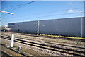
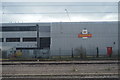
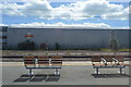
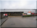
Images taken in and around the cb10be area
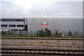
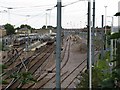
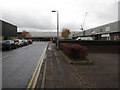
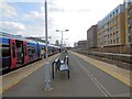
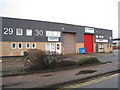
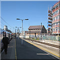
Please click the More button for more images, licensing and image copyright information.
Cambridge and nearby Videos From YouTube
Dry Cambridge (UK) hot summer ambience drone footage 2018
Sample footage from DJI Spark - editing and music by me - all rights reserved.
Channel: fishbloom (View Channel)
Published: 5 Jun 2020
Police
This area is policed by Cambridgeshire Constabulary.
Cambridgeshire Constabulary split their policing area into 14 separate neighbourhoods and this postcode is in the Cambridge South and East neighbourhood.

Cambridge South and East Neighbourhood Crime
Top 3 Categories
For full details of all categories together with more crime information, click on the Details button.
Member of UK Parliament
This postcode is in the Cambridge parliamentary constituency.
Cambridge is a constituency in the East of England region of England. The seat has been held by Daniel Zeichner (Labour) since May 2015.

Most Recent House Sales for CB1 0BE
No recorded house sales or transfers for this postcode.
Local Petrol Station Prices
Coordinates for CB1 0BE
Residents at CB1 0BE
Sunrise and Sunset at CB1 0BE
Traffic Emission and Congestion Zones
Historical Weather Summary
| Clear | 10.33% |
| Cloudy | 71.97% |
| Rain | 7.70% |
| Windy | 9.96% |
| Other | 0.04% |
Population
Deprivation Index
the more deprived the postcode
Companies Registered at CB1 0BE
Postcode Details for CB1 0BE
Recent Updates
|
18 Apr 2024 Added Traffic Camera Views from Traffic Scotland to Roadworks within Scotland |
|
15 Apr 2024 Schools Data updated for April 2024 |
|
10 Apr 2024 Companies Data updated for March 2024 |
|
7 Apr 2024 New option to receive automatic updates to roadworks that affect you |
|
7 Apr 2024 Police and Crime data updated for February 2024 |
|
3 Apr 2024 Sold House Price data updated for February 2024 |
|
30 Mar 2024 Energy Performance Certificates (England and Wales) updated February 2024 |
|
28 Mar 2024 New feature to use Geolocating functions to detect your current location |
Random Postcodes
Want an idea of what is in our extensive website? Try somewhere completely random!
The Rural/Urban classification is based upon data collected during the 2011 Census and released in August 2013 and is categorised into 6 distinct classes.
[A] Urban Major conurbation: A built up area with a population of 10,000 (3,000 in Scotland) or more and is assigned to the major conurbation settlement category.
[B] Urban Minor conurbation: A built up area with a population of 10,000 (3,000 in Scotland) or more and is assigned to the minor conurbation settlement category.
[C] Urban City and town: A built up area with a population of 10,000 (3,000 in Scotland) or more and is assigned to the city and town settlement category.
[D] Rural Town and fringe
[E] Rural Village
[F] Rural Hamlet and isolated dwelling
The Index of Multiple Deprivation (IMD) is the official measure of relative deprivation.
The index is based on 39 separate indicators across seven distinct domains (Income; Employment; Health and Disability; Education, Skills and Training; Crime; Barriers to Housing and Services; Living Environment) to provide an overall measure of multiple deprivation and is calculated for every neighbourhood.
The index is relative rather than an absolute scale and so a neighbourhood with a score of 10 is more deprived than one rated 20, but this does not equate to being twice as deprived.
Please note: Different indices are used in England, Scotland, Wales and Northern Ireland and so comparison of scores from neighbourhoods in different countries should not be undertaken.
These figures report on incorporated UK companies only that are registered at this postcode and do not include sole-traders, partnerships or overseas organisations.
The population figure shown for your area are an estimate provided by the Office for National Statistics and is rounded to the nearest 1,000.
The estimates are derived from the Annual Population Survey (APS) which is the Labour Force Survey (LFS) plus various sample boosts.
Large User Postcode
This postcode is designated a large user postcode. A large user postcode is assigned by Royal Mail to those organisations typically receiving at least 500 mail items per day and so will usually be found assigned to business premises.
There are 26 county councils in 2-tier areas, providing services such as education, social services and waste disposal.
In 2-tier areas, each county council area is subdivided into districts, for which there is an independent district council. There are 192 district councils.
District councils are responsible for local services such as rubbish collection, housing and planning applications.