Overview for Ballyward Road, CASTLEWELLAN, BT31 9PS
Introduction
Castlewellan (from Irish Caisleán Uidhilín 'Hugelin's Castle') is a small town in County Down, in the south-east of Northern Ireland close to the Irish Sea. It is beside Castlewellan Lake and Slievenaslat mountain, 11 miles (18 km) southwest of Downpatrick. It lies between the Mourne Mountains and Slieve Croob. It had a population of 2,782 people in the 2011 census.
Castlewellan has a wide main street which runs through two main squares lined with chestnut trees. The town was designed by a French architect for the Annesley Family. The Annesley family did not always own the land as they bought it from The Maginess Family. (see Earl Annesley), then owners of what is now Castlewellan Christian Conference Centre and Forest Park, and is unique within Ireland due to its tree-lined squares both in the old town (upper square) and new town (lower square) as well as its very wide main street. The old market house in the upper square was built in 1764 and now houses the public library.
Summary for Ballyward Road, CASTLEWELLAN, BT31 9PS
Roadworks near BT31 9PS
Local roadworks in Northern Ireland are provided by Traffic Watch NI on their website at trafficwatchni.com/twni/traffic-news.
Unfortunately, whilst the information is provided, the orgasation do not provide location coordinates and so we are unable to map the planned works to local postcodes at this time.
Road Safety near BT31 9PS
Details of personal injury accidents in and around Ballyward Road, BT31 9PS that have been reported to Police Service of Northern Ireland over the past 20 years.
Traffic Levels near BT31 9PS
View traffic levels near Ballyward Road, BT31 9PS from official Department for Transport counts.
Images taken near to Ballyward Road, BT31 9PS and the surrounding area
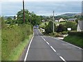
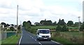
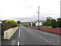
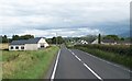
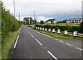
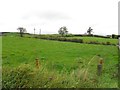
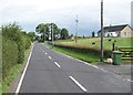
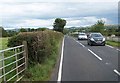
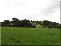
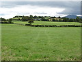
Please click the More button for more images, licensing and image copyright information.
Police
This area is policed by Police Service of Northern Ireland.
Police Service of Northern Ireland split their policing area into 26 separate neighbourhoods and this postcode is in the Armagh neighbourhood.

Armagh Neighbourhood Crime
Top 3 Categories
For full details of all categories together with more crime information, click on the Details button.
Member of UK Parliament
Unfortunately, Parliamentary details are not available for this postcode.
Most Recent House Sales for Ballyward Road, BT31 9PS
No recorded house sales or transfers for this postcode.
Local Petrol Station Prices
Coordinates for BT31 9PS
Sunrise and Sunset at BT31 9PS
Traffic Emission and Congestion Zones
Historical Weather Summary
| Clear | 15.56% |
| Cloudy | 55.01% |
| Rain | 13.61% |
| Windy | 15.12% |
| Other | 0.70% |
Companies Registered at BT31 9PS
Postcode Details for BT31 9PS
Recent Updates
|
18 Apr 2024 Added Traffic Camera Views from Traffic Scotland to Roadworks within Scotland |
|
15 Apr 2024 Schools Data updated for April 2024 |
|
10 Apr 2024 Companies Data updated for March 2024 |
|
7 Apr 2024 New option to receive automatic updates to roadworks that affect you |
|
7 Apr 2024 Police and Crime data updated for February 2024 |
|
3 Apr 2024 Sold House Price data updated for February 2024 |
|
30 Mar 2024 Energy Performance Certificates (England and Wales) updated February 2024 |
|
28 Mar 2024 New feature to use Geolocating functions to detect your current location |
Random Postcodes
Want an idea of what is in our extensive website? Try somewhere completely random!
The Rural/Urban classification is based upon data collected during the 2011 Census and released in August 2013 and is categorised into 6 distinct classes.
[A] Urban Major conurbation: A built up area with a population of 10,000 (3,000 in Scotland) or more and is assigned to the major conurbation settlement category.
[B] Urban Minor conurbation: A built up area with a population of 10,000 (3,000 in Scotland) or more and is assigned to the minor conurbation settlement category.
[C] Urban City and town: A built up area with a population of 10,000 (3,000 in Scotland) or more and is assigned to the city and town settlement category.
[D] Rural Town and fringe
[E] Rural Village
[F] Rural Hamlet and isolated dwelling
The Index of Multiple Deprivation (IMD) is the official measure of relative deprivation.
The index is based on 39 separate indicators across seven distinct domains (Income; Employment; Health and Disability; Education, Skills and Training; Crime; Barriers to Housing and Services; Living Environment) to provide an overall measure of multiple deprivation and is calculated for every neighbourhood.
The index is relative rather than an absolute scale and so a neighbourhood with a score of 10 is more deprived than one rated 20, but this does not equate to being twice as deprived.
Please note: Different indices are used in England, Scotland, Wales and Northern Ireland and so comparison of scores from neighbourhoods in different countries should not be undertaken.
These figures report on incorporated UK companies only that are registered at this postcode and do not include sole-traders, partnerships or overseas organisations.
The population figure shown for your area are an estimate provided by the Office for National Statistics and is rounded to the nearest 1,000.
The estimates are derived from the Annual Population Survey (APS) which is the Labour Force Survey (LFS) plus various sample boosts.
There are 26 county councils in 2-tier areas, providing services such as education, social services and waste disposal.
In 2-tier areas, each county council area is subdivided into districts, for which there is an independent district council. There are 192 district councils.
District councils are responsible for local services such as rubbish collection, housing and planning applications.