Overview for Pococks Road, EASTBOURNE, BN21 2RS
Introduction
Eastbourne is a town and seaside resort in East Sussex, on the south coast of England, 19 miles (31 km) east of Brighton and 54 miles (87 km) south of London. It is also a local government district with borough status. Eastbourne is immediately east of Beachy Head, the highest chalk sea cliff in Great Britain and part of the larger Eastbourne Downland Estate.
The seafront consists largely of Victorian hotels, a pier, theatre, contemporary art gallery and a Napoleonic era fort and military museum. Although Eastbourne is a relatively new town, there is evidence of human occupation in the area from the Stone Age. The town grew as a fashionable tourist resort largely thanks to prominent landowner William Cavendish, later to become the Duke of Devonshire. Cavendish appointed architect Henry Currey to design a street plan for the town, but not before sending him to Europe to draw inspiration. The resulting mix of architecture is typically Victorian and remains a key feature of Eastbourne.
As a seaside resort, Eastbourne derives a large and increasing income from tourism, with revenue from traditional seaside attractions augmented by conferences, public events and cultural sightseeing. The other main industries in Eastbourne include trade and retail, healthcare, education, construction, manufacturing, professional scientific and the technical sector.
Eastbourne's population is growing; between 2001 and 2011, it increased from 89,800 to 99,412. The 2011 census shows that the average age of residents has decreased as the town has attracted students, families and those commuting to London and Brighton. In the 2021 census, the population of Eastbourne was 101,700.
Summary for Pococks Road, EASTBOURNE, BN21 2RS
Roadworks near BN21 2RS
Road Safety near BN21 2RS
Details of personal injury accidents in and around Pococks Road, BN21 2RS that have been reported to Sussex Police over the past 20 years.
Traffic Levels near BN21 2RS
View traffic levels near Pococks Road, BN21 2RS from official Department for Transport counts.
Images taken near to Pococks Road, BN21 2RS and the surrounding area
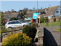
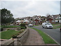
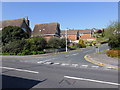
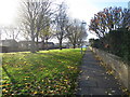
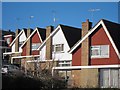
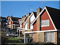
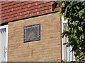
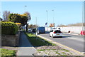
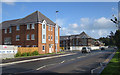
Please click the More button for more images, licensing and image copyright information.
Eastbourne and nearby Videos From YouTube
Seven Sisters Cliffs in golden hour | Drone footage | DJI Mavic Air | 60 FPS
Beautiful landscape 2 hours far from London during the golden hour. Checkout my instagram: ...
Channel: Oleksandr Mukhopad (View Channel)
Published: 2 Mar 2021
Police
This area is policed by Sussex Police.
Sussex Police split their policing area into 273 separate neighbourhoods and this postcode is in the Rodmill neighbourhood.

Rodmill Neighbourhood Crime
Top 3 Categories
For full details of all categories together with more crime information, click on the Details button.
Member of UK Parliament
This postcode is in the Eastbourne parliamentary constituency.
Eastbourne is a constituency in the South East region of England. The seat has been held by Caroline Ansell (Conservative) since December 2019.

Most Recent House Sales for Pococks Road, BN21 2RS
8 Jul 2022
20 Aug 2021
3 Jul 2017
30 Nov 2012
Local Petrol Station Prices
Coordinates for BN21 2RS
Residents at BN21 2RS
Sunrise and Sunset at BN21 2RS
Traffic Emission and Congestion Zones
Historical Weather Summary
| Clear | 11.36% |
| Cloudy | 68.32% |
| Rain | 11.13% |
| Windy | 9.16% |
| Other | 0.03% |
Population
Deprivation Index
the more deprived the postcode
Average Energy Performance
Companies Registered at BN21 2RS
Postcode Details for BN21 2RS
Recent Updates
|
15 Apr 2024 Schools Data updated for April 2024 |
|
10 Apr 2024 Companies Data updated for March 2024 |
|
7 Apr 2024 New option to receive automatic updates to roadworks that affect you |
|
7 Apr 2024 Police and Crime data updated for February 2024 |
|
3 Apr 2024 Sold House Price data updated for February 2024 |
|
30 Mar 2024 Energy Performance Certificates (England and Wales) updated February 2024 |
|
28 Mar 2024 New feature to use Geolocating functions to detect your current location |
|
17 Mar 2024 Schools Data updated for March 2024 |
Random Postcodes
Want an idea of what is in our extensive website? Try somewhere completely random!
The Rural/Urban classification is based upon data collected during the 2011 Census and released in August 2013 and is categorised into 6 distinct classes.
[A] Urban Major conurbation: A built up area with a population of 10,000 (3,000 in Scotland) or more and is assigned to the major conurbation settlement category.
[B] Urban Minor conurbation: A built up area with a population of 10,000 (3,000 in Scotland) or more and is assigned to the minor conurbation settlement category.
[C] Urban City and town: A built up area with a population of 10,000 (3,000 in Scotland) or more and is assigned to the city and town settlement category.
[D] Rural Town and fringe
[E] Rural Village
[F] Rural Hamlet and isolated dwelling
The Index of Multiple Deprivation (IMD) is the official measure of relative deprivation.
The index is based on 39 separate indicators across seven distinct domains (Income; Employment; Health and Disability; Education, Skills and Training; Crime; Barriers to Housing and Services; Living Environment) to provide an overall measure of multiple deprivation and is calculated for every neighbourhood.
The index is relative rather than an absolute scale and so a neighbourhood with a score of 10 is more deprived than one rated 20, but this does not equate to being twice as deprived.
Please note: Different indices are used in England, Scotland, Wales and Northern Ireland and so comparison of scores from neighbourhoods in different countries should not be undertaken.
These figures report on incorporated UK companies only that are registered at this postcode and do not include sole-traders, partnerships or overseas organisations.
The population figure shown for your area are an estimate provided by the Office for National Statistics and is rounded to the nearest 1,000.
The estimates are derived from the Annual Population Survey (APS) which is the Labour Force Survey (LFS) plus various sample boosts.
There are 26 county councils in 2-tier areas, providing services such as education, social services and waste disposal.
In 2-tier areas, each county council area is subdivided into districts, for which there is an independent district council. There are 192 district councils.
District councils are responsible for local services such as rubbish collection, housing and planning applications.