Overview for New Street, WELLS, BA5 2LA
Introduction
Wells is a cathedral city and civil parish in Somerset, located on the southern edge of the Mendip Hills, 21 miles (34 km) south-east of Weston-super-Mare, 22 mi (35 km) south-west of Bath and 23 mi (37 km) south of Bristol. Although the population recorded in the 2011 census was only 10,536, (increased to 12,000 by 2018) and with a built-up area of just 3.244 km2 (1.253 sq mi), Wells has had city status since medieval times, because of the presence of Wells Cathedral. Often described as England's smallest city, it is actually second smallest to the City of London in area and population, but unlike London it is not part of a larger urban agglomeration.
Wells takes its name from three wells dedicated to Saint Andrew, one in the market place and two within the grounds of the Bishop's Palace and cathedral. A small Roman settlement surrounded them, which grew in importance and size under the Anglo-Saxons when King Ine of Wessex founded a minster church there in 704. The community became a trading centre based on cloth making and Wells is notable for its 17th-century involvement in both the English Civil War and the Monmouth Rebellion. In the 19th century, transport infrastructure improved with stations on three different railway lines. However, since 1964 the city has been without a railway link.
The cathedral and the associated religious and medieval architectural history provide
much of the employment. The city has a variety of sporting and cultural activities and houses several schools including The Blue School, a state coeducational comprehensive school that was founded in 1641, and the private Wells Cathedral School, which was founded possibly as early as 909 and is one of the five established musical schools for school-age children in the United Kingdom. Wells's historic architecture has led to the city being used as a shooting location for numerous films and television programmes.
Summary for New Street, WELLS, BA5 2LA
Roadworks near BA5 2LA
Road Safety near BA5 2LA
Details of personal injury accidents in and around New Street, BA5 2LA that have been reported to Avon and Somerset Constabulary over the past 20 years.
Traffic Levels near BA5 2LA
View traffic levels near New Street, BA5 2LA from official Department for Transport counts.
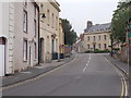
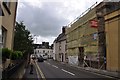
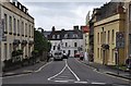
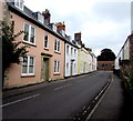
Images taken near to New Street, BA5 2LA and the surrounding area
![Wells houses [17]](https://s3.geograph.org.uk/geophotos/06/33/16/6331699_1d428323_120x120.jpg)
![Wells houses [16]](https://s0.geograph.org.uk/geophotos/06/33/16/6331696_13912de1_120x120.jpg)

![Wells houses [15]](https://s0.geograph.org.uk/geophotos/06/33/16/6331692_d259daa1_120x120.jpg)


Please click the More button for more images, licensing and image copyright information.
Police
This area is policed by Avon and Somerset Constabulary.
Avon and Somerset Constabulary split their policing area into 123 separate neighbourhoods and this postcode is in the Wells City neighbourhood.

Wells City Neighbourhood Crime
Top 3 Categories
For full details of all categories together with more crime information, click on the Details button.
Member of UK Parliament
This postcode is in the Wells parliamentary constituency.
Wells is a constituency in the South West region of England. The seat has been held by James Heappey (Conservative) since May 2015.

Most Recent House Sales for New Street, BA5 2LA
12 Mar 2014
4 Apr 2008
27 Aug 2004
26 Apr 2000
Local Petrol Station Prices
Coordinates for BA5 2LA
Residents at BA5 2LA
Sunrise and Sunset at BA5 2LA
Traffic Emission and Congestion Zones
Historical Weather Summary
| Clear | 20.24% |
| Cloudy | 65.06% |
| Rain | 7.93% |
| Windy | 6.51% |
| Other | 0.26% |
Deprivation Index
the more deprived the postcode
Average Energy Performance
Companies Registered at BA5 2LA
Postcode Details for BA5 2LA
Recent Updates
|
18 Apr 2024 Added Traffic Camera Views from Traffic Scotland to Roadworks within Scotland |
|
15 Apr 2024 Schools Data updated for April 2024 |
|
10 Apr 2024 Companies Data updated for March 2024 |
|
7 Apr 2024 New option to receive automatic updates to roadworks that affect you |
|
7 Apr 2024 Police and Crime data updated for February 2024 |
|
3 Apr 2024 Sold House Price data updated for February 2024 |
|
30 Mar 2024 Energy Performance Certificates (England and Wales) updated February 2024 |
|
28 Mar 2024 New feature to use Geolocating functions to detect your current location |
Random Postcodes
Want an idea of what is in our extensive website? Try somewhere completely random!
The Rural/Urban classification is based upon data collected during the 2011 Census and released in August 2013 and is categorised into 6 distinct classes.
[A] Urban Major conurbation: A built up area with a population of 10,000 (3,000 in Scotland) or more and is assigned to the major conurbation settlement category.
[B] Urban Minor conurbation: A built up area with a population of 10,000 (3,000 in Scotland) or more and is assigned to the minor conurbation settlement category.
[C] Urban City and town: A built up area with a population of 10,000 (3,000 in Scotland) or more and is assigned to the city and town settlement category.
[D] Rural Town and fringe
[E] Rural Village
[F] Rural Hamlet and isolated dwelling
The Index of Multiple Deprivation (IMD) is the official measure of relative deprivation.
The index is based on 39 separate indicators across seven distinct domains (Income; Employment; Health and Disability; Education, Skills and Training; Crime; Barriers to Housing and Services; Living Environment) to provide an overall measure of multiple deprivation and is calculated for every neighbourhood.
The index is relative rather than an absolute scale and so a neighbourhood with a score of 10 is more deprived than one rated 20, but this does not equate to being twice as deprived.
Please note: Different indices are used in England, Scotland, Wales and Northern Ireland and so comparison of scores from neighbourhoods in different countries should not be undertaken.
These figures report on incorporated UK companies only that are registered at this postcode and do not include sole-traders, partnerships or overseas organisations.
The population figure shown for your area are an estimate provided by the Office for National Statistics and is rounded to the nearest 1,000.
The estimates are derived from the Annual Population Survey (APS) which is the Labour Force Survey (LFS) plus various sample boosts.
There are 55 unitary authorities. They provide all local government services in their areas. These are mainly in the cities, urban areas and larger towns although there are now 6 shire county councils that are unitary (ie have no district councils beneath them).