Overview for Mill Road, RADSTOCK, BA3 5TX
Introduction
Radstock is a town and civil parish on the northern slope of the Mendip Hills in Somerset, England, about 9 miles (14 km) south-west of Bath and 8 miles (13 km) north-west of Frome. It is within the area of the unitary authority of Bath and North East Somerset. The Radstock built-up area had a population of 9,419 at the 2011 Census.
Radstock has been settled since the Iron Age, and its importance grew after the construction of the Fosse Way, a Roman road. The town grew after 1763, when coal was discovered in the area. Large numbers of mines opened during the 19th century, including several owned by the Waldegrave family, who had been Lords of the Manor since the Civil War. Admiral Lord Radstock, brother of George, fourth Earl Waldegrave, took the town's name as his title when created a Baron.
The spoil heap of Writhlington colliery is now the Writhlington Site of Special Scientific Interest, which includes 3,000 tons of Upper Carboniferous spoil from which more than 1,400 insect fossil specimens have been recovered. The complex geology and narrow seams made coal extraction difficult. Tonnage increased throughout the 19th century, reaching a peak around 1901, when there were 79 separate collieries and annual production was 1,250,000 tons per annum. However, due to local geological difficulties and manpower shortages, output declined and the number of pits reduced from 30 at the beginning of the 20th century to 14 by the mid-thirties; the last two pits, Kilmersdon and Writhlington, closed in September 1973. Manufacturing industries such as printing, binding and packaging provide some local employment. In recent years, Radstock has increasingly become a commuter town for the cities of Bath and Bristol.
Radstock is home to the Radstock Museum which is housed in a former market hall, and has a range of exhibits which offer an insight into north-east Somerset life since the 19th century. Many of the exhibits relate to local geology and the now disused Somerset coalfield. The town is also home to Writhlington School, famous for its Orchid collection, and a range of educational, religious and cultural buildings and sporting clubs.
Summary for Mill Road, RADSTOCK, BA3 5TX
Roadworks near BA3 5TX
Road Safety near BA3 5TX
Details of personal injury accidents in and around Mill Road, BA3 5TX that have been reported to Avon and Somerset Constabulary over the past 20 years.
Traffic Levels near BA3 5TX
View traffic levels near Mill Road, BA3 5TX from official Department for Transport counts.
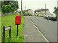
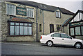
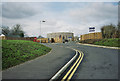
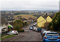
Images taken near to Mill Road, BA3 5TX and the surrounding area
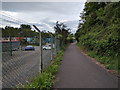
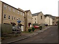
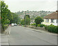
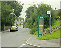
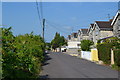
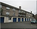
Please click the More button for more images, licensing and image copyright information.
Police
This area is policed by Avon and Somerset Constabulary.
Avon and Somerset Constabulary split their policing area into 123 separate neighbourhoods and this postcode is in the Somer Valley neighbourhood.

Somer Valley Neighbourhood Crime
Top 3 Categories
For full details of all categories together with more crime information, click on the Details button.
Member of UK Parliament
This postcode is in the North East Somerset parliamentary constituency.
North East Somerset is a constituency in the South West region of England. The seat has been held by Sir Jacob Rees-Mogg (Conservative) since May 2010.

Most Recent House Sales for Mill Road, BA3 5TX
No recorded house sales or transfers for this postcode.
Local Petrol Station Prices
Coordinates for BA3 5TX
Residents at BA3 5TX
Sunrise and Sunset at BA3 5TX
Traffic Emission and Congestion Zones
Historical Weather Summary
| Clear | 20.44% |
| Cloudy | 71.28% |
| Rain | 7.53% |
| Windy | 0.50% |
| Other | 0.25% |
Population
Deprivation Index
the more deprived the postcode
Companies Registered at BA3 5TX
Postcode Details for BA3 5TX
Recent Updates
|
18 Apr 2024 Added Traffic Camera Views from Traffic Scotland to Roadworks within Scotland |
|
15 Apr 2024 Schools Data updated for April 2024 |
|
10 Apr 2024 Companies Data updated for March 2024 |
|
7 Apr 2024 New option to receive automatic updates to roadworks that affect you |
|
7 Apr 2024 Police and Crime data updated for February 2024 |
|
3 Apr 2024 Sold House Price data updated for February 2024 |
|
30 Mar 2024 Energy Performance Certificates (England and Wales) updated February 2024 |
|
28 Mar 2024 New feature to use Geolocating functions to detect your current location |
Random Postcodes
Want an idea of what is in our extensive website? Try somewhere completely random!
The Rural/Urban classification is based upon data collected during the 2011 Census and released in August 2013 and is categorised into 6 distinct classes.
[A] Urban Major conurbation: A built up area with a population of 10,000 (3,000 in Scotland) or more and is assigned to the major conurbation settlement category.
[B] Urban Minor conurbation: A built up area with a population of 10,000 (3,000 in Scotland) or more and is assigned to the minor conurbation settlement category.
[C] Urban City and town: A built up area with a population of 10,000 (3,000 in Scotland) or more and is assigned to the city and town settlement category.
[D] Rural Town and fringe
[E] Rural Village
[F] Rural Hamlet and isolated dwelling
The Index of Multiple Deprivation (IMD) is the official measure of relative deprivation.
The index is based on 39 separate indicators across seven distinct domains (Income; Employment; Health and Disability; Education, Skills and Training; Crime; Barriers to Housing and Services; Living Environment) to provide an overall measure of multiple deprivation and is calculated for every neighbourhood.
The index is relative rather than an absolute scale and so a neighbourhood with a score of 10 is more deprived than one rated 20, but this does not equate to being twice as deprived.
Please note: Different indices are used in England, Scotland, Wales and Northern Ireland and so comparison of scores from neighbourhoods in different countries should not be undertaken.
These figures report on incorporated UK companies only that are registered at this postcode and do not include sole-traders, partnerships or overseas organisations.
The population figure shown for your area are an estimate provided by the Office for National Statistics and is rounded to the nearest 1,000.
The estimates are derived from the Annual Population Survey (APS) which is the Labour Force Survey (LFS) plus various sample boosts.
There are 55 unitary authorities. They provide all local government services in their areas. These are mainly in the cities, urban areas and larger towns although there are now 6 shire county councils that are unitary (ie have no district councils beneath them).