IMAGES TAKEN NEAR TO
Cardinals Court, SELBY, YO8 3TD

Introduction

This page details the photographs taken nearby to Cardinals Court, YO8 3TD by members of the Geograph project.

The Geograph project started in 2005 with the aim of publishing, organising and preserving representative images for every square kilometre of Great Britain, Ireland and the Isle of Man.

There are currently over 7.5m images from over14,400 individuals and you can help contribute to the project by visiting https://www.geograph.org.uk

Image Map


Images are licensed for reuse under creativecommons.org/licenses/by-sa/2.0
Notes
  • Clicking on the map will re-center to the selected point.
  • The higher the marker number, the further away the image location is from the centre of the postcode.

Image Listing (236 Images Found)

Images are licensed for reuse under creativecommons.org/licenses/by-sa/2.0
  • ...
Image
Details
Distance
1
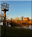
Swing Bridge at Cawood
View from the banks of the Ouse in Cawood towards the bridge.
Image: © Andy Farrington Taken: 27 Feb 2013
0.03 miles
2
Cawood floods
The River Ouse seriously above its normal level.
Image: © Steve Fareham Taken: 9 Sep 2008
0.03 miles
3
The River Ouse
Looking downstream from Cawood Swing Bridge.
Image: © JThomas Taken: 1 Feb 2020
0.03 miles
4
The River Ouse downstream of Cawood Bridge
The river is tidal at this point.
Image: © Jonathan Thacker Taken: 16 Jul 2018
0.04 miles
5
The Old Mill
Looking along this row of riverside cottages by the River Ouse in Cawood.
Image: © Andy Farrington Taken: 27 Feb 2013
0.04 miles
6
Petrol pumps, Thorpe Lane
Avery-Hardoll petrol pumps circa 1950’s. The pumps would have originally had an illuminated glass globe on top advertising the fuel on sale.
Image: © Mike Kirby Taken: 13 Aug 2014
0.04 miles
7
18 High Street, Cawood
House built c.1700, later used as retail premises, now again residential. The near end bay now appears to have been separated as an independent dwelling. Listed Grade II.
Image: © Alan Murray-Rust Taken: 19 Aug 2024
0.04 miles
8
Water Row, Cawood
Path squeezed between a row of houses and the River Ouse
Image: © Chris Heaton Taken: 5 Oct 2019
0.05 miles
9
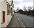
Thorpe Lane (B1223), Cawood
Showing position of Postbox No. YO8 68. See Image] for postbox.
Image: © JThomas Taken: 1 Feb 2020
0.05 miles
10
Cawood swing bridge across the River Ouse
Image: © Steve Fareham Taken: 8 Dec 2014
0.05 miles
  • ...