1
Elevated view of West End.
Kirkby had another public house, the Cricketers, until 2002. The owners
converted the pub into a residence and it is now simply number 80. The
scaffolding provided a fine vantage point.
Image: © Martin Smith
Taken: 21 May 2003
0.01 miles
2
West End, Kirkbymoorside, looking towards the Market Place
This narrow street was once the main road leading from Helmsley into the centre of Kirkbymoorside. The long straggling terrace on the left is a riot of different building styles, periods, sizes, rooflines and materials. Limestone, sandstone, red brick and yellow brick are found in profusion. This terrace is remarkable for being 31 houses long, without a break.
Image: © John Martin
Taken: 11 Mar 2007
0.02 miles
3
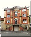
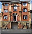
Former Methodist Chapel, West End
A rather grand building which is by far the largest in the street. There's a datestone of 1861, but it is clear that this is no longer a place of worship and has been converted for residential use. There's another Methodist church less than 300m away.
Image: © Gordon Hatton
Taken: 8 Aug 2024
0.02 miles
4
Kirkbymoorside rooftops
In the centre is the windmill tower and to the left, the church tower. Beyond the town, to the right, is Broats Farm.
Image: © Pauline E
Taken: 31 May 2011
0.03 miles
5
Methodist Chapel, No 26, West End (1)
The former Methodist chapel shows a build date of 1861. The building has many fine features architecturally, but is not included in English Heritage's listed buildings.
The chapel has now been converted into apartments.
Image: © Mike Kirby
Taken: 9 Jul 2011
0.03 miles
6
Methodist Chapel, No 26, West End (2)
The building has many fine features architecturally, but is not included in English Heritage's listed buildings.
Image: © Mike Kirby
Taken: 9 Jul 2011
0.03 miles
7
No 22, West End, The Georgian House
The Georgian House and attached railings to front form a grade II listed 3-storey house dated mid C18. Dressed sandstone to front with raised quoins and raised first and second floor bands, coursed rubble and brick gable wall to right. Moulded eaves cornice to slate roof and brick end stacks. Central door in pedimented, pilastered door case. At end right of first floor is a circular sundial which can just be made out in the ivy.
LBS No: 328428
Image: © Mike Kirby
Taken: 9 Jul 2011
0.04 miles
8
The White Horse, West End, Kirkbymoorside
This inn stands on the corner of West End and Piercy End, at the bottom of Market Place
Image: © John Martin
Taken: 11 Mar 2007
0.04 miles
9
Russells yard at Kirkbymoorside
Agricultural machinery dealer occupying the former railway station and sidings at Kirkbymoorside - by the A170.
Image: © Colin Grice
Taken: 17 Jan 2005
0.05 miles
10
Kirkbymoorside centre
The Market place area.
Image: © Colin Grice
Taken: 23 May 2006
0.05 miles


