1
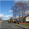
Ruskin Road Shops
Image: © John M
Taken: 9 Dec 2017
0.07 miles
2
Ruskin Road in Old Fallings, Wolverhampton
This shows Ruskin Road, looking north-east from the roundabout by Old Fallings Lane.
Image: © Roger D Kidd
Taken: 8 Mar 2018
0.10 miles
3
Council Housing - Newman Road
Large semi-detached house on a corner plot on the 1937 Scotlands Estate.
Image: © John M
Taken: 20 Dec 2009
0.10 miles
4
Housing in Ruskin Road, Old Fallings, Wolverhampton
Semi-detached freehold houses seen from Old Fallings Lane near the roundabout.
Image: © Roger D Kidd
Taken: 10 Oct 2013
0.13 miles
5
Ruskin Road in Old Fallings, Wolverhampton
This shows Ruskin Road, looking north-east from the roundabout by Old Fallings Lane.
Image: © Roger D Kidd
Taken: 8 Mar 2018
0.13 miles
6
Housing in Ruskin Road, Old Fallings, Wolverhampton
This shows semi-detached houses in Ruskin Road, looking north-east from the roundabout by Old Fallings Lane.
Image: © Roger D Kidd
Taken: 8 Mar 2018
0.13 miles
7
Council Housing - Masefield Road
Evidence here of a Council house sale on the 1937 Scotlands Estate. The nearest property was excluded from the latest modernisation and re-roofing works.
Image: © John M
Taken: 20 Dec 2009
0.14 miles
8
Poplar tree and Ruskin Road in Old Fallings, Wolverhampton
Looking across the junction of Old Fallings Lane with Primrose Lane.
Note: The tree has been felled. I only noticed in 2018.
Image: © Roger D Kidd
Taken: 10 Oct 2013
0.15 miles
9
Housing by Old Fallings Lane in Wolverhampton
This is Old Fallings Lane, by the roundabout, Ruskin Road being off to the right.
Image: © Roger D Kidd
Taken: 8 Mar 2018
0.16 miles
10
Old Fallings Lane, Wolverhampton
This image shows the northern part of Old Fallings Lane and part of the roundabout at the junction with Whitgreave Avenue (off to the left), Ruskin Road and Primrose Lane.
Image: © Roger D Kidd
Taken: 10 Oct 2013
0.16 miles


