1
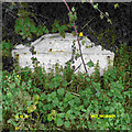
A38 south of Martin Hussingtree
The A38 runs straight towards the wall at Sandyway, where it turns northwards to follow the line of the Roman road from Worcester to Droitwich. From that bend onwards, the A38 (or its former route through Droitwich) follows the line of the Roman road for several miles
Image: © David Smith
Taken: 19 May 2013
0.02 miles
2
A38 at Martin Hussingtree village boundary
Image: © Colin Pyle
Taken: 1 Mar 2020
0.14 miles
3
Old Milestone by the A38, southwest of Martin Hussingtree
Metal plate attached to concrete post by the A38, in parish of Martin Hussingtree (Wychavon District), opposite Farm shop and lay-by, North of Sandyway, high up on roadside bank, on Southeast side of road. Bradley post, erected by the County Council in the 20th century.
Inscription reads:-
A38
WORCESTER 4.
22 BIRMINGHAM.
C.C.W.
Rivet benchmark on top.
Milestone Society National ID: WO_WOBM04
Image: © J Higgins
Taken: 11 May 2008
0.15 miles
4
Farmland at Martin Hussingtree
Farmland and houses at Martin Hussingtree.
Image: © Philip Halling
Taken: 15 Jan 2012
0.20 miles
5
Shed behind St Michael & All Angels, Martin Hussingtree
This splendid shed is used for storing various items and is not, as I first thought, a comfort station.
Image: © Chris Allen
Taken: 28 Feb 2010
0.21 miles
6
St Michael & All Angels, Martin Hussingtree
A pretty little church, off the beaten track.
Image: © John Hill
Taken: 19 May 2003
0.22 miles
7
St Michael & All Angels, Martin Hussingtree
A view from a different direction to the other currently on the site. The OS shows this as a chapel, rather than a church; the vestigial spire obviously not qualifying it for classification as a church.
Image: © Chris Allen
Taken: 28 Feb 2010
0.22 miles
8
Bellcote, Martin Hussingtree church
Image: © Philip Halling
Taken: 15 Jan 2012
0.23 miles
9
St Michael & All Angels, Martin Hussingtree, Worcestershire
Image: © Jeff Gogarty
Taken: 15 May 2016
0.23 miles
10
House next to Church, Martin Hussingtree, Worcestershire
Possibly Martin Court.
Image: © Jeff Gogarty
Taken: 15 May 2016
0.23 miles


