1
Carter Street, Lower Ince
Just a couple of Council Houses in a spur off Manley Street.
Image: © David Long
Taken: 21 Jun 2007
0.02 miles
2
"New Road System", Manley Street, Lower Ince
The new system involved turning the street into a one-way street. The former Manley pub, now an on-call medical centre, is on the left. The large red-brick building on the right is Ince Public Hall, the offices for Ince Urban District Council, prior to the 1974 Local Government Reforms. The small spire in the distance is on the end of Christ Church, Ince-in-Makerfield.
Image: © David Long
Taken: 24 Nov 2006
0.03 miles
3
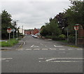
Winifred Street, Ince
From Harvey Street along Winifred Street towards Carter Street.
Image: © Jaggery
Taken: 23 Sep 2017
0.03 miles
4
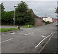
Windleshaw Street, Lower Ince
From Warrington Road along Windleshaw Street towards Manley Street.
Image: © Jaggery
Taken: 23 Sep 2017
0.03 miles
5
Windleshaw Street, Ince
From the corner of Warrington Road along Windleshaw Street towards Manley Street.
White triangles painted on the road surface draw attention to a speed bump.
Image: © Jaggery
Taken: 23 Sep 2017
0.03 miles
6
Delegarte Street, Lower Ince
The building on the right at the top, fronting Manley Street, is a former Primitive Methodist Chapel, now used as a Council Community Centre.
Image: © David Long
Taken: 21 Jun 2007
0.05 miles
7
The "New Road System", from the other side
The junction of Manley Street (right) and Ince Green Lane, with Junction Terrace leading off left. The Historic Map shows that there was once a railway bridge at this point, where the Wigan/ Irlam? Manchester line passed beneath the road. The Terrace overlooked Lower Ince Station in the cutting below.
Image: © David Long
Taken: 24 Nov 2006
0.05 miles
8
Former Bakery and Dairy, Manley Street, Lower Ince
Harveys Bakery and Hansons Dairies successively occupied this site.
Image: © David Long
Taken: 24 Nov 2006
0.06 miles
9
Junction Terrace
Once overlooked Ince Station on the Wigan - Irlam line.
Image: © David Long
Taken: 21 Dec 2005
0.06 miles
10
Wishful thinking on Junction Terrace
I doubt if many daisies were seen thereabouts.
Image: © David Long
Taken: 17 Mar 2004
0.06 miles


