IMAGES TAKEN NEAR TO
Annabels Mews, LONDON, W5 1LJ
Introduction
This page details the photographs taken nearby to Annabels Mews, W5 1LJ by members of the Geograph project.
The Geograph project started in 2005 with the aim of publishing, organising and preserving representative images for every square kilometre of Great Britain, Ireland and the Isle of Man.

There are currently over 7.5m images from over14,400 individuals and you can help contribute to the project by visiting https://www.geograph.org.uk
Image Map (Loading...)


Getting Data...Please wait
Leaflet Map data © OpenStreetMap
Images are licensed for reuse under creativecommons.org/licenses/by-sa/2.0
Notes
- Clicking on the map will re-center to the selected point.
- The higher the marker number, the further away the image location is from the centre of the postcode.
Image Listing (35 Images Found)
Images are licensed for reuse under creativecommons.org/licenses/by-sa/2.0
Image
Details
Distance
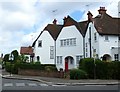
1
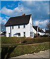
Terraced housing, Brentham Garden Suburb
Arts & Crafts style terrace: architect G Lister Sutcliffe.
Image: © Jim Osley
Taken: 7 Mar 2018
0.10 miles
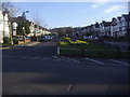
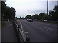
2
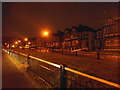
Junction of Lynwood Road with Brunswick Road, Ealing
Image: © Ruth Sharville
Taken: 22 May 2011
0.15 miles
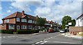
3
Junction of Bentham Way and Woodfield Crescent
Image: © Roger Templeman
Taken: 1 Apr 2016
0.15 miles
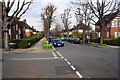
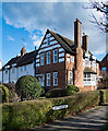
4
Brentham Garden Suburb
Brentham Garden Suburb was the first garden suburb to be built on ‘Co-partnership’ principles and was an inspiration for the later, larger and more famous Hampstead Garden Suburb .It was designed to a plan by the leading garden city architects Barry Parker and Raymond Unwin, with houses, mostly in the Arts and Crafts style.
In 1969 Brentham Garden Suburb was designated a conservation area. The Brentham Society was formed in the same year to support and maintain the character of the area. See http://brentham.com/ for more information.
This photograph was taken looking across Brentham Way to the corner with Fowler's Walk.
Image: © Marathon
Taken: 8 Oct 2014
0.16 miles
9
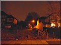
Path between houses on Sandall Road, Ealing
By the pass is a fenced off grass track, which usually means a water supply which has been restricted from the public. Some have notices up naming the owners as such.
Image: © David Howard
Taken: 6 Jan 2015
0.18 miles