IMAGES TAKEN NEAR TO
Conway Crescent, GREENFORD, UB6 8JG

Introduction

This page details the photographs taken nearby to Conway Crescent, UB6 8JG by members of the Geograph project.

The Geograph project started in 2005 with the aim of publishing, organising and preserving representative images for every square kilometre of Great Britain, Ireland and the Isle of Man.

There are currently over 7.5m images from over14,400 individuals and you can help contribute to the project by visiting https://www.geograph.org.uk

Image Map


Images are licensed for reuse under creativecommons.org/licenses/by-sa/2.0
Notes
  • Clicking on the map will re-center to the selected point.
  • The higher the marker number, the further away the image location is from the centre of the postcode.

Image Listing (23 Images Found)

Images are licensed for reuse under creativecommons.org/licenses/by-sa/2.0
  • ...
Image
Details
Distance
1
Roofscape, Perivale
Image: © N Chadwick Taken: 11 Apr 2013
0.03 miles
2
Charter train waits at signal at Greenford East Junction
Waiting at the semaphore signals before being allowed to continue towards South Greenford
Image: © Roger Templeman Taken: 7 Feb 2015
0.08 miles
3
East from Greenford
The lines toward Acton viewed from Greenford East Signal Box. Photographed under the supervision of Network Rail local management.
Image: © Peter Whatley Taken: 17 Jul 2010
0.13 miles
4
Greenford Curve
This is one of those odd stretches of railway that it is very difficult for the lay person to understand what its purpose is! It forms the eastern side of the triangle of railways at Greenford and is a Network Rail line that curves off northwards and then eastwards from the line between South Greenford and Greenford stations. It then heads off back towards London paralleling the London Underground Central Line from Greenford past Perivale, Hanger Lane, etc. It is certainly not a route used by scheduled passenger trains, so possibly it is now some means of reversing trains in the Paddington area through 180˚. What is certain is that it is shown as the Great Western Railway's Greenford Curve on the Ordnance Survey's maps of 1920, long before any residential or industrial development took place in the area, and its alignment has dictated the similar curved shape of the more recent road to the east, the residential Conway Crescent. On the skyline in the distance, around the curve towards South Greenford, is a semaphore signal. This photograph was taken from the Lyon Way industrial estate.
Image: © Nigel Cox Taken: 5 May 2008
0.16 miles
5
Little Elms Meadow, Perivale Wood
This ancient unploughed meadow is grazed from May to October each year. View on open day. See Image for more information about this nature reserve.
Image: © David Hawgood Taken: 26 Apr 2009
0.17 miles
6
Ash trees in Perivale Wood
The larger trees in this ancient woodland are ash and oak. There are thousands of coppiced hazel trees, also hawthorn, holly and rowan among others.
Image: © David Hawgood Taken: 26 Apr 2009
0.17 miles
7
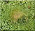
Yellow Meadow Ants nest, Perivale Wood
This grass covered mound in the Little Elms Meadow area of the Perivale Wood nature reserve is a nest of the Yellow Meadow ant, Lasius flavus. An information board in the meadow and the nature trail leaflet say that these nests occur only in old grasslands. They can extend a metre down into the soil.
Image: © David Hawgood Taken: 26 Apr 2009
0.17 miles
8
Roofscape, Perivale
Image: © N Chadwick Taken: 11 Apr 2013
0.18 miles
9
St Edward the Confessor, Medway Drive, Greenford
Image: © John Salmon Taken: 5 Oct 2004
0.18 miles
10
St Edward the Confessor, Medway Drive, Greenford
Image: © John Salmon Taken: 5 Oct 2004
0.19 miles
  • ...