IMAGES TAKEN NEAR TO
Perranwell Station, TRURO, TR3 7LZ

Introduction

This page details the photographs taken nearby to TR3 7LZ by members of the Geograph project.

The Geograph project started in 2005 with the aim of publishing, organising and preserving representative images for every square kilometre of Great Britain, Ireland and the Isle of Man.

There are currently over 7.5m images from over14,400 individuals and you can help contribute to the project by visiting https://www.geograph.org.uk

Image Map


Images are licensed for reuse under creativecommons.org/licenses/by-sa/2.0
Notes
  • Clicking on the map will re-center to the selected point.
  • The higher the marker number, the further away the image location is from the centre of the postcode.

Image Listing (9 Images Found)

Images are licensed for reuse under creativecommons.org/licenses/by-sa/2.0
Image
Details
Distance
1
Hole in the Road
The roads around Frogpool leave a lot to be desired. The white stick is 48 inches in length
Image: © Phillip Roscorla Taken: 21 Dec 2006
0.02 miles
2
Road Junction east of Frogpool
Image: © Tony Atkin Taken: 6 Apr 2006
0.10 miles
3
Stone Stile SW7640b
West of Four Winds, beside the road from Greensplat to Frogpool. Stone protruding from the hedge with a galvanised pole across the top. Public footpath from the road that runs between Greensplat to Frogpool. Stile leads into a field Footpath 307/32/1 (Silver).
Image: © Carrie Langford Taken: 14 Oct 2021
0.12 miles
4
Stone Stile SW7640c
At boundary between fields north of road from Greensplatt to Frogpool, on footpath to Lanner Farm. Two granite steps each side of raised granite slab with a galvanised pole across the top. Public footpath from the road that runs between Greensplat to Frogpool to Lanner farm. 307/32/1 (Silver).
Image: © Carrie Langford Taken: 14 Oct 2021
0.16 miles
5
Farmland, Gwennap
A crop of barley beside a footpath to the east of Frogpool.
Image: © Andrew Smith Taken: 14 May 2022
0.17 miles
6
Stone Stile SW7640d
Where the footpath across the fields joins a green lane to Lanner Farm. Approaching from the south, there is a wooden fence with a wooden stile, then the stone hedge with the stone stile. There are no protruding stones on the south side, but three protruding stones on the north side (a sheep stile) dropping into the green lane. Public footpath from the road that runs between Greensplat to Frogpool to Lanner farm. 307/32/1 (Silver). The footpath runs west and then north along the green lane. Note the green lane to the east of the stile is not a public right of way.
Image: © Carrie Langford Taken: 14 Oct 2021
0.21 miles
7
East of Frogpool
Houses and bales of hay wrapped in blue plastic.
Image: © Tony Atkin Taken: 6 Apr 2006
0.22 miles
8
The Cornish Arms
Taken early in the evening
Image: © Phillip Roscorla Taken: 5 Nov 2005
0.22 miles
9
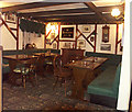
The Cornish Arms - Interior
Image: © Phillip Roscorla Taken: 28 Jan 2004
0.22 miles