IMAGES TAKEN NEAR TO
Marys Well, REDRUTH, TR15 3UU

Introduction

This page details the photographs taken nearby to Marys Well, TR15 3UU by members of the Geograph project.

The Geograph project started in 2005 with the aim of publishing, organising and preserving representative images for every square kilometre of Great Britain, Ireland and the Isle of Man.

There are currently over 7.5m images from over14,400 individuals and you can help contribute to the project by visiting https://www.geograph.org.uk

Image Map


Images are licensed for reuse under creativecommons.org/licenses/by-sa/2.0
Notes
  • Clicking on the map will re-center to the selected point.
  • The higher the marker number, the further away the image location is from the centre of the postcode.

Image Listing (14 Images Found)

Images are licensed for reuse under creativecommons.org/licenses/by-sa/2.0
Image
Details
Distance
1
Housing near Illogan
Image: © David Medcalf Taken: 29 Aug 2022
0.12 miles
2
Crossroads on Alexandra Road, Illogan
Image: © Philip Halling Taken: 7 Nov 2017
0.14 miles
3
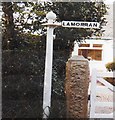
Old Direction Sign - Signpost by Alexandra Road, Illogan parish
Re-used as a house sign; inside the front gate of "Lamorran", No.70, on the north side of Alexandra Road but visible from the road. See also https://www.geograph.org.uk/photo/7612825. Surveyed Milestone Society National ID: CW_SW6643
Image: © Milestone Society Taken: 1 Jan 2013
0.15 miles
4
Illogen : Cot Road
Cot Road in the parish of Illogen.
Image: © Lewis Clarke Taken: 2 Dec 2019
0.15 miles
5
Mary's Well Illogan
Given by Gustavus Lambert Basset of Tehidy Park.
Image: © Rod Allday Taken: 16 Oct 2008
0.15 miles
6
Alexandra Road, Illogan.
Image: © Colin Pyle Taken: 6 Apr 2010
0.15 miles
7
Mary's Well, Illogan
Mary's Well is inscribed with the date 21st June 1888 and was given to the community by Gustavus Lambart Bassetis and named after the wife.
Image: © Philip Halling Taken: 7 Nov 2017
0.15 miles
8
Drinking fountain & horse trough at Mary's Well
Given by the local landowner Gustavus Lambert Basset of Tehidy Park in 1888.
Image: © Rod Allday Taken: 16 Oct 2008
0.16 miles
9
Alexandra Road, Illogan
This road is lined with large or expensive houses set back from the road behind high hedges.
Image: © Tony Atkin Taken: 15 Jun 2006
0.17 miles
10
Former railway, now a footpath
Part of the route of the former Hayle Railway branchline into Portreath, which gave access to the quayside for the export of copper from the mines near Camborne.
Image: © Richard Law Taken: 21 Sep 2012
0.21 miles