IMAGES TAKEN NEAR TO
Coopers Lane, CROWBOROUGH, TN6 1SJ

Introduction

This page details the photographs taken nearby to Coopers Lane, TN6 1SJ by members of the Geograph project.

The Geograph project started in 2005 with the aim of publishing, organising and preserving representative images for every square kilometre of Great Britain, Ireland and the Isle of Man.

There are currently over 7.5m images from over14,400 individuals and you can help contribute to the project by visiting https://www.geograph.org.uk

Image Map


Images are licensed for reuse under creativecommons.org/licenses/by-sa/2.0
Notes
  • Clicking on the map will re-center to the selected point.
  • The higher the marker number, the further away the image location is from the centre of the postcode.

Image Listing (46 Images Found)

Images are licensed for reuse under creativecommons.org/licenses/by-sa/2.0
  • ...
Image
Details
Distance
1
Coopers Lane, TN6 (2)
Image: © Mike Quinn Taken: 22 Aug 2012
0.02 miles
2
Coopers Lane, TN6
Shows the location of Image
Image: © Mike Quinn Taken: 22 Aug 2012
0.03 miles
3
Sign for The Coopers Arms, Coopers Lane, TN6
See Image
Image: © Mike Quinn Taken: 22 Aug 2012
0.04 miles
4
The Coopers' Arms, Coopers Lane, St John's, Crowborough
Not marked on Withyham's 1842 tithe map but does appear on the 1874 OS map. Coopers Lane was the original site for the new settlement of Crowborough until the town centre migrated eastwards to The Cross reducing this area to little more than a quiet suburb.
Image: © Simon Carey Taken: 18 Jun 2022
0.04 miles
5
The Coopers Arms, Coopers Lane, TN6
The location of this pub is shown in Image
Image: © Mike Quinn Taken: 22 Aug 2012
0.04 miles
6
Coopers Arms
The local public house for the St John's area of Crowborough. Located in Coopers Lane.
Image: © David BROOKER Taken: 16 Jul 2006
0.04 miles
7
Shrublands Cottages
Some of the original cottages in the "Twitten" off Coopers Wood.
Image: © David BROOKER Taken: Unknown
0.04 miles
8
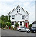
The Old Post Office, Coopers Lane, St John's, Crowborough
Former village shop and post office for the area that was the original site of the town of Crowborough before it shifted eastwards to The Cross. The old signs were discovered when the owners planned to repaint the front so they decided to restore them.
Image: © Simon Carey Taken: 18 Jun 2022
0.06 miles
9
Boxgate, St John's, Crowborough
Modern cul de sac off Coopers Lane named after a former entrance to Ashdown Forest whose former pale originally ran to the west.
Image: © Simon Carey Taken: 18 Jun 2022
0.06 miles
10
1-7, Brook View, St John's, Crowborough
Numbers 1-4 centre and left date from the late 19th century whilst 5-7 on the right are much older, the white cottage being marked on Withyham's 1842 tithe map. To the left is Brook Terrace whilst the modern white cottage is Little Harrods.
Image: © Simon Carey Taken: 18 Jun 2022
0.07 miles
  • ...