1
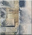
OS benchmark - Donnington, no 1 St Georges Road
An OS cutmark on the wall of the house at no 1 St George's Road; originally levelled at 95.33m above Ordnance Datum Newlyn.
Image: © Richard Law
Taken: 10 Aug 2014
0.07 miles
2
Donnington Wood Baptist Church
Image: © Richard Law
Taken: 15 Jan 2011
0.20 miles
3
St Matthew's church, Donnington Wood
Taken on a much better day than my rather poorly-lit last effort
Image, and highlighting the fact that this fine church, designed by G G Scott in 1843, attracted a Grade II listing https://britishlistedbuildings.co.uk/101054176-church-of-st-matthew-lilleshall-and-donnington#.W6uRKdQrLGg in 1983.
Image: © Richard Law
Taken: 26 Sep 2018
0.21 miles
4
St Matthews, Donnington Wood
The church of St Matthew, the parish church for Donnington Wood, Donnington and The Humbers. It dates from 1845, during which time there have been colossal changes in the geography around it.
http://www.stmatthewsdonningtonwood.org.uk
Image: © Richard Law
Taken: 15 Jan 2011
0.21 miles
5
St Matthew's Benchmark
The Ordnance Survey benchmark cut into St Matthew's Church, Donnington Wood, Telford. The benchmark, last verified by the OS in 1961, is 0.8-metres off the ground and 93.55-metres above the Newlyn Datum. The Church was built between 1842 & 1844 for local colliery workers. It is Grade-II listed.
Image: © Anthony Rowley
Taken: 9 Sep 2021
0.21 miles
6
OS benchmark - Donnington, St Matthew's church
An OS cutmark on the east angle of the church seen in
Image; originally levelled at 93.552m above Ordnance Datum Newlyn.
Image: © Richard Law
Taken: 25 Jul 2015
0.21 miles
7
The northern wash-house at 5 Bradley Road
Part of the collectively-listed remaining workers' housing at
Image - ignore the relatively modern extension on the right and porch/doorway.
This wash-house has its own listing at https://britishlistedbuildings.co.uk/101258273-northern-wash-house-approximately-3-metres-west-of-numbers-3-and-5-lilleshall-and-donnington#.W6uVb9QrLGg, as does the southern one attached to no 3
Image
Image: © Richard Law
Taken: 26 Sep 2018
0.24 miles
8
3 & 5 Bradley Road, Donnington Wood
Not that you'd really know it from this side, but these two single storey cottages date from early 19th century, and are believed to be the only two remaining examples of extensive 'barracks'-style housing provided by the Earl Gower Company (which later became the Lilleshall Company) to house workers at its nearby canal, brick, ironstone and clay workings. They were Grade II listed https://britishlistedbuildings.co.uk/101030946-3-and-5-bradley-road-lilleshall-and-donnington#.W6uTEdQrLGg in 1988, along with their attached wash-houses. The privies, pigsty and stables referred to in the listing details appear to have been lost to housing developments.
Image: © Richard Law
Taken: 26 Sep 2018
0.24 miles
9
The southern wash-house at 3 Bradley Road
Part of the collectively-listed remaining workers' housing at
Image This wash-house has its own listing at https://britishlistedbuildings.co.uk/101377113-southern-wash-house-approximately-3-metres-west-of-numbers-3-and-5-lilleshall-and-donnington#.W6uWz9QrLGg, as does the northern one attached to no 5
Image
Image: © Richard Law
Taken: 26 Sep 2018
0.24 miles


