IMAGES TAKEN NEAR TO
Ashwick, DULVERTON, TA22 9QD
Introduction
This page details the photographs taken nearby to TA22 9QD by members of the Geograph project.
The Geograph project started in 2005 with the aim of publishing, organising and preserving representative images for every square kilometre of Great Britain, Ireland and the Isle of Man.

There are currently over 7.5m images from over14,400 individuals and you can help contribute to the project by visiting https://www.geograph.org.uk
Image Map (Loading...)


Getting Data...Please wait
Leaflet Map data © OpenStreetMap
Images are licensed for reuse under creativecommons.org/licenses/by-sa/2.0
Notes
- Clicking on the map will re-center to the selected point.
- The higher the marker number, the further away the image location is from the centre of the postcode.
Image Listing (7 Images Found)
Images are licensed for reuse under creativecommons.org/licenses/by-sa/2.0
Image
Details
Distance
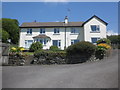
3
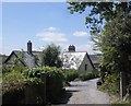
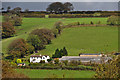
Dulverton: Springfield
A relatively remote Exmoor farm offering holiday accommodation
Image: © Martin Bodman
Taken: 30 Nov 2005
0.06 miles
4
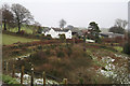
West Somerset : Countryside Scenery
Looking out across towards Slade Farm and the surrounding hillside.
Image: © Lewis Clarke
Taken: 19 Oct 2014
0.09 miles
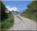
6
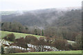
Dulverton: near Springfield
Overlooking a side valley with the Barle valley beyond. View south-south-east on a November day
Image: © Martin Bodman
Taken: 30 Nov 2005
0.16 miles
