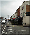
IMAGES TAKEN NEAR TO
Michael Road, LONDON, SW6 2YA

Introduction

This page details the photographs taken nearby to Michael Road, SW6 2YA by members of the Geograph project.

The Geograph project started in 2005 with the aim of publishing, organising and preserving representative images for every square kilometre of Great Britain, Ireland and the Isle of Man.

There are currently over 7.5m images from over14,400 individuals and you can help contribute to the project by visiting https://www.geograph.org.uk

Image Map


Images are licensed for reuse under creativecommons.org/licenses/by-sa/2.0
Notes
  • Clicking on the map will re-center to the selected point.
  • The higher the marker number, the further away the image location is from the centre of the postcode.

Image Listing (235 Images Found)

Images are licensed for reuse under creativecommons.org/licenses/by-sa/2.0
  • ...
Image
Details
Distance
1
View from Michael Road
Something of a ramshackle view, less glamour-filled than one might expect in this area. The gasworks lay just beyond the fence; beyond is the old Lots Road Power Station, now part of a new development which includes the tall tower (Image]).
Image: © Stephen Richards Taken: 23 Mar 2019
0.05 miles
2
London : Chelsea - Cambria Street
Looking down Cambria Street from King's Road in Chelsea.
Image: © Lewis Clarke Taken: 13 May 2011
0.05 miles
3
The Imperial Arms
According to their website, the Imperial Arms is a traditional London Victorian pub showcasing the best in contemporary photography.
Image: © Robin Webster Taken: 14 Apr 2012
0.06 miles
4
Chelsea fans outside "The Imperial Arms"
On Kings Road before the first match of the 2013-14 season versus Hull City A.F.C.
Image: © Neil Theasby Taken: 18 Aug 2013
0.06 miles
5
King's Road
Looking towards Michael Road.
Image: © Thomas Nugent Taken: 8 Oct 2014
0.06 miles
6
The Imperial, Fulham
Image: © Chris Whippet Taken: 24 Jul 2015
0.06 miles
7
The Imperial Arms
On King's Road.
Image: © JThomas Taken: 27 May 2022
0.06 miles
8
King's Road
Shops at the corner of Michael Road.
Image: © Thomas Nugent Taken: 8 Oct 2014
0.06 miles
9
King's Road
A parade of shops and houses viewed from the junction with Rumbold Road.
Image: © Martin Addison Taken: 19 Apr 2013
0.07 miles
10
King's Road
At Holmead Road.
Image: © Thomas Nugent Taken: 8 Oct 2014
0.07 miles
  • ...