1
A quiet backwater
Crescent Road
Image: © Ron Galliers
Taken: 19 Mar 2009
0.07 miles
2
The Admiral Jellicoe, Canvey Island
Pub in the High Street.
Image: © John Myers
Taken: 24 Sep 2006
0.15 miles
3
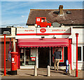
Canvey Island : Canvey-on-Sea post office
Image: © Jim Osley
Taken: 7 Oct 2023
0.18 miles
4
High Street, Canvey Island
Away from the central shopping area the High Street is lined with housing. Here by the junction with Hope Road a First bus collects a passenger from the Lappmark Road bus stop.
Image: © Martin Addison
Taken: 2 Mar 2013
0.19 miles
5
Canvey Island: Kismet Park outdoor gym
A fine sunny morning but there are no takers at this Adidas sponsored outdoor gym in Kismet Park.
Image: © Nigel Cox
Taken: 8 Mar 2011
0.20 miles
6
Canvey Island: Gafzelle Drive
This is the intriguingly named Gafzelle Drive viewed from the top of the sea defence wall. The Canvey Community Archive website http://canveyisland.org/page_id__1140_path__0p2p30p.aspx has several images of Gafzelle Drive taken during a freshwater flood event in 1968, some 15 years after the catastrophic seawater flood and inundation of Canvey Island in 1953.
Image: © Nigel Cox
Taken: 8 Mar 2011
0.20 miles
7
Canvey Island: Kismet Park Dyke
The photographer does not know the formal name of this dyke but it does run along the eastern side of Kismet Park and excess water is pumped out into the Thames estuary by the St Anne's Pumping Station which is behind him. Although the dyke runs in a concrete conduit, old maps show that historically, and certainly before there was any residential development, there has always been a drain along this route.
Image: © Nigel Cox
Taken: 8 Mar 2011
0.20 miles
8
Canvey Island: The Admiral Jellicoe
This huge estate public house has been a fixture on Canvey Island since the 1930s, and was for many years the only hotel on the island. Indeed the 1956 Ordnance Survey map actually describes it as such.
This was the local and regular haunt of the utterly underrated Dr Feelgood band, and the cover photo of their 5th album, Be Seeing You, released in 1977, featuring Lee and the rest of the group, (but not Wilko Johnson who had just very recently left the group), was taken in the public bar.
R.I.P. Lee Brilleaux (1952-1994)
Image: © Nigel Cox
Taken: 8 Mar 2011
0.20 miles
9
Hellendoorn Road, Canvey Island
Just about every direction you looked, the weather was doing something dramatic, but miraculously Canvey Island escaped.
Image: © Robin Webster
Taken: 21 Feb 2015
0.20 miles
10
Kismet Park
Image: © Robert Eva
Taken: 2 Jun 2017
0.21 miles


