IMAGES TAKEN NEAR TO
Brock Hill, WICKFORD, SS11 7PA
Introduction
This page details the photographs taken nearby to Brock Hill, SS11 7PA by members of the Geograph project.
The Geograph project started in 2005 with the aim of publishing, organising and preserving representative images for every square kilometre of Great Britain, Ireland and the Isle of Man.

There are currently over 7.5m images from over14,400 individuals and you can help contribute to the project by visiting https://www.geograph.org.uk
Image Map (Loading...)


Getting Data...Please wait
Leaflet Map data © OpenStreetMap
Images are licensed for reuse under creativecommons.org/licenses/by-sa/2.0
Notes
- Clicking on the map will re-center to the selected point.
- The higher the marker number, the further away the image location is from the centre of the postcode.
Image Listing (6 Images Found)
Images are licensed for reuse under creativecommons.org/licenses/by-sa/2.0
Image
Details
Distance
1
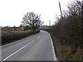
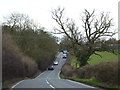
Brock Hill
This road leads to Downham and Hanningfield.
Image: © terry joyce
Taken: 21 Feb 2012
0.15 miles
2

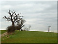
Brock Hill View
This is the view that I had as I exited the footpath onto Brock Hill.
Image: © terry joyce
Taken: 21 Feb 2012
0.18 miles
3
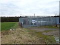
Brock Hill Gas Pumping Station
The sign on the fence now reads: National Grid Stn35 Brock Hill AGI. It is located near to the start of the footpath from Brock Hill.
Image: © terry joyce
Taken: 21 Feb 2012
0.20 miles
4
Brock Hill Footpath
This is the start of the footpath from Brock Hill.
Image: © terry joyce
Taken: 21 Feb 2012
0.21 miles
5
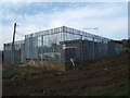
Brock Hill Gas Pumping Station
This is Transcos Brock Hill Pumping Station (PRS 35). I am glad I do not live near one of these stations the sound of what I assume was flowing gas could be heard nearly 50 yards away
Image: © Glyn Baker
Taken: 18 Feb 2006
0.21 miles
6
Brock Hill
Looking towards Runwell. This road changes to Swan Lane and leads to The Broadway in Wickford.
Image: © terry joyce
Taken: 21 Feb 2012
0.23 miles