IMAGES TAKEN NEAR TO
Sway Road, BROCKENHURST, SO42 7SH

Introduction

This page details the photographs taken nearby to Sway Road, SO42 7SH by members of the Geograph project.

The Geograph project started in 2005 with the aim of publishing, organising and preserving representative images for every square kilometre of Great Britain, Ireland and the Isle of Man.

There are currently over 7.5m images from over14,400 individuals and you can help contribute to the project by visiting https://www.geograph.org.uk

Image Map


Images are licensed for reuse under creativecommons.org/licenses/by-sa/2.0
Notes
  • Clicking on the map will re-center to the selected point.
  • The higher the marker number, the further away the image location is from the centre of the postcode.

Image Listing (377 Images Found)

Images are licensed for reuse under creativecommons.org/licenses/by-sa/2.0
  • ...
Image
Details
Distance
1
Telecoms cabinets and speed cameras sign, Sway Road, Brockenhurst
On the east side of the B3055 Sway Road.
Image: © Jaggery Taken: 2 Jun 2016
0.01 miles
2
Ponies
New Forest ponies at ease with traffic along the Sway Road
Image: © Kurseong Carl Taken: 30 Aug 2011
0.02 miles
3
Rowan
Along the Sway Road
Image: © Kurseong Carl Taken: 30 Aug 2011
0.02 miles
4
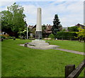
Brockenhurst War Memorial
The War Memorial is on the west side of Sway Road. http://www.geograph.org.uk/photo/5033678 to a closer view.
Image: © Jaggery Taken: 2 Jun 2016
0.02 miles
5
Brockenhurst War Memorial
Located here. http://www.geograph.org.uk/photo/5033676
Image: © Jaggery Taken: 2 Jun 2016
0.02 miles
6
War Memorial, Brockenhurst
Image: © JThomas Taken: 28 Apr 2022
0.02 miles
7
Pont Saint Martin War Memorial in Brockenhurst
Located on the right here. http://www.geograph.org.uk/photo/5033676 The dedication is "From Pont Saint Martin to its twin community of Brockenhurst, in grateful remembrance of the young English airmen who came to liberate France and lost their lives in Pont Saint Martin in 1941 when their aircraft crashed."
Image: © Jaggery Taken: 2 Jun 2016
0.02 miles
8
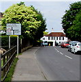
Sway Road directions sign, Brockenhurst
Facing northbound traffic on the B3055 Sway Road. At the staggered junction ahead, turn left for the village centre, right for Lymington and ahead for Beaulieu and Lyndhurst.
Image: © Jaggery Taken: 2 Jun 2016
0.02 miles
9
Brockenhurst Telephone Exchange
Situated on the B3055 Sway Road, this TE serves Brockenhurst and the surrounding rural area. This redbrick building has the appearance of a village hall, although the BT warning notices on it indicate otherwise. It has (01590) 62xxxx numbers and its postcode is SO42 7SH.
Image: © David Hillas Taken: 8 Jul 2011
0.03 miles
10
Donkeys, Brockenhurst
Roaming freely around on a small green off Sway Road.
Image: © Robin Webster Taken: 30 Oct 2017
0.03 miles
  • ...