IMAGES TAKEN NEAR TO
Minety, MALMESBURY, SN16 9QA

Introduction

This page details the photographs taken nearby to SN16 9QA by members of the Geograph project.

The Geograph project started in 2005 with the aim of publishing, organising and preserving representative images for every square kilometre of Great Britain, Ireland and the Isle of Man.

There are currently over 7.5m images from over14,400 individuals and you can help contribute to the project by visiting https://www.geograph.org.uk

Image Map


Images are licensed for reuse under creativecommons.org/licenses/by-sa/2.0
Notes
  • Clicking on the map will re-center to the selected point.
  • The higher the marker number, the further away the image location is from the centre of the postcode.

Image Listing (15 Images Found)

Images are licensed for reuse under creativecommons.org/licenses/by-sa/2.0
Image
Details
Distance
1
Crossing Lane
Road in Upper Minety.
Image: © Wayland Smith Taken: 30 May 2020
0.10 miles
2
Pleydells Farm
Image: © Vieve Forward Taken: 4 May 2016
0.11 miles
3
Gate at entrance to Rigsby's Lane near Minety
The gate referred to here Image can now be seen in its full beauty. It is padlocked and the sides are fenced off with barbed wire.
Image: © Brian Robert Marshall Taken: 22 Aug 2011
0.13 miles
4
West along Rigsby's Lane near Minety
The lane is a bridleway. This hasn't stopped someone putting a padlocked gate across its entrance.
Image: © Brian Robert Marshall Taken: 22 Aug 2011
0.13 miles
5
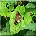
Butterfly and bindweed, Rigsby's Lane, Minety
This fine butterfly is tentatively identified as a Speckled Wood (Pararge aegeria). The stuff it is resting on is the bane of keen gardeners everywhere.
Image: © Brian Robert Marshall Taken: 22 Aug 2011
0.15 miles
6
Acres Farm
Image: © Roger Cornfoot Taken: 16 Feb 2007
0.16 miles
7
The barn
A modern house, located near Cooles farm.
Image: © Roger Cornfoot Taken: 29 Jan 2007
0.17 miles
8
Field, north of The Barn, Upper Minety
The barn appears to be the large residence to the left of the farm buildings.
Image: © Brian Robert Marshall Taken: 29 Mar 2011
0.19 miles
9
Field near Cooles Farm, Upper Minety
The farm can be seen in the background across this flat pastoral field.
Image: © Brian Robert Marshall Taken: 29 Mar 2011
0.20 miles
10
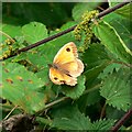
Butterfly and nettles, Rigsby's Lane, Minety
A rather world-weary butterfly, provisionally identified as a Gatekeeper butterfly (Pyronia tithonus) is taking a rest on some nettles alongside the bridleway.
Image: © Brian Robert Marshall Taken: 22 Aug 2011
0.21 miles