1
Athelstan Court, Malmesbury
Dwellings along Park Road, built in the first decade of the 21st century.
Image: © Jaggery
Taken: 17 Aug 2014
0.01 miles
2
Faded mini-roundabout in Malmesbury
Weathering and countless vehicle tyres have worn away the white paint
on the road surface at the junction of Park Road and Gloucester Road.
Image: © Jaggery
Taken: 17 Aug 2014
0.02 miles
3
Park Road Centre, Malmesbury
A small area of businesses on the north side of Park Road. Ryalls http://www.geograph.org.uk/photo/4141292 is on the left.
Image: © Jaggery
Taken: 17 Aug 2014
0.03 miles
4
Railinged path, Park Road Centre, Malmesbury
Railings line the path heading away from the NE corner of Park Road Centre.
Image: © Jaggery
Taken: 17 Aug 2014
0.03 miles
5
Ryalls, Malmesbury
Building, transport and industrial supplies trade outlet located in Unit 1 Park Road Centre.
Image: © Jaggery
Taken: 17 Aug 2014
0.04 miles
6
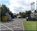
Fire station training tower, Malmesbury
At the edge of the fire station. http://www.geograph.org.uk/photo/4127360 The yellow bin is for donations to the Firefighters Charity.
Image: © Jaggery
Taken: 17 Aug 2014
0.04 miles
7
Somerfield bus shelter now opposite a Co-operative Food store in Malmesbury
The glass triangle on the side of the Gloucester Road bus shelter shows Somerfield.
The supermarket opposite the shelter now has another occupier. http://www.geograph.org.uk/photo/4127411
Image: © Jaggery
Taken: 17 Aug 2014
0.04 miles
8
Lumley Garden and Pet Supplies, Malmesbury
Located in Stainsbridge Mill, Gloucester Road.
Image: © Jaggery
Taken: 17 Aug 2014
0.04 miles
9
C and J Electrical in Malmesbury
Located in the Park Road Centre.
Image: © Jaggery
Taken: 17 Aug 2014
0.04 miles
10
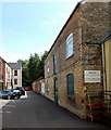
Access road to Stainsbridge Mill facilities, Malmesbury
From the east side of Gloucester Road. Notices on the wall state that this is private,
access-only, road. There is no public right of way. Trespassers will be prosecuted.
Image: © Jaggery
Taken: 17 Aug 2014
0.04 miles


