1
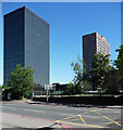
Langley Park Road, Sutton
Image: © David Howard
Taken: 4 Apr 2018
0.06 miles
2
Two trains leaving Sutton station
The lines diverge to the east of Sutton station, as they do to the west - see http://www.geograph.org.uk/photo/3013941 The right hand route was opened from West Croydon to Epsom on 10th May 1847 when Sutton station was also opened. The left hand route was opened on 1st October 1868 from Peckham Rye to Sutton via Mitcham Junction. The next stop for the left hand train will be Carshalton, whilst the right hand train, although it is on the down line as it had terminated at Sutton, will next stop at Carshalton Beeches.
Image: © Marathon
Taken: 27 Jun 2012
0.11 miles
3
View eastwards from Sutton station
The lines diverge to the east of Sutton station, as they do to the west - see http://www.geograph.org.uk/photo/3013941 The right hand route was opened from West Croydon to Epsom on 10th May 1847 when Sutton station was also opened. The left hand route was opened on 1st October 1868 from Peckham Rye to Sutton via Mitcham Junction.
Image: © Marathon
Taken: 27 Jun 2012
0.11 miles
4
Apartments near Sutton Station
Image: © N Chadwick
Taken: 4 Feb 2018
0.13 miles
5
Indepth House, Sutton
Wonderful decoration on the building close to Quadrant House.
Image: © Bob Embleton
Taken: 23 May 2014
0.14 miles
6
The Quadrant, Sutton
The Quadrant, Sutton. The steps on the left lead to an entrance to Sutton railway station, as does the ramp.
Image: © Malc McDonald
Taken: 28 Aug 2010
0.14 miles
7
Cavendish Road / Langley Park Road junction, Sutton
Traffic calming raised road surface with a mini roundabout.
Most of the older victorian properties have been converted into flats or have been demolished and replaced by higher density flats.
Image: © Bob Embleton
Taken: 22 May 2014
0.14 miles
8
The Messenger, Quadrant House, Sutton, London
A bronze art-work with very dark patinationby David Wynne dated 1981 after given the theme for the work as "communication".
Image: © Bob Embleton
Taken: 23 May 2014
0.14 miles
9
Vigilant House and Quadrant House, Sutton
Sutton has a cluster of tall-ish office blocks in this area, most of which seem to have been designed by Robert J. Wood and Partners, and most of which currently appear to be empty and/or awaiting redevelopment. Vigilant, in the foreground on Sutton Court Road, dates from 1961-66, and with its seventeen storeys of curtain-walling is very much of its time. To the right is the pink granite Quadrant House, of 1979-80, by Brewer, Smith and Brewer. It is occupied so neither of the above statements apply.
Image: © Stephen Richards
Taken: Unknown
0.14 miles
10
Sutton Station, Brighton Road (B2230)
Image: © Noel Foster
Taken: 4 Aug 2005
0.14 miles


