IMAGES TAKEN NEAR TO
Greenhill Road, TENBY, SA70 7LJ

Introduction

This page details the photographs taken nearby to Greenhill Road, SA70 7LJ by members of the Geograph project.

The Geograph project started in 2005 with the aim of publishing, organising and preserving representative images for every square kilometre of Great Britain, Ireland and the Isle of Man.

There are currently over 7.5m images from over14,400 individuals and you can help contribute to the project by visiting https://www.geograph.org.uk

Image Map


Images are licensed for reuse under creativecommons.org/licenses/by-sa/2.0
Notes
  • Clicking on the map will re-center to the selected point.
  • The higher the marker number, the further away the image location is from the centre of the postcode.

Image Listing (604 Images Found)

Images are licensed for reuse under creativecommons.org/licenses/by-sa/2.0
  • ...
Image
Details
Distance
1
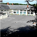
Saint Teilo's Catholic Primary School, Tenby
Viewed from Greenhill Road.
Image: © Jaggery Taken: 13 Jul 2013
0.01 miles
2
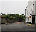
Long row of houses, Greenhill Avenue, Tenby
Viewed looking towards Greenhill Road.
Image: © Jaggery Taken: 13 Jul 2013
0.03 miles
3
Acorn Heights, Tenby
Acorn Heights in Greenhill Road provides sheltered accommodation for people aged at least 60. Residents in the purpose-built complex of 16 self-contained apartments are tenants of Pembrokeshire Housing.
Image: © Jaggery Taken: 13 Jul 2013
0.04 miles
4
Ordnance Survey Cut Mark
This OS cut mark can be found on the wall at the junction of Greenhill Avenue & Greenhill Road. It marks a point 24.882m above mean sea level.
Image: © Adrian Dust Taken: 18 Mar 2022
0.04 miles
5
Tenby - St John's Hill Well - Plaque
Image: © welshbabe Taken: 17 Mar 2016
0.04 miles
6
Tenby - St John's Hill Well
Image: © welshbabe Taken: 17 Mar 2016
0.04 miles
7
Tenby - St John's Hill - well on right
Image: © welshbabe Taken: 17 Mar 2016
0.04 miles
8
Tenby - St John's Hill Well - Plaque
Image: © welshbabe Taken: 17 Mar 2016
0.05 miles
9
Ordnance Survey Cut Mark
This OS cut mark can be found on the south side of Johns Hill. It marks a point 20.744m above mean sea level.
Image: © Adrian Dust Taken: 14 Nov 2015
0.05 miles
10
Eastern end of St John's Hill, Tenby
The 30mph speed limit drops to 20mph along St John's Hill descending from the A478 Norton.
Image: © Jaggery Taken: 16 Jul 2016
0.05 miles
  • ...