1
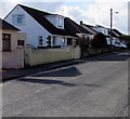
West along Brickhurst Park, Johnston
The eastern part of a long dead-end residential road on the west side of the A4076 Vine Road.
Image: © Jaggery
Taken: 18 Feb 2016
0.02 miles
2
Brickhurst Park houses, Johnston
On the south side of Brickhurst Park, a long dead-end residential road on the west side of the A4076 Vine Road.
Image: © Jaggery
Taken: 18 Feb 2016
0.04 miles
3
Field on the east side of North Johnston Farm
Viewed from this http://www.geograph.org.uk/photo/4832666 gate at the edge of the A4076.
Image: © Jaggery
Taken: 18 Feb 2016
0.05 miles
4
K.O. Carpets and Beds, Johnston
Set back from the west side of the A4076 Vine Road in the north of Johnston, near the Vine Inn. http://www.geograph.org.uk/photo/4832173
Viewed in February 2016, when a notice shows Locals Serving Locals. Now in our 36th year.
Image: © Jaggery
Taken: 18 Feb 2016
0.08 miles
5
Access road to K.O. Carpets and Beds, Johnston
From the west side of the A4076 Vine Road in the north of Johnston, near the Vine Inn. http://www.geograph.org.uk/photo/4832173
The postbox is modern Elizabethan. http://www.geograph.org.uk/photo/4832284
Image: © Jaggery
Taken: 18 Feb 2016
0.08 miles
6
Ordnance Survey Flush Bracket (G5097)
This OS Flush Bracket can be found on the south face of old school building. It marks a point 62.433m above mean sea level.
Image: © Adrian Dust
Taken: 16 Apr 2017
0.09 miles
7
Brickhurst Park electricity substation, Johnston
The Western Power Distribution electricity substation is set back from the corner of Brickhurst Park and the A4076 Vine Road in the north of the village. Its identifier is BRICKHURST PARK JOHNSTON S/S 603765.
Image: © Jaggery
Taken: 18 Feb 2016
0.09 miles
8
Ordnance Survey Flush Bracket G5097
This can be found on the former school building. Now carpet showroom/warehouse.
For more detail see : http://www.bench-marks.org.uk/bm16529
Image: © Peter Wood
Taken: 19 May 2013
0.09 miles
9
The Vine Inn, Johnston
The Vine is a roadside pub at the northern end of Johnston village. Beer has been served here continuously since 1810.
Image: © Stephen McKay
Taken: 14 May 2018
0.09 miles
10
South side of the Vine Inn, Johnston
Pub and restaurant alongside the A4076 Vine Road in the north of the village. http://www.geograph.org.uk/photo/4832173
The red, white and blue notices on the left are at the edge of K.O. Carpets and Beds. http://www.geograph.org.uk/photo/4832276
Image: © Jaggery
Taken: 18 Feb 2016
0.09 miles


