IMAGES TAKEN NEAR TO
Upper Kings Head Road, SWANSEA, SA5 8BR

Introduction

This page details the photographs taken nearby to Upper Kings Head Road, SA5 8BR by members of the Geograph project.

The Geograph project started in 2005 with the aim of publishing, organising and preserving representative images for every square kilometre of Great Britain, Ireland and the Isle of Man.

There are currently over 7.5m images from over14,400 individuals and you can help contribute to the project by visiting https://www.geograph.org.uk

Image Map


Images are licensed for reuse under creativecommons.org/licenses/by-sa/2.0
Notes
  • Clicking on the map will re-center to the selected point.
  • The higher the marker number, the further away the image location is from the centre of the postcode.

Image Listing (6 Images Found)

Images are licensed for reuse under creativecommons.org/licenses/by-sa/2.0
Image
Details
Distance
1
Ordnance Survey Rivet
This OS rivet can be found on the step at the entrance to the school on Pentre Gethin Road. It marks a point 129.592m above mean sea level.
Image: © Adrian Dust Taken: 20 Jan 2019
0.13 miles
2
Ordnance Survey Cut Mark
This OS cut mark can be found on No558 Middle Road, Time2Talk Mobile Shop. It marks a point 121.746m above mean sea level.
Image: © Adrian Dust Taken: 20 Jan 2019
0.17 miles
3
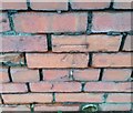
Ordnance Survey Cut Mark
This OS cut mark can be found on the wall between Nos 115 & 117 Ravenhill Road. It marks a point 125.779m above mean sea level.
Image: © Adrian Dust Taken: 20 Jan 2019
0.20 miles
4
Ordnance Survey Cut Mark
This OS cut mark can be found on the stone post of the Embassy Social Club. It marks a point 114.364m above mean sea level.
Image: © Adrian Dust Taken: 20 Jan 2019
0.22 miles
5
Shopping precinct
Suburban shopping precinct in Swansea.
Image: © Alan Hughes Taken: 20 Nov 2017
0.24 miles
6
Ravenhill Road Swansea
Ravenhill Road heads NE into the Raven Hill district of Swansea, away from Carmarthen Road in the Fforestfach district of Swansea.
Image: © Jaggery Taken: 25 Sep 2013
0.24 miles