IMAGES TAKEN NEAR TO
Bearwood College, WOKINGHAM, RG41 5DN

Introduction

This page details the photographs taken nearby to Bearwood College, RG41 5DN by members of the Geograph project.

The Geograph project started in 2005 with the aim of publishing, organising and preserving representative images for every square kilometre of Great Britain, Ireland and the Isle of Man.

There are currently over 7.5m images from over14,400 individuals and you can help contribute to the project by visiting https://www.geograph.org.uk

Image Map


Images are licensed for reuse under creativecommons.org/licenses/by-sa/2.0
Notes
  • Clicking on the map will re-center to the selected point.
  • The higher the marker number, the further away the image location is from the centre of the postcode.

Image Listing (9 Images Found)

Images are licensed for reuse under creativecommons.org/licenses/by-sa/2.0
Image
Details
Distance
1
Working on the Old Buildings
This looks like an area of ancillary buildings connected with Bearwood Park. Formerly a Victorian country estate belonging to the Walter family, proprietors of The Times newspaper, in more recent times the house and grounds became a college. It looks like these buildings have been neglected but now some sort of work, restoration or demolition, is going on here
Image: © Des Blenkinsopp Taken: 15 May 2018
0.10 miles
2
Mole Road to Sindlesham
Image: © Steve Daniels Taken: 24 Sep 2015
0.12 miles
3
Bear Wood
Picture taken from the track in the southwest of the square looking northeast across Bear Wood Lake.
Image: © Brendan and Ruth McCartney Taken: 17 Apr 2005
0.14 miles
4
Bear Wood Lake
A large lake which is almost entirely in this grid square.
Image: © don cload Taken: 17 May 2009
0.20 miles
5
Farmland, Arborfield
A stubble field to the south of the road to Carter's Hill shortly after sunrise.
Image: © Andrew Smith Taken: 12 Dec 2007
0.21 miles
6
Bear Wood
Looking northwest across the square.
Image: © Brendan and Ruth McCartney Taken: 17 Apr 2005
0.22 miles
7
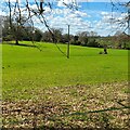
Field next to farm track
Image: © James Emmans Taken: 7 Apr 2023
0.23 miles
8
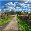
Copse Barnhill Lane towards Mole Lane
Farm access track and public bridleway heading down Carters Hill.
Image: © James Emmans Taken: 7 Apr 2023
0.23 miles
9
Mole Road entering Sindlesham
Image: © Steve Daniels Taken: 24 Sep 2015
0.25 miles