1
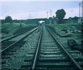
Site of the old Thame railway Station
Phoenix trail at the site of the old Thame railway Station
Image: © Shaun Ferguson
Taken: 14 Oct 2007
0.09 miles
2
Entrance to Thame Business Park
A Granite block marks the entrance.
Image: © David Lally
Taken: 4 Sep 2008
0.09 miles
3
Under the Power Lines
On Wenman Road, Tame.
Image: © David Lally
Taken: 27 Jan 2009
0.11 miles
4
Former railway station at Thame
Now part of the Phoenix Trail, a cycle path.
Image: © Bill Boaden
Taken: 20 Apr 2019
0.11 miles
5
Benchmark on #111 Chinnor Road
Ordnance Survey cut mark benchmark described on the Bench Mark Database at http://www.bench-marks.org.uk/bm35897
Image: © Roger Templeman
Taken: 3 Nov 2010
0.12 miles
6
Wenman Road, Thame
Image: © Peter Whatley
Taken: 19 Aug 2009
0.12 miles
7
Remains of Thame Railway Station, Oxon
Situated in Thame Park Road, this station was on the railway line between Princes Risborough and Oxford, which closed to passengers in January, 1963. However, the track remained between Princes Risborough and Thame until the mid-1990s. It has now been converted into a cycle trail, whilst the station area is now an industrial estate, its postcode being OX9 3UH.
Image: © David Hillas
Taken: 1 Sep 1969
0.12 miles
8
Wenman Road approaching Thame Park Road
Image: © John Firth
Taken: 20 Mar 2012
0.12 miles
9
Chinnor Road, Thame
The B4445 towards the town centre.
Image: © Robin Webster
Taken: 20 Oct 2018
0.13 miles
10
Chinnor Road, Thame
I had noticed these terraced cottages before, when passing through. They look as if they were built to house a growing industrial population, and I'd been wondering which industry it was that led to the expansion of the town along the Chinnor road - perhaps circa 1890. A glance at the map shows that the area on the other (south) side of the road used to be railway land - so that answers my query, at least in part.
I'm left wondering whether the terraced cottages were built by or for a railway company. In any case, some 120 years or so later, the decorative brickwork gives the terrace a character of its own, and makes this an attractive street. The modern residential development on the old railway site contributes much less to the townscape.
Image: © Stefan Czapski
Taken: 17 Aug 2014
0.13 miles


