1
A field for horses in Aston Rowant
The buttercup crop is developing nicely.
Image: © Bill Boaden
Taken: 10 May 2018
0.05 miles
2
Entrance to Aston Park housing estate
Aston Park is a private estate, mainly of detached houses.
Image: © David Hawgood
Taken: 30 Aug 2008
0.08 miles
3
The B4009, Aston Rowant
Most of the village is set back off the main road. Here the road is leaving the village as it heads towards Chinnor.
Image: © Andrew Smith
Taken: 27 Jan 2009
0.11 miles
4
Woodway Farm, Aston Rowant
Aston Rowant is certainly not a one-horse village: Woodway farm hosts Pony Club races; there are two stud farms in the village; and there is a race course a mile away. Note, however, the Penny Farthing bicycle leaning on the stable fence.
Image: © David Ellis
Taken: 20 Jan 2006
0.14 miles
5
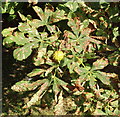
Horse Chestnut with leaf miner damage
Larvae of the Cameraria ohridella moth burrow within the leaf - there can be hundreds in one leaf. The leaves fall early. The tree produces leaves as normal next spring, and it appears that the tree can survive, though the leaves are unsightly. See forest research website http://www.forestresearch.gov.uk/leafminer .
Image: © David Hawgood
Taken: 30 Aug 2008
0.14 miles
6
Chinnor Road, Aston Rowant
The contemporary B4009 is on the line of the ancient Lower Icknield Way,
Image: © Simon Mortimer
Taken: 7 Sep 2022
0.15 miles
7
Church Lane, Aston Rowant
Image: © Basher Eyre
Taken: 17 Apr 2014
0.16 miles
8
Footpath to St Peter & Paul
The footpath leading of the Aston Rowant road leading to the church porch on St Peter & Paul.
Image: © Bill Nicholls
Taken: 26 May 2013
0.16 miles
9
Corner of Church Lane
The corner of Church Lane with the churchyard of St Peter & Paul behind
Image: © Bill Nicholls
Taken: 26 May 2013
0.16 miles
10
Footpaths and Bridleways
On the corner of Church Lane you can find this display which is very useful to get around the village if you have not got a map with you.
Image: © Bill Nicholls
Taken: 26 May 2013
0.16 miles


